File:2020 Luftbild Garenfeld Nord.png
Jump to navigation
Jump to search

Size of this preview: 800 × 538 pixels. Other resolutions: 320 × 215 pixels | 640 × 431 pixels | 1,024 × 689 pixels | 1,275 × 858 pixels.
Original file (1,275 × 858 pixels, file size: 2.25 MB, MIME type: image/png)
Captions
Captions
Add a one-line explanation of what this file represents
Summary
[edit]
| Description | |
| Date | |
| Source | https://www.3d.ruhr/#/legend |
| Author | © RVR, 2020, dl-de/by-2-0 |
Licensing
[edit]

|
This file is licensed under the terms of the Data licence Germany – attribution – version 2.0 |
|
You are free:
Under the following conditions:
|
File history
Click on a date/time to view the file as it appeared at that time.
| Date/Time | Thumbnail | Dimensions | User | Comment | |
|---|---|---|---|---|---|
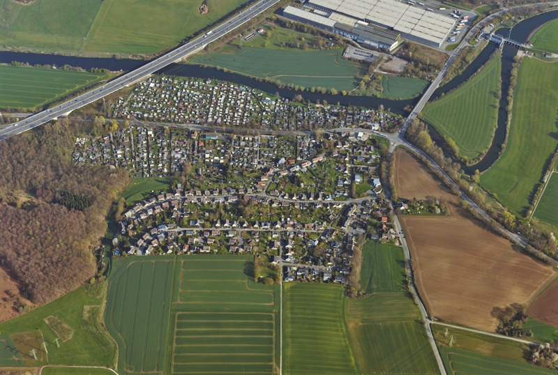
| current | 12:39, 22 December 2020 | | 1,275 × 858 (2.25 MB) | Bärwinkel,Klaus (talk | contribs) | {{Information |Description={{de|1=Schrägluftbild von Süden auf das nördliche Wohngebiet in Hagen-Garenfeld. Zwischen Wohngebiet, Ruhrtalstraße und Ruhr liegen die Garenfelder Campingplätze.}} |Source=https://www.3d.ruhr/#/legend |Date=2020-12-22 |Author=Geonetzwerk.metropoleRuhr – Schrägluftbild-Viewer 3D.RUHR |Permission= |other_versions }} Category:Garenfeld Category:Aerial photographs of Hagen |
You cannot overwrite this file.
File usage on Commons
There are no pages that use this file.