File:2019 European Parliament election in the United Kingdom area results (East Midlands).svg
Jump to navigation
Jump to search

Size of this PNG preview of this SVG file: 505 × 600 pixels. Other resolutions: 202 × 240 pixels | 404 × 480 pixels | 647 × 768 pixels | 862 × 1,024 pixels | 1,725 × 2,048 pixels | 1,099 × 1,305 pixels.
Original file (SVG file, nominally 1,099 × 1,305 pixels, file size: 1.61 MB)
Captions
Captions
Add a one-line explanation of what this file represents
Summary[edit]
.svg&action=edit§ion=1)
| Description |
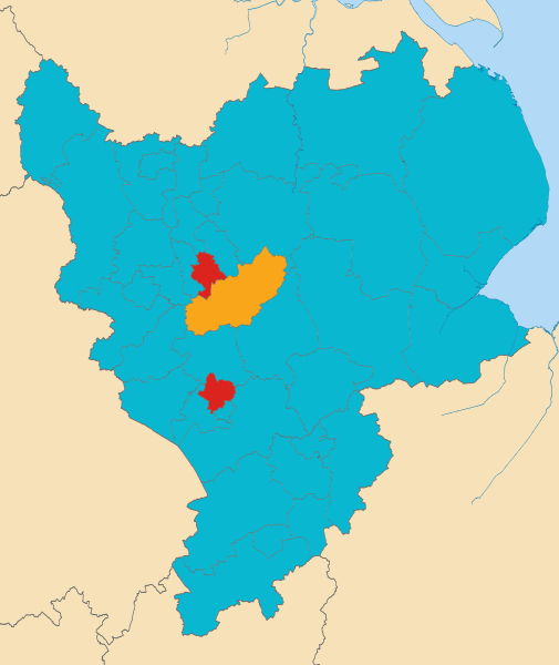
English: Map showing the results of the European Parliament election, 2019 (United Kingdom) by counting area in the East Midlands electoral region. |
| Date | |
| Source | This work is derived from East Midlands districts 2011 map.svg by Nilfanion (which contains Ordnance Survey OpenData). |
| Author | Mirrorme22, created from East Midlands districts 2011 map.svg by Nilfanion (which contains Ordnance Survey data © Crown copyright and database right). |
| SVG development |
Licensing[edit]
.svg&action=edit§ion=2)
This file is licensed under the Creative Commons Attribution 3.0 Unported license.
- You are free:
- to share – to copy, distribute and transmit the work
- to remix – to adapt the work
- Under the following conditions:
- attribution – You must give appropriate credit, provide a link to the license, and indicate if changes were made. You may do so in any reasonable manner, but not in any way that suggests the licensor endorses you or your use.
File history
Click on a date/time to view the file as it appeared at that time.
| Date/Time | Thumbnail | Dimensions | User | Comment | |
|---|---|---|---|---|---|
| current | 00:00, 27 May 2019 | | 1,099 × 1,305 (1.61 MB) | Mirrorme22 (talk | contribs) | Results |
| 21:28, 25 May 2019 |  | 1,099 × 1,305 (1.61 MB) | Mirrorme22 (talk | contribs) | User created page with UploadWizard |
You cannot overwrite this file.
File usage on Commons
The following page uses this file:
File usage on other wikis
The following other wikis use this file:
- Usage on en.wikipedia.org
- Usage on fr.wikipedia.org
.svg&oldid=861619160)