File:20171015140DR Dresden-Plauen Blick vom Hohen Stein.jpg
Jump to navigation
Jump to search

Size of this preview: 800 × 599 pixels. Other resolutions: 320 × 240 pixels | 640 × 479 pixels | 1,024 × 767 pixels | 1,280 × 958 pixels | 2,560 × 1,916 pixels | 3,648 × 2,731 pixels.
Original file (3,648 × 2,731 pixels, file size: 6.98 MB, MIME type: image/jpeg)
Captions
Captions
Add a one-line explanation of what this file represents
Summary[edit]
| Description |
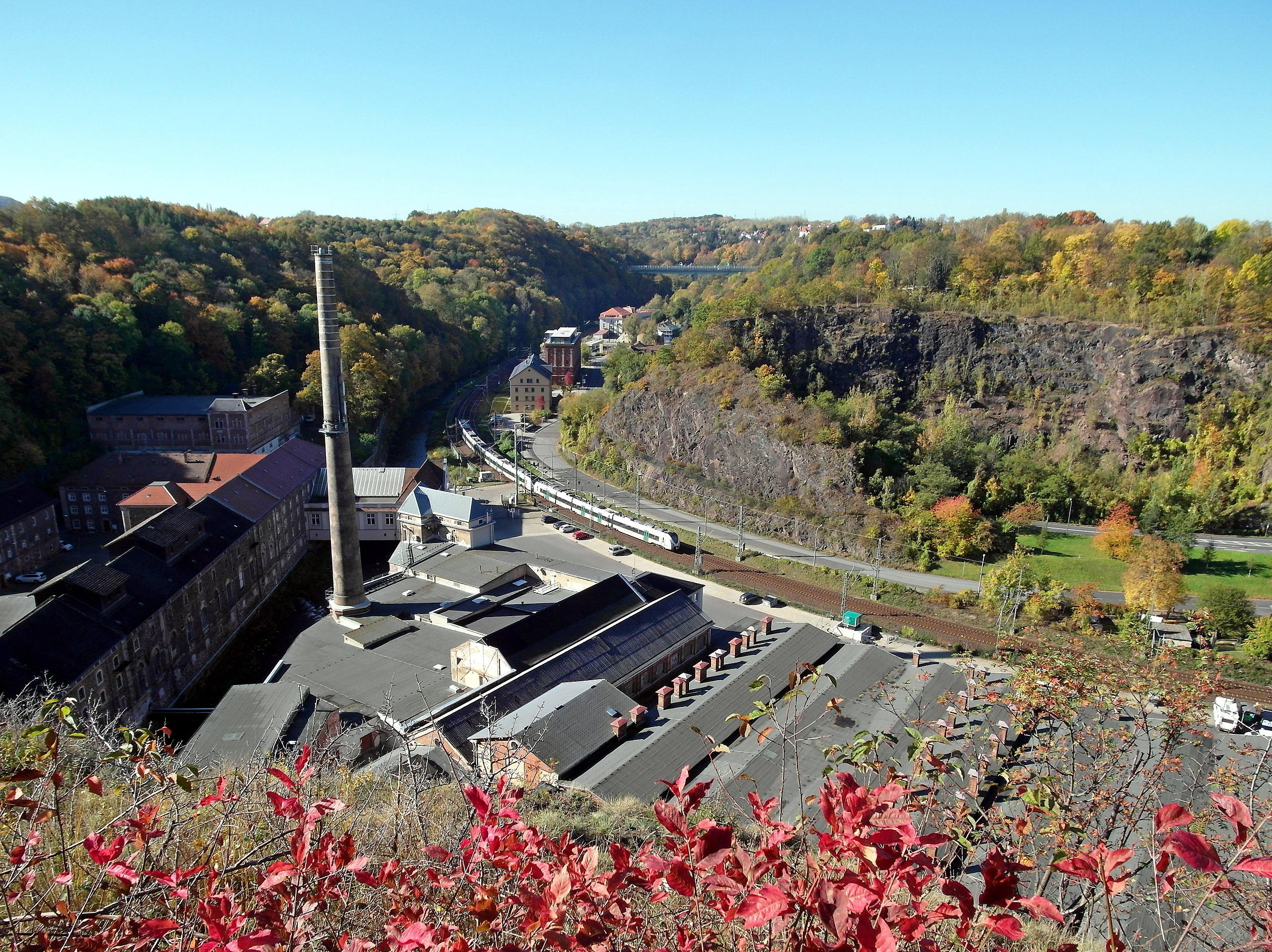
Deutsch: 15.10.2017 Dresden: Blick vom Aussichtspunkt in Dresden-Hohenplauen am Hohen Stein / Felsenkeller Bastei (GMP: 51.023282,13.703268) nach Westen über die von der Vereinigten Weißeritz zweigeteilte ehemalige Felsenkeller Brauerei (GMP: 51.023129,13.701592) in den Plauenschen Grund. Der Bau der Felsenkellerbrauerei auf dem Gelände der Buschmühle begann 1857. 1855 war die Bahnlinie der Albertbahn (heute Sachsen-Franken-Magistrale) eingeweiht worden. Gebraut wurde bis 1991. Rechts der Forsthaussteinbruch (GMP: 51.023660,13.699314) Dölzschen, an den sich links der 1993 fertiggestellte "Ingrid-Tunnel" (GMP: 51.023052,13.699474) der Tharandter Straße Richtung Freital anschließt. Er ist hier vom Felsen verdeckt. Im Hintergrund die Autobahnbrücke. [SAM2356.JPG]20171015140DR.JPG(c)Blobelt |
||||||||||||||
| Date | |||||||||||||||
| Source | Own work | ||||||||||||||
| Author |
|
||||||||||||||

| Object location | | View this and other nearby images on: OpenStreetMap |
|---|
Licensing[edit]
This file is licensed under the Creative Commons Attribution-Share Alike 4.0 International license.
- You are free:
- to share – to copy, distribute and transmit the work
- to remix – to adapt the work
- Under the following conditions:
- attribution – You must give appropriate credit, provide a link to the license, and indicate if changes were made. You may do so in any reasonable manner, but not in any way that suggests the licensor endorses you or your use.
- share alike – If you remix, transform, or build upon the material, you must distribute your contributions under the same or compatible license as the original.
File history
Click on a date/time to view the file as it appeared at that time.
| Date/Time | Thumbnail | Dimensions | User | Comment | |
|---|---|---|---|---|---|
| current | 20:14, 30 May 2020 | | 3,648 × 2,731 (6.98 MB) | Jörg Blobelt (talk | contribs) | Uploaded a work by {{Creator:Jörg Blobelt}} from {{own}} with UploadWizard |
You cannot overwrite this file.
File usage on Commons
The following 3 pages use this file: