File:2016 View from Brunhildisfelsen.jpg
Original file (4,474 × 2,982 pixels, file size: 8.95 MB, MIME type: image/jpeg)
Captions
Description2016 View from Brunhildisfelsen.jpg |
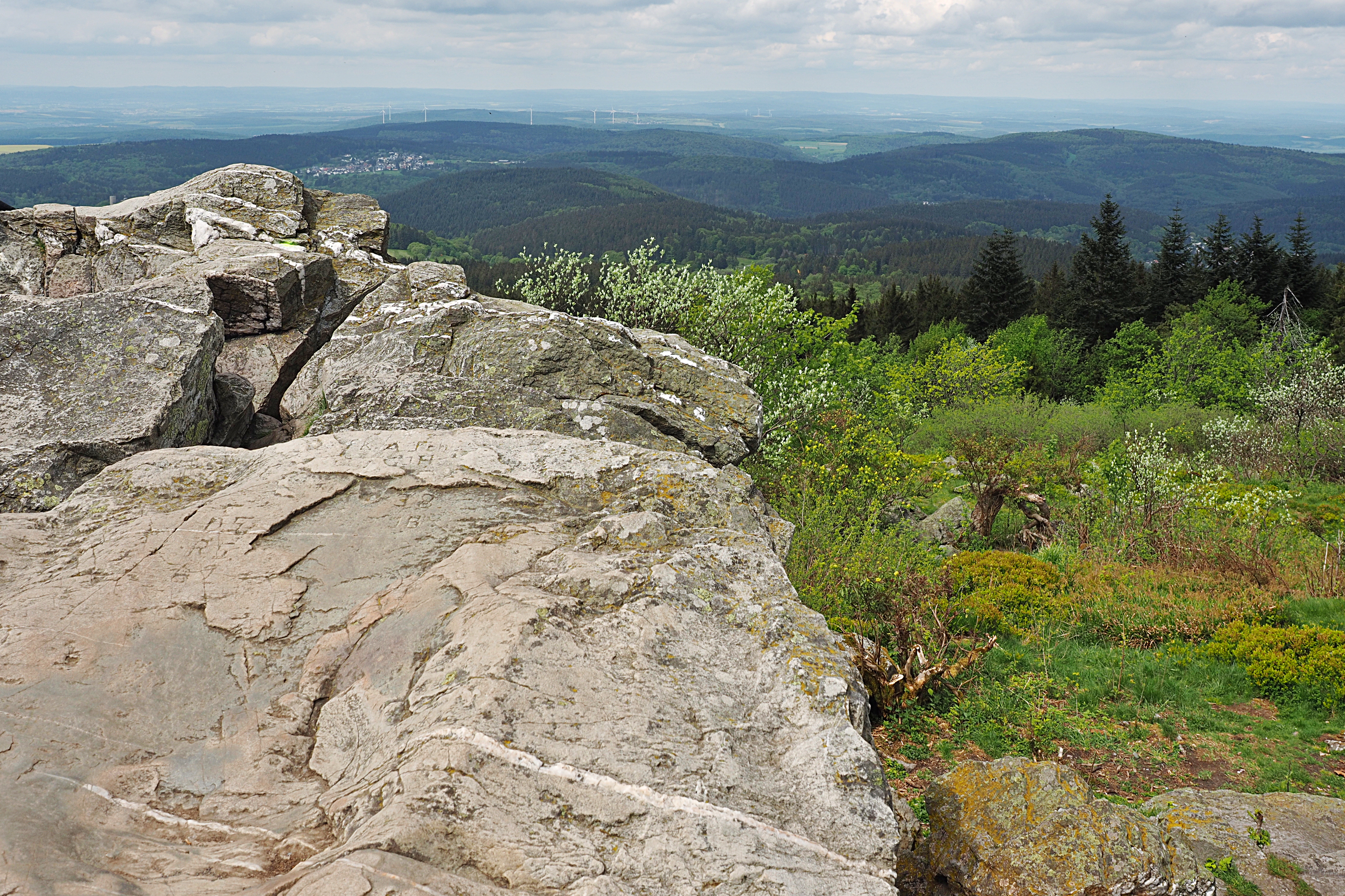
English: View from Brunhildis rock, en:Großer Feldberg, Germany, to the north
Deutsch: Blick vom Brunhildisfelsen am nördlichen Plateaurand des Großen Feldbergs nach Norden auf den Ort Seelenberg; halblinks der Berg Windhain, links darüber sowie rechts darüber den Bremer Berg bzw. Grünschiebel, rechts davor der Sängelberg; weiter rechts im Mittelgrund Judenkopf und Pfaffenrod, darüber der Pferdskopf mit Aussichtsturm. |
|||||||||
Date | ||||||||||
Source | Own work | |||||||||
Author | Kreuzschnabel | |||||||||
Permission (Reusing this file) |
I, the copyright holder of this work, hereby publish it under the following license: This file is licensed under the Creative Commons Attribution-Share Alike 3.0 Unported license.
|
Camera location | 50° 14′ 02.91″ N, 8° 27′ 28.54″ E | View this and other nearby images on: OpenStreetMap | 50.234143; 8.457928 |
---|
Annotations InfoField | This image is annotated: View the annotations at Commons |
Burg Reifenberg
Pferdskopf
Arnoldshain
Seelenberg
File history
Click on a date/time to view the file as it appeared at that time.
Date/Time | Thumbnail | Dimensions | User | Comment | |
---|---|---|---|---|---|
current | 09:47, 22 May 2016 | 4,474 × 2,982 (8.95 MB) | Kreuzschnabel (talk | contribs) | {{Information |Description ={{en|1=View from Brunhildis rock, en:Großer Feldberg, Germany, to the north}} {{de|1=Blick vom Brunhildisfelsen, de:Großer Feldberg, nach Norden}} |Source ={{own}} |Author =[[User:Kreuzschnabel... |
You cannot overwrite this file.
File usage on Commons
The following 2 pages use this file:
File usage on other wikis
The following other wikis use this file:
- Usage on de.wikipedia.org
Metadata
This file contains additional information such as Exif metadata which may have been added by the digital camera, scanner, or software program used to create or digitize it. If the file has been modified from its original state, some details such as the timestamp may not fully reflect those of the original file. The timestamp is only as accurate as the clock in the camera, and it may be completely wrong.
Image title | OLYMPUS DIGITAL CAMERA |
---|---|
Camera manufacturer | OLYMPUS IMAGING CORP. |
Camera model | E-M1 |
Exposure time | 1/350 sec (0.0028571428571429) |
F-number | f/6.7 |
ISO speed rating | 100 |
Date and time of data generation | 14:05, 21 May 2016 |
Lens focal length | 17 mm |
Orientation | Normal |
Horizontal resolution | 350 dpi |
Vertical resolution | 350 dpi |
Software used | GIMP 2.8.14 |
File change date and time | 11:41, 22 May 2016 |
Y and C positioning | Co-sited |
Exposure Program | Manual |
Exif version | 2.3 |
Date and time of digitizing | 14:05, 21 May 2016 |
Meaning of each component |
|
APEX exposure bias | 0 |
Maximum land aperture | 3 APEX (f/2.83) |
Metering mode | Pattern |
Light source | Unknown |
Flash | Flash did not fire, compulsory flash firing |
Supported Flashpix version | 1 |
Color space | sRGB |
File source | Digital still camera |
Custom image processing | Normal process |
Exposure mode | Manual exposure |
White balance | Auto white balance |
Digital zoom ratio | 1 |
Scene capture type | Standard |
Scene control | None |
Contrast | Normal |
Saturation | Normal |
Sharpness | Soft |
GPS tag version | 0.0.3.2 |
Image width | 4,608 px |
Image height | 3,456 px |
Structured data
Items portrayed in this file
depicts
some value
21 May 2016
50°14'2.915"N, 8°27'28.541"E
image/jpeg
870d0472d30ad09db025e7b55baf4cb930499084
9,387,072 byte
2,982 pixel
4,474 pixel
- CC-BY-SA-3.0
- Self-published work
- License migration redundant
- GFDL
- FAL
- Files with coordinates missing SDC location of creation (50° N, 8° E)
- Images by Kreuzschnabel/Landschaften
- Taken with Olympus E-M1 and Olympus M.Zuiko Digital ED 12-40mm f/2.8 PRO
- PNG created with GIMP
- Images with annotations
- Pages with maps