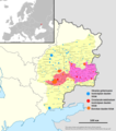
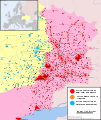
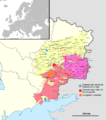
File:2014ko Ukraina ekialdeko gatazka armatua.png
From Wikimedia Commons, the free media repository
Jump to navigation
Jump to search

Size of this preview: 529 × 599 pixels. Other resolutions: 212 × 240 pixels | 424 × 480 pixels | 678 × 768 pixels | 904 × 1,024 pixels | 1,816 × 2,056 pixels.
Original file (1,816 × 2,056 pixels, file size: 678 KB, MIME type: image/png)
File information
Structured data
Captions
Captions
Add a one-line explanation of what this file represents
Summary
[edit]| Description2014ko Ukraina ekialdeko gatazka armatua.png |
Euskara: 2014ko apiriletik aurrera Ukraniako Donbass eskualdean jazotako gatazkari buruzko mapa. |
| Date | |
| Source |
This file was derived from: |
| Author | User:Euskalduna |
| Permission (Reusing this file) |
Ikus behean |
| Other versions |
[edit]
|
Licensing
[edit]I, the copyright holder of this work, hereby publish it under the following license:
This file is licensed under the Creative Commons Attribution-Share Alike 4.0 International license.
- You are free:
- to share – to copy, distribute and transmit the work
- to remix – to adapt the work
- Under the following conditions:
- attribution – You must give appropriate credit, provide a link to the license, and indicate if changes were made. You may do so in any reasonable manner, but not in any way that suggests the licensor endorses you or your use.
- share alike – If you remix, transform, or build upon the material, you must distribute your contributions under the same or compatible license as the original.
File history
Click on a date/time to view the file as it appeared at that time.
| Date/Time | Thumbnail | Dimensions | User | Comment | |
|---|---|---|---|---|---|
| current | 09:07, 9 August 2014 |  | 1,816 × 2,056 (678 KB) | Turkmenistan (talk | contribs) | Como el mapa fue creado para jamás mantenerlo actualizado, me digno a colaborar un poco, aunque serán infrecuentes mis ediciones en este mapa. http://liveuamap.com/e/2014/9-of-august-terrorists-have-retreated-from-krasnyi-luch-?ll=48.0582911262955;38... |
| 14:05, 28 July 2014 |  | 640 × 725 (260 KB) | Euskaldunaa (talk | contribs) | User created page with UploadWizard |
You cannot overwrite this file.
File usage on Commons
The following 17 pages use this file:
- User:Magog the Ogre/Maps of conflicts/2014 July
- File:2014 Russo-ukrainian-conflict map.svg
- File:2014ko Ukraina ekialdeko gatazka armatua.png
- File:East Ukraine Conflict.svg
- File:East Ukraine Conflict RBK.svg
- File:East Ukraine conflict.png
- File:East Ukraine conflict2.png
- File:East Ukraine conflict (English language version).png
- File:East Ukraine conflict dynamics.gif
- File:Insurgencia en Donbass.png
- File:Map of the war in Donbass.svg
- File:Map of the war in Donbass 22 02 2022.svg
- File:Map of war in eastern Ukraine in 08.08.14.png
- File:Военный конфликт на востоке Украины.svg
- File:Карта боевых действий на Востоке Украины-b.svg
- File:Карта боевых действий на Востоке Украины.svg
- Template:Other versions/East Ukraine conflict
Metadata
This file contains additional information such as Exif metadata which may have been added by the digital camera, scanner, or software program used to create or digitize it. If the file has been modified from its original state, some details such as the timestamp may not fully reflect those of the original file. The timestamp is only as accurate as the clock in the camera, and it may be completely wrong.
| Horizontal resolution | 37.79 dpc |
|---|---|
| Vertical resolution | 37.79 dpc |


