File:20080729 Melbylejren Beach.JPG
Jump to navigation
Jump to search

Size of this preview: 800 × 600 pixels. Other resolutions: 320 × 240 pixels | 640 × 480 pixels | 1,024 × 768 pixels | 1,280 × 960 pixels | 2,048 × 1,536 pixels.
Original file (2,048 × 1,536 pixels, file size: 1.56 MB, MIME type: image/jpeg)
Captions
Captions
Add a one-line explanation of what this file represents
| Camera location | | View this and other nearby images on: OpenStreetMap |
|---|
| Description |
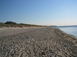
Dansk: Stranden ud for Tangvej, Melbylejren, Asserbo. billedet er taget i østsydøstlig retning mod Liseleje. (Billedet har Geotag-informationer gemt i EXIF)
English: The beach at the end of Tangvej, Melbylejren, Asserbo, Denmark. The picture was taken in direction ESE of Liseleje (Note: Picture has Geotag information stored in EXIF.) |
| Date | |
| Source | Taken with my Digital Ixus v3 |
| Author | Fod |
| Permission (Reusing this file) |
I, the copyright holder of this work, hereby publish it under the following license: This file is licensed under the Creative Commons Attribution 2.5 Denmark license.
 |
File history
Click on a date/time to view the file as it appeared at that time.
| Date/Time | Thumbnail | Dimensions | User | Comment | |
|---|---|---|---|---|---|
| current | 14:26, 30 July 2008 | | 2,048 × 1,536 (1.56 MB) | Fod (talk | contribs) | {{Information |Description={{da|Stranden ud for Tangvej, Melbylejren, Asserbo. billedet er taget i østsydøstlig retning mod Liseleje. (Billedet har Geotag-informationer gemt i EXIF)}}{{en|The beach at the end of Tangvej, Melbylejren, Asserbo, Denmark. T |
You cannot overwrite this file.
File usage on Commons
The following 2 pages use this file:
File usage on other wikis
The following other wikis use this file:
- Usage on da.wikipedia.org
- Usage on en.wikipedia.org
- Usage on no.wikipedia.org
- Usage on sv.wikipedia.org