File:2éme Bataille de la Marne - Lucy le Bocage (photo VestPocket Kodak Marius Vasse 1891-1987) (3911988066).jpg

Original file (954 × 626 pixels, file size: 349 KB, MIME type: image/jpeg)
Captions
Captions
Summary[edit]
_(3911988066).jpg&action=edit§ion=1)
| Description |
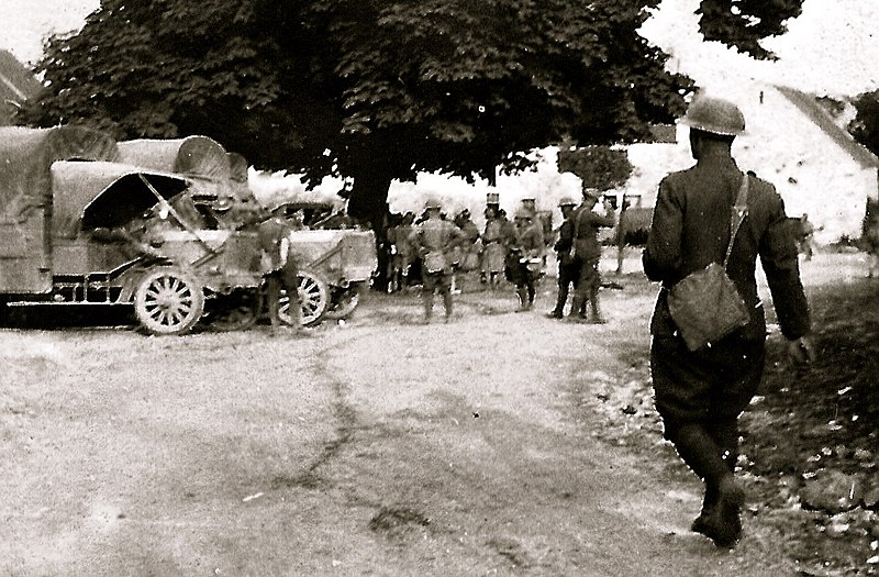
le 2 juin 18, le 15-2 tout entier se reformait en arriére de lucy le bocage. le colonel meilhan qui était resté à lucy n'était plus protégé que par un mince rideau d'américains. Si les boches profitaient de la nuit pour exploiter leur succés, qui sait si lucy à son tour ne serait pas pris (aprés belleau). Coûte que côute , il fallait défendre lucy le bocage, personne ne voulait plus envisager un nouveau replis. Jamais le vieux dilemme vaincre ou mourir ne s'était posé a des hommes d'armes de façon aussi impérative. Comme le colonel préparait la défense du village - le général Michel, commandant de la division, venait de donner l'ordre au 15-2 de passer à la contre attaque. Le lendemain 3 juin, le 15-2 dépassait la ligne des américains et reprenait une grande partie du terrain perdu la veille. 2 June 18, 15-2 entire re-formed in rear lucy le bocage. Colonel Meilhan who remained at Lucy was no longer protected by a thin curtain of Americans. If the Germans took advantage of the night to exploit their success, who knows if lucy in turn would not be taken (after belleau). Whatever the cost, he had to defend lucy, nobody wanted to consider a new folds. Not the old dilemma conquer or die has not landed the men of arms so imperative. As the colonel was preparing the defense of the village - General Michel, the division commander, had given orders to move against the attack. The next day June 3, 15-2 exceeded the line of American and reconquest much of the ground lost the day before. |
| Date | |
| Source | 2éme Bataille de la Marne - Lucy le Bocage (photo VestPocket Kodak Marius Vasse 1891-1987) |
| Author | vasse nicolas,antoine from Tarbes, FRANCE |
| Camera location | | View this and other nearby images on: OpenStreetMap |
|---|
_(3911988066).jpg¶ms=049.057663_N_0003.279102_E_globe:Earth_type:camera_source:Flickr_&language=en)
Licensing[edit]
_(3911988066).jpg&action=edit§ion=2)
- You are free:
- to share – to copy, distribute and transmit the work
- to remix – to adapt the work
- Under the following conditions:
- attribution – You must give appropriate credit, provide a link to the license, and indicate if changes were made. You may do so in any reasonable manner, but not in any way that suggests the licensor endorses you or your use.
| This image was originally posted to Flickr by Vasnic64 at https://flickr.com/photos/39887688@N02/3911988066. It was reviewed on 30 December 2021 by FlickreviewR 2 and was confirmed to be licensed under the terms of the cc-by-2.0. |
File history
Click on a date/time to view the file as it appeared at that time.
| Date/Time | Thumbnail | Dimensions | User | Comment | |
|---|---|---|---|---|---|
| current | 16:50, 30 December 2021 | | 954 × 626 (349 KB) | Siloepic (talk | contribs) | Transferred from Flickr via #flickr2commons |
You cannot overwrite this file.
File usage on Commons
There are no pages that use this file.
_(3911988066).jpg&oldid=840826785)