File:1 Strasbourg-Carlsruhe 2 Besançon-Basel - btv1b10223421n.jpg
Jump to navigation
Jump to search

Size of this preview: 658 × 600 pixels. Other resolutions: 263 × 240 pixels | 527 × 480 pixels | 843 × 768 pixels | 1,123 × 1,024 pixels | 2,247 × 2,048 pixels | 6,105 × 5,565 pixels.
Original file (6,105 × 5,565 pixels, file size: 10.37 MB, MIME type: image/jpeg)
Captions
Captions
Add a one-line explanation of what this file represents
Summary[edit]
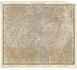
| 1 Strasbourg-Carlsruhe 2 Besançon-Basel
( |
|||||||||||||||||||||||||||
|---|---|---|---|---|---|---|---|---|---|---|---|---|---|---|---|---|---|---|---|---|---|---|---|---|---|---|---|
| Author |
Woerl, J. E.. Cartographe Herder, Bartholomäus (1774-1839). Cartographe |
||||||||||||||||||||||||||
| Title |
1 Strasbourg-Carlsruhe 2 Besançon-Basel |
||||||||||||||||||||||||||
| Description |
Français : Échelle(s) : 0 500 000
Appartient à l’ensemble documentaire : BNUStr007 Appartient à l’ensemble documentaire : BNUStras1 Langue : français français Éditeur : (Paris) |
||||||||||||||||||||||||||
| Dimensions | height: 45.7 cm (17.9 in); width: 37.8 cm (14.9 in) | ||||||||||||||||||||||||||
| Collection |
|
||||||||||||||||||||||||||
| References |
Français : Notice du catalogue : http://catalogue.bnf.fr/ark:/12148/cb419090428 |
||||||||||||||||||||||||||
| Source/Photographer |
Français : Bibliothèque nationale et universitaire de Strasbourg, MCARTE10280
Bibliothèque nationale de France |
||||||||||||||||||||||||||
| Permission (Reusing this file) |
|
||||||||||||||||||||||||||

File history
Click on a date/time to view the file as it appeared at that time.
| Date/Time | Thumbnail | Dimensions | User | Comment | |
|---|---|---|---|---|---|
| current | 17:22, 15 July 2022 | | 6,105 × 5,565 (10.37 MB) | Gzen92Bot (talk | contribs) | Gallica btv1b10223421n |
You cannot overwrite this file.
File usage on Commons
The following page uses this file: