File:1F244039030EFF8700P1151L0M1.jpg
Jump to navigation
Jump to search
Size of this preview: 600 × 600 pixels. Other resolutions: 240 × 240 pixels | 480 × 480 pixels | 768 × 768 pixels | 1,024 × 1,024 pixels.
Original file (1,024 × 1,024 pixels, file size: 132 KB, MIME type: image/jpeg)
Captions
Captions
Add a one-line explanation of what this file represents
Summary[edit]
| Description |
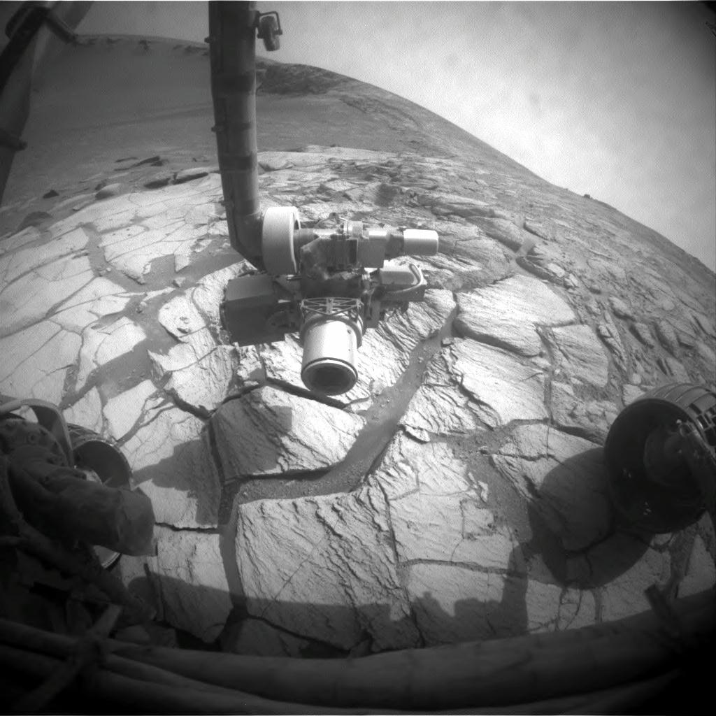
English: A layer of light-toned rock exposed inside Victoria Crater in the Meridiani Planum region of Mars appears to mark where the surface was at the time, many millions of years ago, when an impact excavated the crater. NASA's Mars Exploration Rover Opportunity drove to this bright band as the science team's first destination for the rover during investigations inside the crater. Opportunity's left front hazard-identification camera took this image just after the rover finished a drive of 2.25 meters (7 feet, 5 inches) during the rover's 1,305th Martian day, or sol, (Sept. 25, 2007). The rocks beneath the rover and its extended robotic arm are part of the bright band.
Victoria Crater has a scalloped shape of alternating alcoves and promontories around the crater's circumference. Opportunity descended into the crater two weeks earlier, within an alcove called "Duck Bay." Counterclockwise around the rim, just to the right of the arm in this image, is a promontory called "Cabo Frio." |
| Date | |
| Source | http://marsrovers.jpl.nasa.gov/gallery/all/1/f/1305/1F244039030EFF8700P1151L0M1.HTML and http://www.nasa.gov/mission_pages/mer/images/caption20070926.html |
| Author | NASA/JPL-Caltech |
This image or video was catalogued by Jet Propulsion Laboratory of the United States National Aeronautics and Space Administration (NASA) under Photo ID: 1F244039030EFF8700P1151L0M1. This tag does not indicate the copyright status of the attached work. A normal copyright tag is still required. See Commons:Licensing. Other languages:
|
Licensing[edit]
| This file is in the public domain in the United States because it was solely created by NASA. NASA copyright policy states that "NASA material is not protected by copyright unless noted". (See Template:PD-USGov, NASA copyright policy page or JPL Image Use Policy.) | ||
 |
Warnings:
|
File history
Click on a date/time to view the file as it appeared at that time.
| Date/Time | Thumbnail | Dimensions | User | Comment | |
|---|---|---|---|---|---|
| current | 03:42, 16 February 2013 | | 1,024 × 1,024 (132 KB) | Huntster (talk | contribs) | == {{int:filedesc}} == {{Information |Description={{en|1=A layer of light-toned rock exposed inside Victoria Crater in the Meridiani Planum region of Mars appears to mark where the surface was at the time, many millions of years ago, when an impact exc... |
You cannot overwrite this file.
File usage on Commons
The following page uses this file:
File usage on other wikis
The following other wikis use this file:
- Usage on fa.wikipedia.org