File:1930 BERy rapid transit map.png
Jump to navigation
Jump to search

Size of this preview: 532 × 600 pixels. Other resolutions: 213 × 240 pixels | 426 × 480 pixels | 681 × 768 pixels | 908 × 1,024 pixels | 1,816 × 2,048 pixels | 3,500 × 3,946 pixels.
Original file (3,500 × 3,946 pixels, file size: 17.78 MB, MIME type: image/png)
Captions
Captions
Add a one-line explanation of what this file represents
Summary[edit]
| Description |
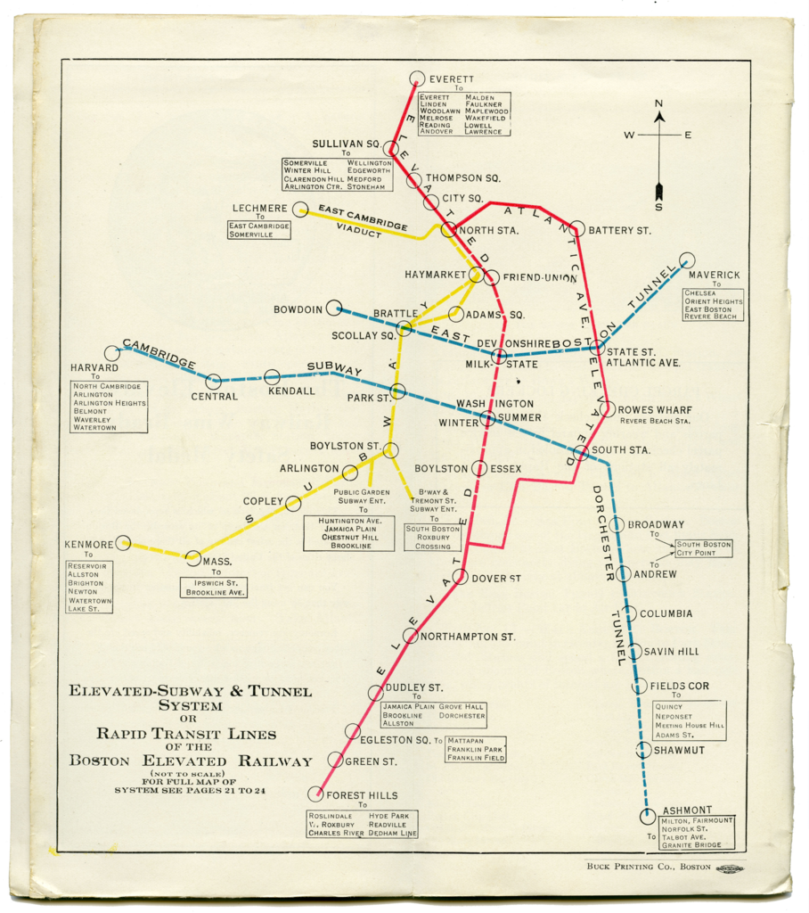
English: 1930 map of the Boston Elevated Railway rapid transit system |
||||
| Date | |||||
| Source | BERy Guide and Information Brochure, via Ward Maps | ||||
| Author | Boston Elevated Railway | ||||
| Permission (Reusing this file) |
|


File history
Click on a date/time to view the file as it appeared at that time.
| Date/Time | Thumbnail | Dimensions | User | Comment | |
|---|---|---|---|---|---|
| current | 06:21, 12 June 2020 | | 3,500 × 3,946 (17.78 MB) | Pi.1415926535 (talk | contribs) | == {{int:filedesc}} == {{Information |description ={{en|1=1930 map of the Boston Elevated Railway rapid transit system}} |date =1930 |source =BERy Guide and Information Brochure, via [https://www.wardmaps.com/viewasset.php?aid=21103 Ward Maps] |author =Boston Elevated Railway |permission ={{PD-scan|PD-US-no notice}} }} Category:1930 in Boston Category:1930 maps of Massachusetts Category:Maps of the Boston Elevated Railway [[Category:Other images upload... |
You cannot overwrite this file.
File usage on Commons
The following 3 pages use this file: