File:1924 map of American fliers route from Alaska to Japan.png
Jump to navigation
Jump to search
Size of this preview: 800 × 282 pixels. Other resolutions: 320 × 113 pixels | 640 × 226 pixels | 1,024 × 361 pixels | 1,280 × 452 pixels | 2,928 × 1,033 pixels.
Original file (2,928 × 1,033 pixels, file size: 101 KB, MIME type: image/png)
Captions
Captions
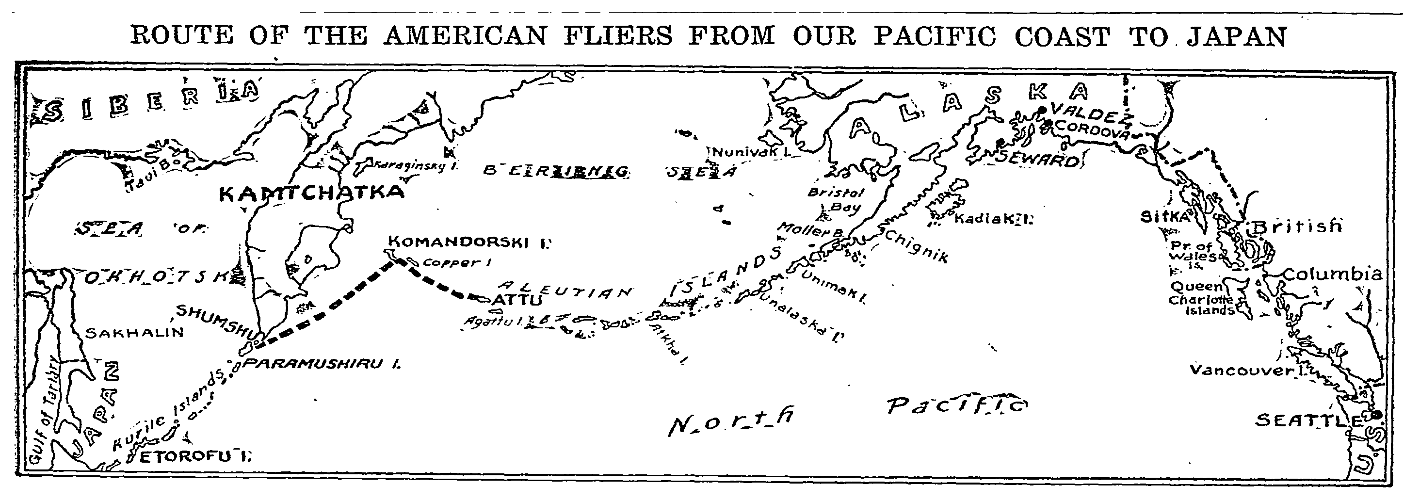
1924 map that shows a planned flight path from Attu Island, Alaska to Etorofu Island (now known as Iturup, Sakhalin Oblast, Russia)
Summary
[edit]
| Description |
English: Caption text says "On their trip from Seattle the army aviators followed the coast of Alaska to a large extent and then coursed down along the Aleutian Islands to the very end of them. The final flight to Paramashiru Island in the Japanese Kuriles, shown by the broken line, was made by way of Komandorski Islands, a distance of about 1,200 miles. The American fliers are now about the same distance northeast of Tokio. Their next stopping place is Etorofu Island." |
| Date | |
| Source | The New York Times, May 18, 1924 |
| Author | The New York Times |
Licensing
[edit]
This work is in the public domain in the United States because it was published (or registered with the U.S. Copyright Office) before January 1, 1929.
Public domain works must be out of copyright in both the United States and in the source country of the work in order to be hosted on the Commons. If the work is not a U.S. work, the file must have an additional copyright tag indicating the copyright status in the source country.
Note: This tag should not be used for sound recordings. |
File history
Click on a date/time to view the file as it appeared at that time.
| Date/Time | Thumbnail | Dimensions | User | Comment | |
|---|---|---|---|---|---|
| current | 19:53, 27 March 2024 | 2,928 × 1,033 (101 KB) | Abzeronow (talk | contribs) | Uploaded a work by The New York Times from The New York Times, May 18, 1924 with UploadWizard |
You cannot overwrite this file.
File usage on Commons
There are no pages that use this file.