File:1919 Official map of American and Canadian airways and aerial mail routes, from the Digital Commonwealth - commonwealth 7h149w33d.jpg
Jump to navigation
Jump to search

Size of this preview: 800 × 593 pixels. Other resolutions: 320 × 237 pixels | 640 × 474 pixels | 1,024 × 759 pixels | 1,280 × 949 pixels | 2,560 × 1,898 pixels | 14,298 × 10,599 pixels.
Original file (14,298 × 10,599 pixels, file size: 242.58 MB, MIME type: image/jpeg)
Captions
Captions
Add a one-line explanation of what this file represents
Summary
[edit]
| Warning | The original file is very high-resolution. It might not load properly or could cause your browser to freeze when opened at full size. |
|---|
| Description |
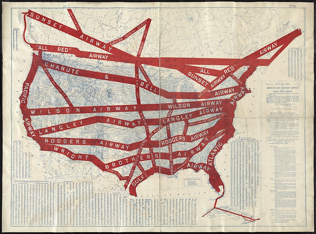
English: 1919 Official map of American and Canadian airways and aerial mail routes, by the Aeronautic Maps Association, from the Digital Commonwealth - commonwealth 7h149w33d. (https://www.digitalcommonwealth.org/search/commonwealth:7h149w33d) |
| Date | |
| Source | Digital Commonwealth |
| Author | Aeronautic Maps Association |
Licensing
[edit]
This work is in the public domain in the United States because it was published (or registered with the U.S. Copyright Office) before January 1, 1929.
Public domain works must be out of copyright in both the United States and in the source country of the work in order to be hosted on the Commons. If the work is not a U.S. work, the file must have an additional copyright tag indicating the copyright status in the source country.
Note: This tag should not be used for sound recordings. |
File history
Click on a date/time to view the file as it appeared at that time.
| Date/Time | Thumbnail | Dimensions | User | Comment | |
|---|---|---|---|---|---|
| current | 21:19, 30 November 2021 | | 14,298 × 10,599 (242.58 MB) | Daderot (talk | contribs) | Uploaded a work by Aeronautic Maps Association from Digital Commonwealth with UploadWizard |
You cannot overwrite this file.
File usage on Commons
The following 2 pages use this file: