File:1915 Route of Explorer Kishen Singh in Western Tibet in 1873-74 VI.jpg

Original file (4,462 × 5,010 pixels, file size: 11.8 MB, MIME type: image/jpeg)
Captions
Captions
Summary[edit]
| Description |
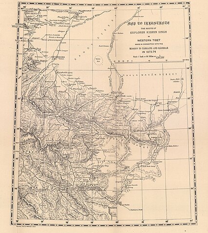
Route of Kishen Singh Pandit in 1873 |
|||||||||
| Date | ||||||||||
| Source | Pandit Maps | |||||||||
| Creator |
Survey of India |
|||||||||
| Permission (Reusing this file) |
|
|||||||||
| Geotemporal data | ||||||||||
| Bounding box |
|
|||||||||
| Georeferencing | ||||||||||

File history
Click on a date/time to view the file as it appeared at that time.
| Date/Time | Thumbnail | Dimensions | User | Comment | |
|---|---|---|---|---|---|
| current | 10:41, 23 August 2022 | | 4,462 × 5,010 (11.8 MB) | Shyamal (talk | contribs) | {{Information |Description=Route of Kishen Singh Pandit in 1873 |Source=[https://zenodo.org/record/6501841 Pandit Maps] |Date=1915 |Author=Survey of India |Permission={{PD-India}} |other_versions= }} Category:Maps of India |
You cannot overwrite this file.
File usage on Commons
There are no pages that use this file.