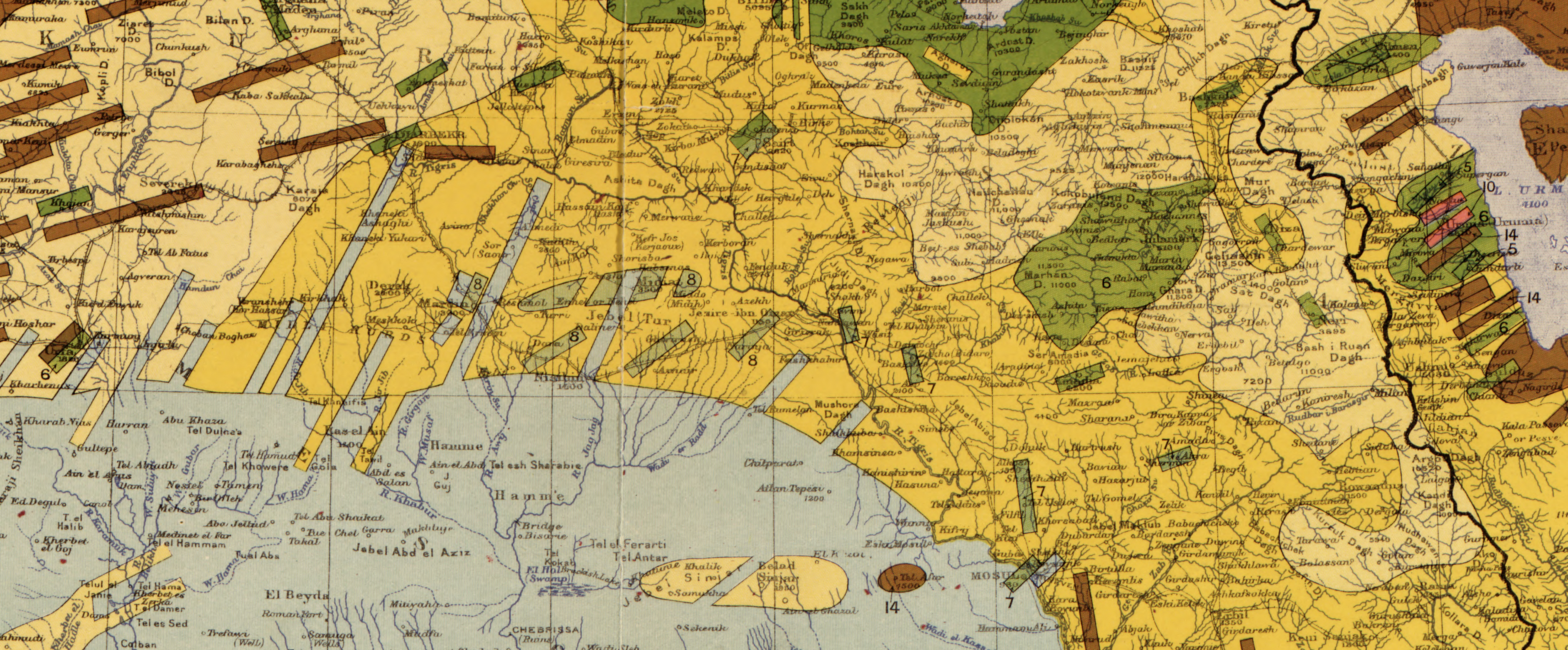
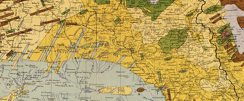
File:1910 map showing "Nestorians" (6), "Chaldeans" (7) and "Jacobites" (8), in Maunsell's map, Pre-World War I British Ethnographical Map of eastern Turkey in Asia, Syria and western Persia 01 (cropped).jpg
Jump to navigation
Jump to search
Size of this preview: 800 × 332 pixels. Other resolutions: 320 × 133 pixels | 640 × 265 pixels | 1,024 × 424 pixels | 1,280 × 530 pixels | 3,774 × 1,564 pixels.
Original file (3,774 × 1,564 pixels, file size: 8.28 MB, MIME type: image/jpeg)
Captions
Captions
Add a one-line explanation of what this file represents
Summary
[edit]| Description |
English: .jpg) |
| Date | |
| Source | Library of Congress: https://www.loc.gov/resource/g7431e.ct002182/?r=-0.507,0.215,1.553,0.83,0 |
| Author | Lieutenant Colonel Francis Richard Maunsell (1861 - 1936) [1][2] |
| Other versions |

,_%22Chaldeans%22_(7)_and_%22Jacobites%22_(8),_in_Maunsell%27s_map,_Pre-World_War_I_British_Ethnographical_Map_of_eastern_Turkey_in_Asia,_Syria_and_western_Persia_01_(cropped).jpg&action=edit§ion=1)
Licensing
[edit],_%22Chaldeans%22_(7)_and_%22Jacobites%22_(8),_in_Maunsell%27s_map,_Pre-World_War_I_British_Ethnographical_Map_of_eastern_Turkey_in_Asia,_Syria_and_western_Persia_01_(cropped).jpg&action=edit§ion=2)
|
The author died in 1936, so this work is in the public domain in its country of origin and other countries and areas where the copyright term is the author's life plus 80 years or fewer. This work is in the public domain in the United States because it was published (or registered with the U.S. Copyright Office) before January 1, 1929. | |
| This file has been identified as being free of known restrictions under copyright law, including all related and neighboring rights. | |
File history
Click on a date/time to view the file as it appeared at that time.
| Date/Time | Thumbnail | Dimensions | User | Comment | |
|---|---|---|---|---|---|
| current | 08:54, 6 May 2022 | | 3,774 × 1,564 (8.28 MB) | Onceinawhile (talk | contribs) | File:Maunsell's map, Pre-World War I British Ethnographical Map of eastern Turkey in Asia, Syria and western Persia 01.jpg cropped 65 % horizontally, 83 % vertically using CropTool with precise mode. |
You cannot overwrite this file.
File usage on Commons
The following page uses this file:
File usage on other wikis
The following other wikis use this file:
- Usage on en.wikipedia.org
,_%22Chaldeans%22_(7)_and_%22Jacobites%22_(8),_in_Maunsell%27s_map,_Pre-World_War_I_British_Ethnographical_Map_of_eastern_Turkey_in_Asia,_Syria_and_western_Persia_01_(cropped).jpg&oldid=746551807)