File:1900 U.S.G.S Map of Huntington and Northport, Long Island, New York - Geographicus - Northport-uscs-1925.jpg
Original file (3,000 × 3,896 pixels, file size: 2.23 MB, MIME type: image/jpeg)
Captions
Captions
| New York Northport Quadrangle | ||||||
|---|---|---|---|---|---|---|
| Artist | ||||||
| Title |
New York Northport Quadrangle |
|||||
| Description |
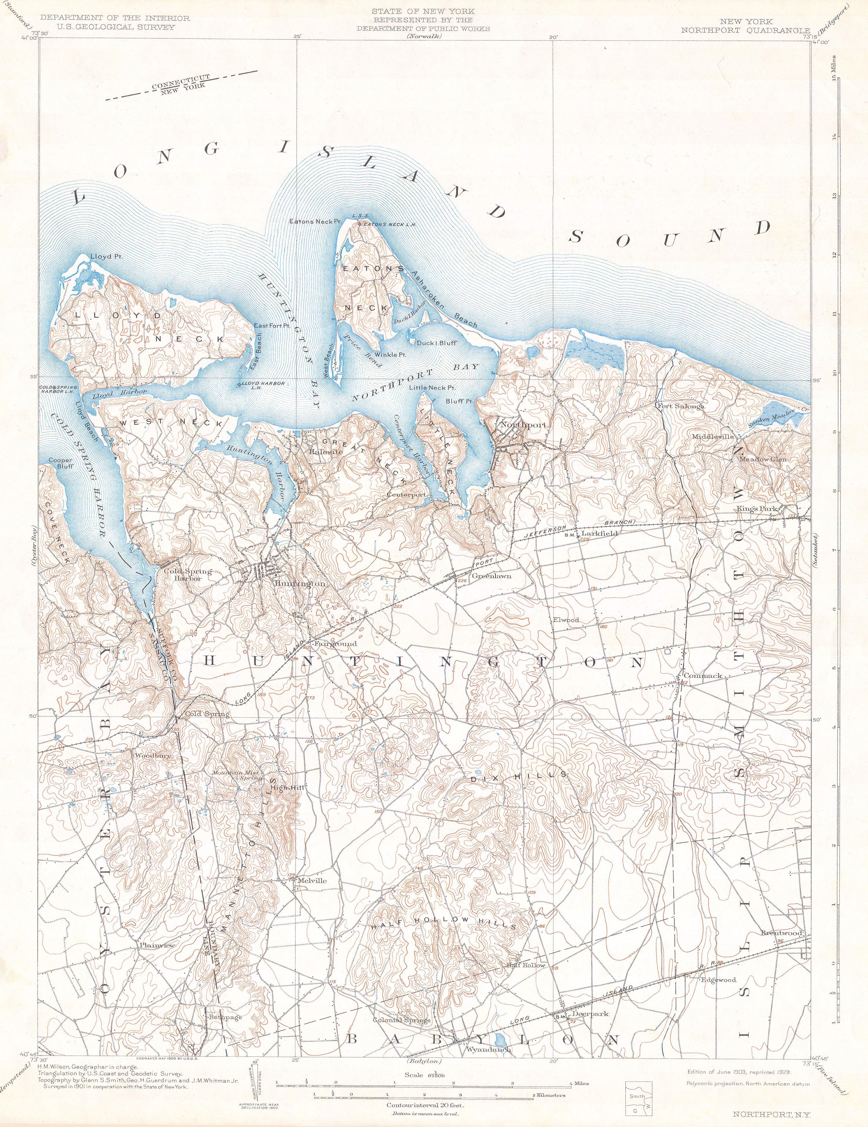
English: This beautiful and fascinating topographical chart depicts Long Island, New York from Oyster Bay through Huntington and Northport to Smithtown, Islip, and Babylon. Highly detailed with important buildings, and trains and rail lines. A rare and stunning geological survey of this highly populated region. From the 1928 reissue of the Feb. 1900 charts. |
|||||
| Date | 1900 | |||||
| Dimensions | height: 15 in (38.1 cm); width: 19 in (48.2 cm) | |||||
| Accession number |
Geographicus link: Northport-uscs-1925 |
|||||
| Source/Photographer |
|
|||||
| Permission (Reusing this file) |
|
|||||
File history
Click on a date/time to view the file as it appeared at that time.
| Date/Time | Thumbnail | Dimensions | User | Comment | |
|---|---|---|---|---|---|
| current | 12:50, 12 March 2011 | | 3,000 × 3,896 (2.23 MB) | BotMultichill (talk | contribs) | {{subst:User:Multichill/Geographicus |link=http://www.geographicus.com/P/AntiqueMap/Northport-uscs-1925 |product_name=1900 U.S.G.S Map of Huntington and Northport, Long Island, New York |map_title=New York Northport Quadrangle |description=This beautifu |
You cannot overwrite this file.
File usage on Commons
The following page uses this file:
File usage on other wikis
The following other wikis use this file:
- Usage on fr.wikipedia.org