File:1900- Temperature change in the United States (color-coded map).png
Jump to navigation
Jump to search

Size of this preview: 611 × 599 pixels. Other resolutions: 245 × 240 pixels | 490 × 480 pixels | 928 × 910 pixels.
Original file (928 × 910 pixels, file size: 74 KB, MIME type: image/png)
Captions
Captions
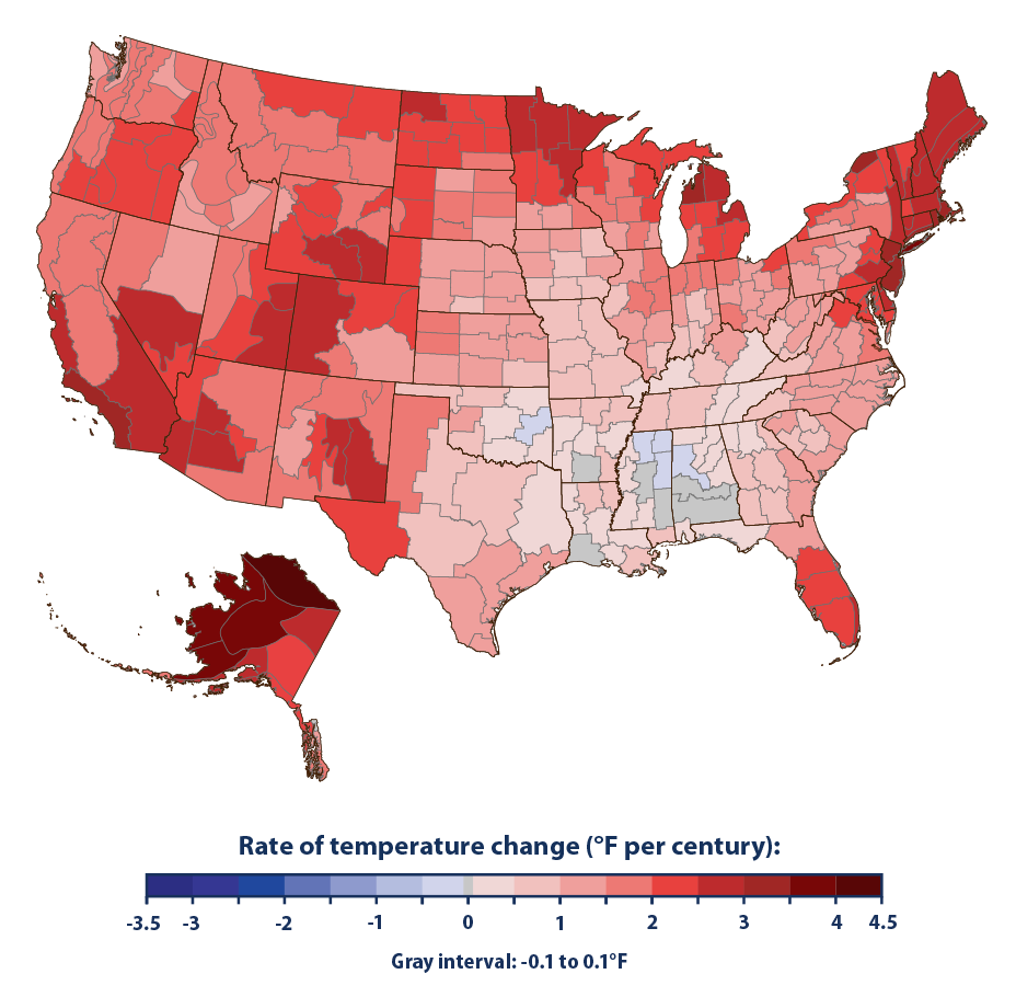
Color-coded map of the United States depicting region-by-region temperature change since 1900
Summary[edit]
.png&action=edit§ion=1)
| Description |
English: Color-coded map of the United States depicting region-by-region temperature change since 1900 |
| Date | |
| Source |
|
| Author | Environmental Protection Agency, an agency of the U.S. federal government |
Licensing[edit]
.png&action=edit§ion=2)
This image (or other media) is a work of an Environmental Protection Agency employee, taken or made as part of that person's official duties. As works of the U.S. federal government, all EPA images are in the public domain.
|
||
File history
Click on a date/time to view the file as it appeared at that time.
| Date/Time | Thumbnail | Dimensions | User | Comment | |
|---|---|---|---|---|---|
| current | 06:12, 3 January 2022 | | 928 × 910 (74 KB) | RCraig09 (talk | contribs) | Uploaded a work by Environmental Protection Agency, an agency of the U.S. federal government from * Formal citation to source: {{cite web |title=Climate Change Indicators: U.S. and Global Temperature |url=https://www.epa.gov/climate-indicators/climate-change-indicators-us-and-global-temperature |website=EPA.gov |publisher=Environmental Protection Agency |archive-url=https://web.archive.org/web/20211230101600/https://www.epa.gov/climate-indicators/climate-change-indicators-us-and-global-temper... |
You cannot overwrite this file.
File usage on Commons
The following page uses this file:
File usage on other wikis
The following other wikis use this file:
- Usage on de.wikipedia.org
- Usage on en.wikipedia.org
- Usage on ha.wikipedia.org
- Usage on yo.wikipedia.org
.png&oldid=747793984)