File:1888 Old Colony Railroad Cape Cod map.png
Jump to navigation
Jump to search
Size of this preview: 800 × 557 pixels. Other resolutions: 320 × 223 pixels | 640 × 445 pixels | 1,024 × 713 pixels | 1,280 × 891 pixels | 2,560 × 1,782 pixels | 3,500 × 2,436 pixels.
Original file (3,500 × 2,436 pixels, file size: 18.69 MB, MIME type: image/png)
Captions
Captions
Add a one-line explanation of what this file represents
Summary
[edit]
| Description |
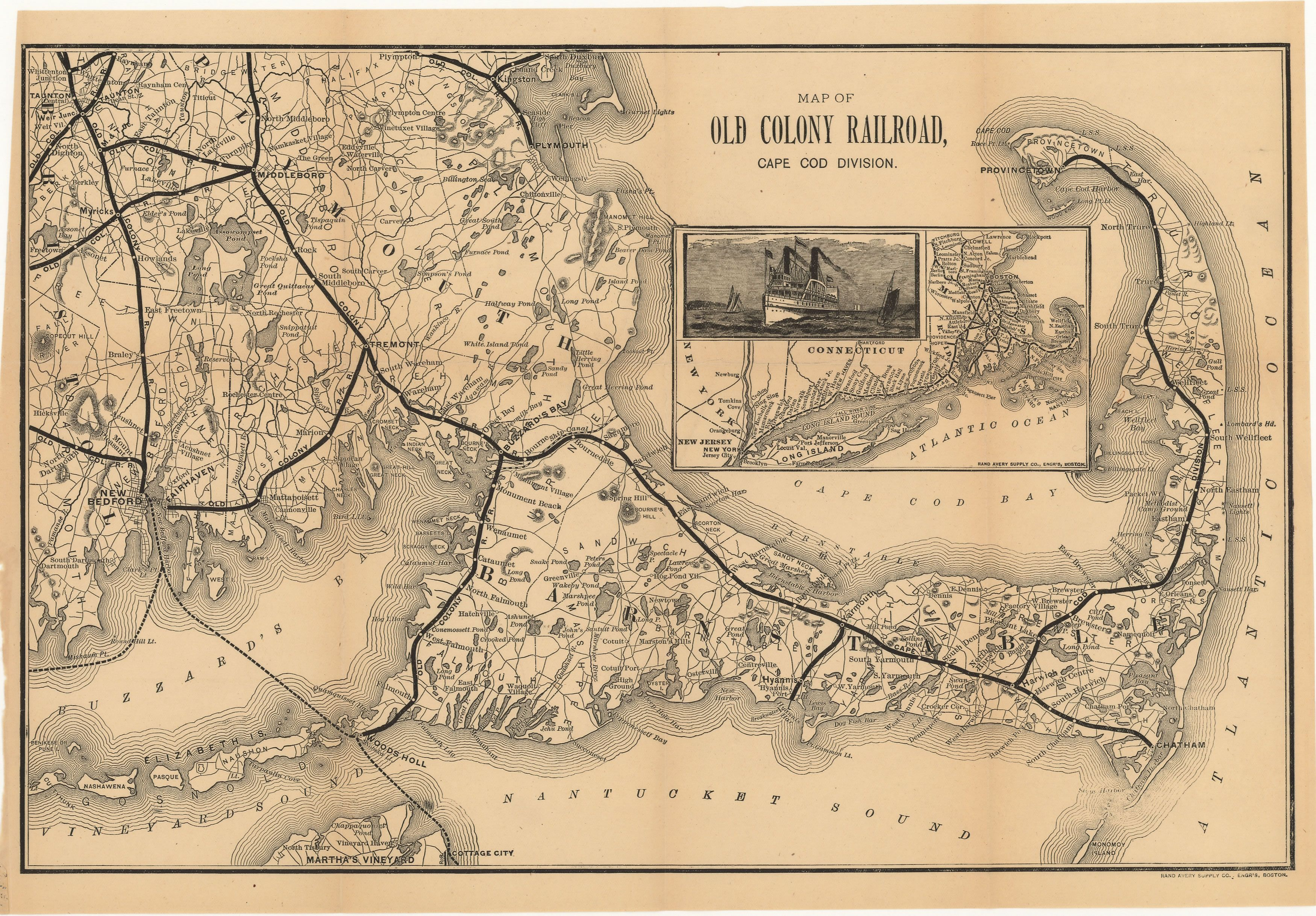
English: 1888 map of the Old Colony Railroad's Cape Cod Division |
| Date | |
| Source | Scanned map on WardMaps |
| Author | Old Colony Railroad |
| Other versions |
 |
Licensing
[edit]
|
This is a faithful photographic reproduction of a two-dimensional, public domain work of art. The work of art itself is in the public domain for the following reason:
The official position taken by the Wikimedia Foundation is that "faithful reproductions of two-dimensional public domain works of art are public domain".
This photographic reproduction is therefore also considered to be in the public domain in the United States. In other jurisdictions, re-use of this content may be restricted; see Reuse of PD-Art photographs for details. | ||||
File history
Click on a date/time to view the file as it appeared at that time.
| Date/Time | Thumbnail | Dimensions | User | Comment | |
|---|---|---|---|---|---|
| current | 07:33, 12 January 2014 | | 3,500 × 2,436 (18.69 MB) | Pi.1415926535 (talk | contribs) | {{Information |Description ={{en|1=1888 map of the Old Colony Railroad's Cape Cod Division}} |Source =[http://www.wardmaps.com/viewasset.php?aid=6615 Scanned map] on WardMaps |Author =Old Colony Railroad |Date =1888 |Permis... |
You cannot overwrite this file.
File usage on Commons
The following page uses this file: