File:1870 map of the area of Sheikh Bureik and Beit She'arim.png
Original file (1,840 × 858 pixels, file size: 2.43 MB, MIME type: image/png)
Captions
Captions
Summary[edit]
| Description |
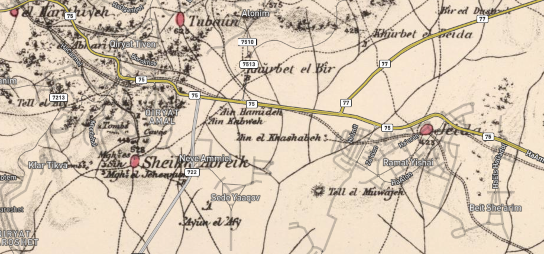
English: 1870 map of the area of Sheikh Bureik and Beit She'arim, overlaying in grey the modern Israeli roads |
| Date | 1870s and 2018 |
| Source | Palestine Open Maps, with underlying data from PEF Survey of Palestine and OpenStreetMaps |
| Author | PEF Survey of Palestine and OpenStreetMaps |
Licensing[edit]
|
This work is in the public domain in its country of origin and other countries and areas where the copyright term is the author's life plus 70 years or fewer.
| |
| This file has been identified as being free of known restrictions under copyright law, including all related and neighboring rights. | |
| This work contains information from OpenStreetMap, which is made available under the Open Database License (ODbL).
The ODbL does not require any particular license for maps produced from ODbL data. Prior to 1 August 2020, map tiles produced by the OpenStreetMap Foundation were licensed under the CC-BY-SA-2.0 license. Maps produced by other people may be subject to other licences. |
File history
Click on a date/time to view the file as it appeared at that time.
| Date/Time | Thumbnail | Dimensions | User | Comment | |
|---|---|---|---|---|---|
| current | 10:27, 29 January 2021 | | 1,840 × 858 (2.43 MB) | Onceinawhile (talk | contribs) | Uploaded a work by PEF Survey of Palestine and OpenStreetMaps from Palestine Open Maps, with underlying data from PEF Survey of Palestine and OpenStreetMaps with UploadWizard |
You cannot overwrite this file.
File usage on Commons
There are no pages that use this file.
File usage on other wikis
The following other wikis use this file:
- Usage on en.wikipedia.org