File:1852 Andrews Railroad Map of the United States - Geographicus - UnitedStates-andrews-1852.jpg
Original file (5,852 × 5,482 pixels, file size: 6.28 MB, MIME type: image/jpeg)
Captions
Captions
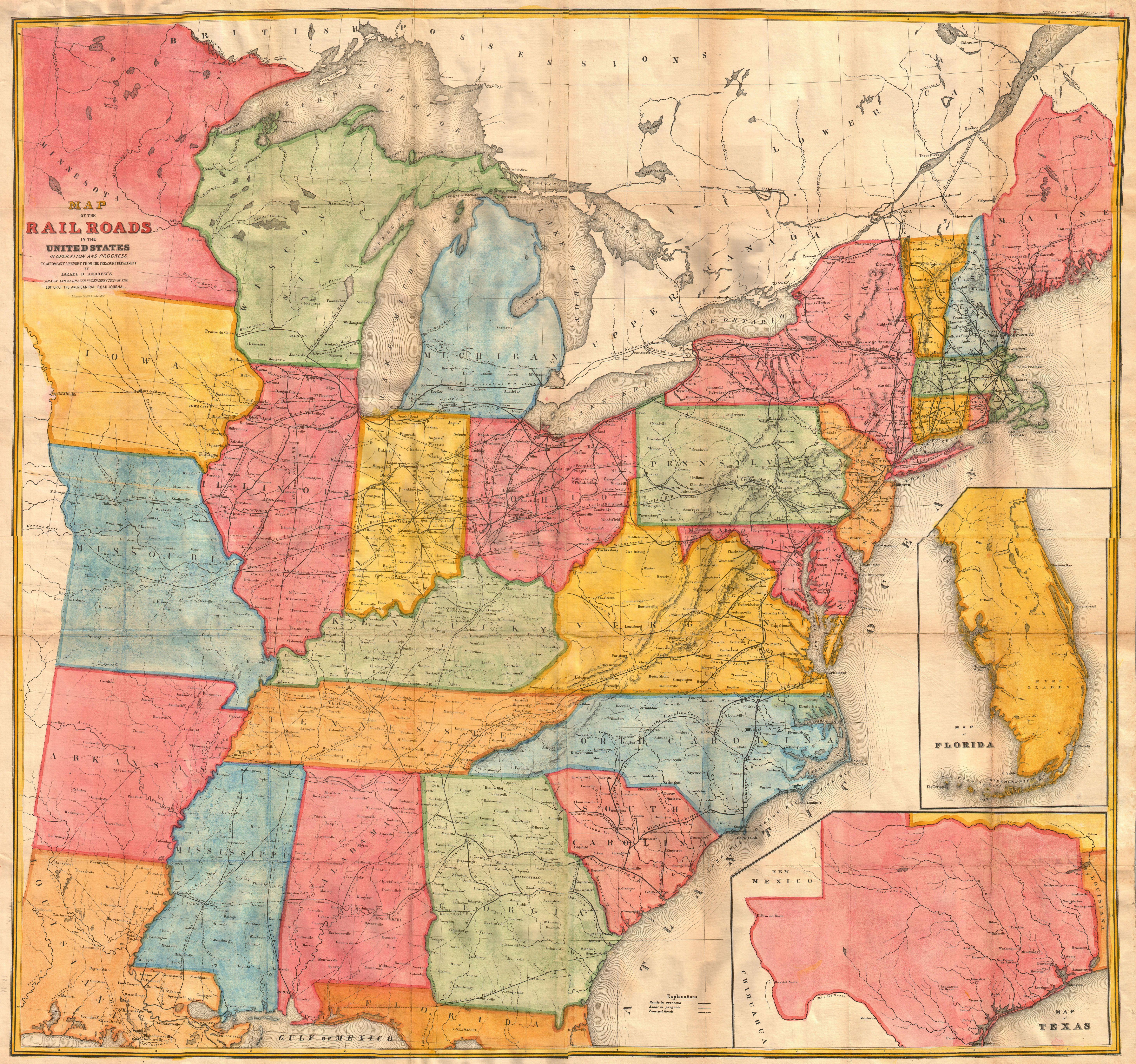
| Map of the Railroads in the United States in Operation and Progress to accompany a report from the Treasury Department by Israel D. Andrews. | ||||||
|---|---|---|---|---|---|---|
| Artist | ||||||
| Title |
Map of the Railroads in the United States in Operation and Progress to accompany a report from the Treasury Department by Israel D. Andrews. |
|||||
| Description |
English: A rare and attractive wall sized railroad map of the United States issued in 1852 for Israel de Wolf Andrew’s report for the Treasury Department. Depicts from the Great Lakes south to the Gulf of Mexico, and from the states of Iowa, Missouri, Arkansas and Louisiana eastward to the Atlantic. Inset maps focus on Florida and Texas. Offers superb detail of the American railway network, both extant and proposed, at a critical juncture in U.S. history. Essentially an updated version of McLellen’s map of 1850. Drawn and engraved under the direction of the editor of the “American Railroad Journal”. |
|||||
| Date | 1852 (undated) | |||||
| Dimensions | height: 39 in (99 cm); width: 42 in (106.6 cm) | |||||
| Accession number |
Geographicus link: UnitedStates-andrews-1852 |
|||||
| Source/Photographer |
Communication from the Secretary of the Treasury, transmitting in compliance with a resolution of the Senate of March 8, 1851, the Report of Israel D. Andrews, consul of the United States for Canada and New Brunswick on the Trade and Commerce of the British North American Colonies, and upon the Trade of the Great Lakes and Rivers; also, notices of the internal imporvements in each state, of the Gulf of Mexico and the Straits of Florida, and a Paper on the Cotton Crop of the United States., (1852 editon).
|
|||||
| Permission (Reusing this file) |
|
|||||
File history
Click on a date/time to view the file as it appeared at that time.
| Date/Time | Thumbnail | Dimensions | User | Comment | |
|---|---|---|---|---|---|
| current | 16:27, 16 March 2011 | | 5,852 × 5,482 (6.28 MB) | BotMultichill (talk | contribs) | {{subst:User:Multichill/Geographicus |link=http://www.geographicus.com/P/AntiqueMap/UnitedStates-andrews-1852 |product_name=1852 Andrews Railroad Map of the United States |map_title=Map of the Railroads in the United States in Operation and Progress to ac |
You cannot overwrite this file.
File usage on Commons
The following page uses this file: