File:1850 Mitchell Map of Peru and Bolivia - Geographicus - PeruBolivia-mitchell-1850.jpg
Jump to navigation
Jump to search

Size of this preview: 723 × 600 pixels. Other resolutions: 289 × 240 pixels | 579 × 480 pixels | 926 × 768 pixels | 1,234 × 1,024 pixels | 2,468 × 2,048 pixels | 3,500 × 2,904 pixels.
Original file (3,500 × 2,904 pixels, file size: 3.55 MB, MIME type: image/jpeg)
Captions
Captions
Add a one-line explanation of what this file represents
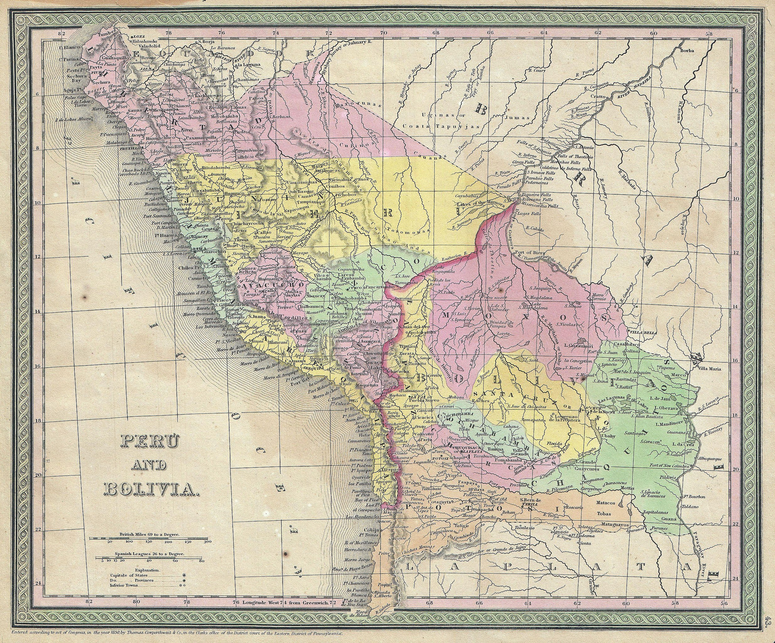
| Samuel Augustus Mitchell: Peru and Bolivia.
( |
||||||||||||||||||||
|---|---|---|---|---|---|---|---|---|---|---|---|---|---|---|---|---|---|---|---|---|
| Artist |
|
|||||||||||||||||||
| Title |
Peru and Bolivia. |
|||||||||||||||||||
| Description |
English: An attractive example of S. A. Mitchell Senior’s 1850 Map of Peru and Bolivia. Covers from Equator south to La Plata. When this map was made Bolivia had access to the sea through the province of Potosi – this territory is not controlled by Chili. Prepared by S. A. Mitchell for publication as plate no. 43 in T. Cowperthwait’s 1850 edition of Mitchell’s New Universal Atlas . |
|||||||||||||||||||
| Date | 1850 (dated) | |||||||||||||||||||
| Dimensions | height: 13 in (33 cm); width: 15 in (38.1 cm) | |||||||||||||||||||
| Accession number |
Geographicus link: PeruBolivia-mitchell-1850 |
|||||||||||||||||||
| Source/Photographer |
Mitchell S. A., A New Universal Atlas Containing Maps of the various Empires, Kingdoms, States and Republics Of The World. (1850 - 1853 issue)
|
|||||||||||||||||||
| Permission (Reusing this file) |
|
|||||||||||||||||||
File history
Click on a date/time to view the file as it appeared at that time.
| Date/Time | Thumbnail | Dimensions | User | Comment | |
|---|---|---|---|---|---|
| current | 21:49, 15 March 2011 | | 3,500 × 2,904 (3.55 MB) | BotMultichill (talk | contribs) | {{subst:User:Multichill/Geographicus |link=http://www.geographicus.com/P/AntiqueMap/PeruBolivia-mitchell-1850 |product_name=1850 Mitchell Map of Peru and Bolivia |map_title=Peru and Bolivia. |description=An attractive example of S. A. Mitchell Senior’s |
You cannot overwrite this file.
File usage on Commons
The following page uses this file:
File usage on other wikis
The following other wikis use this file:
- Usage on es.wikipedia.org
- Usage on pt.wikipedia.org