File:1848 U.S. Coast Survey Map of the Delaware Bay - Geographicus - DelawareBay-uscs-1848.jpg
Jump to navigation
Jump to search

Size of this preview: 429 × 600 pixels. Other resolutions: 172 × 240 pixels | 343 × 480 pixels | 549 × 768 pixels | 733 × 1,024 pixels | 1,465 × 2,048 pixels | 3,000 × 4,193 pixels.
Original file (3,000 × 4,193 pixels, file size: 1.76 MB, MIME type: image/jpeg)
Captions
Captions
Add a one-line explanation of what this file represents
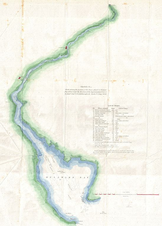
| Sketch B (bis) Sketch showing the positions of the Buoys placed in Delaware Bay & River under the direction of the Superintendent U.S.C.S. By Lieuts. Com. J. R. Goldsborough & R. Bache U.S. Navy, 1847. | ||||
|---|---|---|---|---|
| Artist | ||||
| Title |
Sketch B (bis) Sketch showing the positions of the Buoys placed in Delaware Bay & River under the direction of the Superintendent U.S.C.S. By Lieuts. Com. J. R. Goldsborough & R. Bache U.S. Navy, 1847. |
|||
| Description |
English: A unusual triangulation chart of the Delaware Bay — from the scarce 1848 edition of the Superintendent's Report, of the United States Coast Survey.
|
|||
| Date | 1848 (dated) | |||
| Dimensions | height: 21 in (53.3 cm); width: 17 in (43.1 cm) | |||
| Accession number |
Geographicus link: DelawareBay-uscs-1848 |
|||
| Source/Photographer |
Report of the Superintendant of the United States Coast Survey, Washington, (1848 edition).
|
|||
| Permission (Reusing this file) |
|
|||
File history
Click on a date/time to view the file as it appeared at that time.
| Date/Time | Thumbnail | Dimensions | User | Comment | |
|---|---|---|---|---|---|
| current | 18:16, 24 March 2011 | | 3,000 × 4,193 (1.76 MB) | BotMultichillT (talk | contribs) | {{subst:User:Multichill/Geographicus |link=http://www.geographicus.com/P/AntiqueMap/DelawareBay-uscs-1848 |product_name=1848 U.S. Coast Survey Map of the Delaware Bay |map_title=Sketch B (bis) Sketch showing the positions of the Buoys placed in Delaware B |
You cannot overwrite this file.
File usage on Commons
The following page uses this file: