File:1847 Levasseur Map of Sarthe, France - Geographicus - Sarthe-levasseur-1847.jpg
Jump to navigation
Jump to search
Size of this preview: 800 × 561 pixels. Other resolutions: 320 × 224 pixels | 640 × 449 pixels | 1,024 × 718 pixels | 1,280 × 898 pixels | 2,560 × 1,796 pixels | 5,177 × 3,631 pixels.
Original file (5,177 × 3,631 pixels, file size: 4.68 MB, MIME type: image/jpeg)
Captions
Captions
Add a one-line explanation of what this file represents
| Dept. De La Sarthe. | ||||||||||||||||||||||||||||||||||||
|---|---|---|---|---|---|---|---|---|---|---|---|---|---|---|---|---|---|---|---|---|---|---|---|---|---|---|---|---|---|---|---|---|---|---|---|---|
| Artist |
|
|||||||||||||||||||||||||||||||||||
| Title |
Dept. De La Sarthe. |
|||||||||||||||||||||||||||||||||||
| Description |
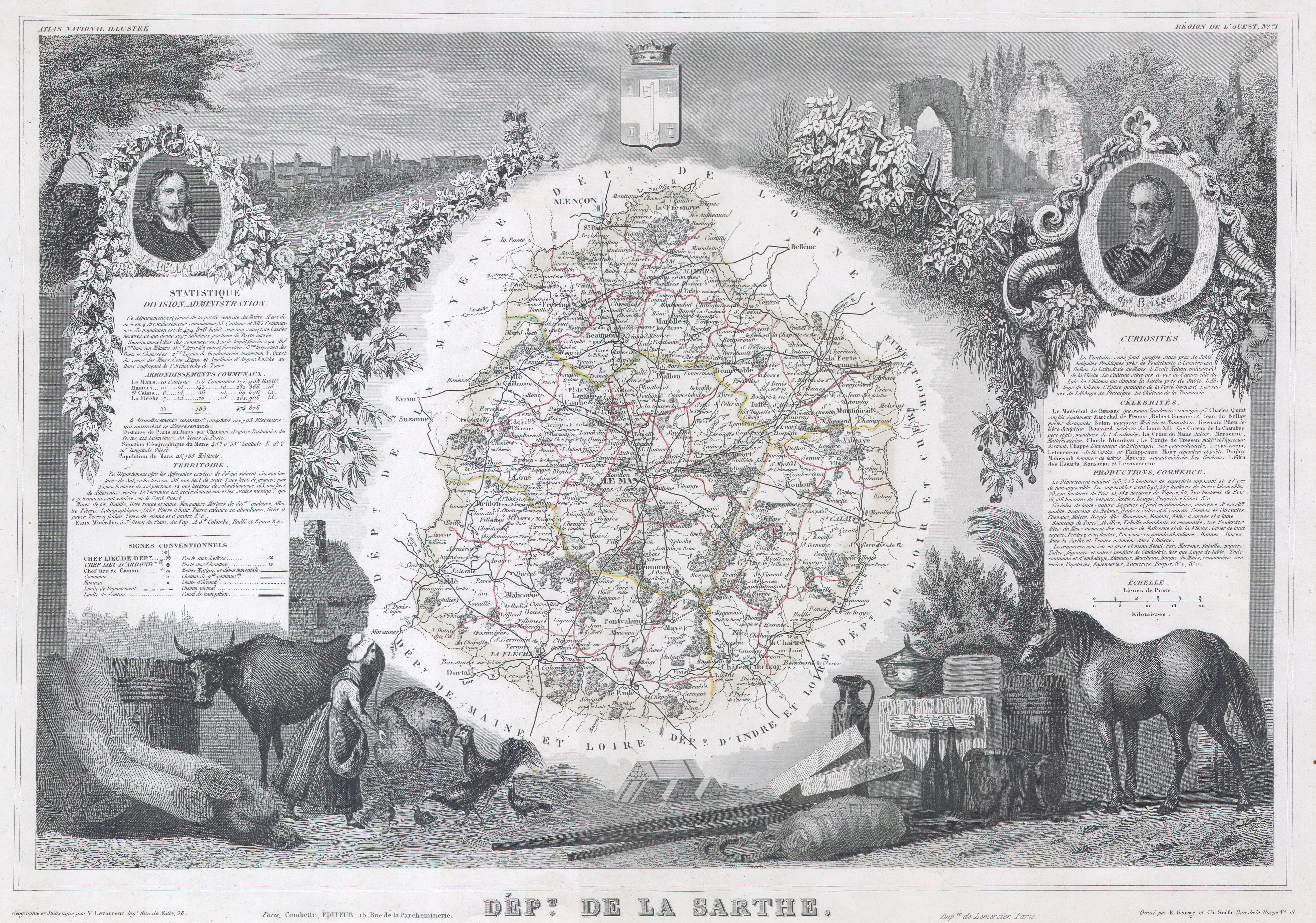
English: This is a fascinating 1847 map of the French department of Sarthe, surrounding the city of Le Mans. Sarthe is a Loire valley wine growing region that specializes in the lesser known French varietals of Jasnieres and Coteaux du Loir. It is also one of the primary areas where the oak barrels for many European wines are produced. The whole is surrounded by elaborate decorative engravings designed to illustrate both the natural beauty and trade richness of the land. There is a short textual history of the regions depicted on both the left and right sides of the map. |
|||||||||||||||||||||||||||||||||||
| Date | 1847 | |||||||||||||||||||||||||||||||||||
| Dimensions | height: 12 in (30.4 cm); width: 17 in (43.1 cm) | |||||||||||||||||||||||||||||||||||
| Accession number |
Geographicus link: Sarthe-levasseur-1847 |
|||||||||||||||||||||||||||||||||||
| Source/Photographer |
|
|||||||||||||||||||||||||||||||||||
| Permission (Reusing this file) |
|
|||||||||||||||||||||||||||||||||||
| Other versions |
|
|||||||||||||||||||||||||||||||||||

File history
Click on a date/time to view the file as it appeared at that time.
| Date/Time | Thumbnail | Dimensions | User | Comment | |
|---|---|---|---|---|---|
| current | 08:51, 16 March 2011 | | 5,177 × 3,631 (4.68 MB) | BotMultichill (talk | contribs) | {{subst:User:Multichill/Geographicus |link=http://www.geographicus.com/P/AntiqueMap/Sarthe-levasseur-1847 |product_name=1847 Levasseur Map of Sarthe, France |map_title=Dept. De La Sarthe. |description=This is a fascinating 1847 map of the French departm |
You cannot overwrite this file.
File usage on Commons
The following 2 pages use this file:
File usage on other wikis
The following other wikis use this file:
- Usage on fr.wikipedia.org
- Usage on ja.wikipedia.org