File:1844 Spruneri Map of Asia in the 15th and 16th Centuries (Ming China) - Geographicus - AsiaXVXVI-spruneri-1855.jpg
Jump to navigation
Jump to search

Size of this preview: 740 × 600 pixels. Other resolutions: 296 × 240 pixels | 592 × 480 pixels | 948 × 768 pixels | 1,263 × 1,024 pixels | 2,527 × 2,048 pixels | 3,500 × 2,837 pixels.
Original file (3,500 × 2,837 pixels, file size: 2.46 MB, MIME type: image/jpeg)
Captions
Captions
Add a one-line explanation of what this file represents
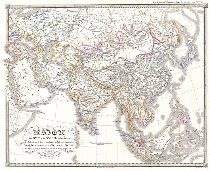
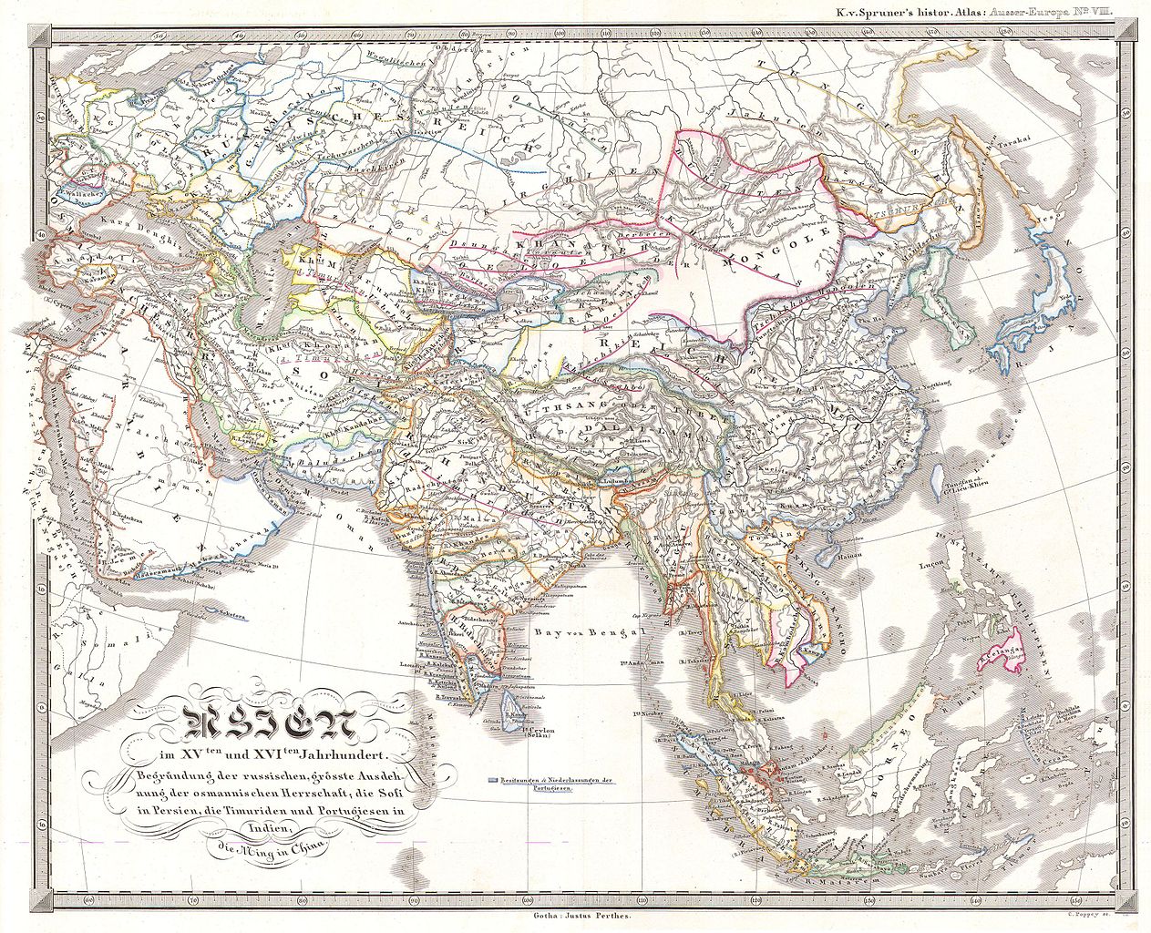
| Justus Perthes: Asien im XVten und XVIten Jahrhundert. Begründung der russuschen, grösste Ausdehnung der osmannischen Herrschaft; die Sofi in Persien, die Timuriden und Portugiesen in Indien, die Ming in China
( |
|||||||||||||||||||||||||||
|---|---|---|---|---|---|---|---|---|---|---|---|---|---|---|---|---|---|---|---|---|---|---|---|---|---|---|---|
| Artist |
|
||||||||||||||||||||||||||
| Title |
Asien im XVten und XVIten Jahrhundert. Begründung der russuschen, grösste Ausdehnung der osmannischen Herrschaft; die Sofi in Persien, die Timuriden und Portugiesen in Indien, die Ming in China |
||||||||||||||||||||||||||
| Description |
English: This fascinating hand colored map depicts Asia in the 15th and 16th centuries. This period roughly corresponds to the Ming Dyansty in China, the incursions of Persia and Portugal in India, and the beginning of the Russian Expansion. The Timur dynasty ruled Persia. Singapur (Singapor) is labeled. All text is in German. Issued in the 1870 edition of Stieler’s Hand Atlas. |
||||||||||||||||||||||||||
| Date | 1844 | ||||||||||||||||||||||||||
| Dimensions | height: 14 in (35.5 cm); width: 17 in (43.1 cm) | ||||||||||||||||||||||||||
| Accession number |
Geographicus link: AsiaXVXVI-spruneri-1855 |
||||||||||||||||||||||||||
| Source/Photographer |
|
||||||||||||||||||||||||||
| Permission (Reusing this file) |
|
||||||||||||||||||||||||||

File history
Click on a date/time to view the file as it appeared at that time.
| Date/Time | Thumbnail | Dimensions | User | Comment | |
|---|---|---|---|---|---|
| current | 08:29, 16 March 2011 | | 3,500 × 2,837 (2.46 MB) | BotMultichill (talk | contribs) | {{subst:User:Multichill/Geographicus |link=http://www.geographicus.com/P/AntiqueMap/AsiaXVXVI-spruneri-1855 |product_name=1844 Spruneri Map of Asia in the 15th and 16th Centuries (Ming China) |map_title=Asien im VIten und XVIten Jahrhundert. Begrundung de |
You cannot overwrite this file.
File usage on Commons
The following page uses this file:
_-_Geographicus_-_AsiaXVXVI-spruneri-1855.jpg)
_-_Geographicus_-_AsiaXVXVI-spruneri-1855.jpg&oldid=744974965)