File:1837 S.D.U.K. City Map or Plan of Frankfort, Germany - Geographicus - Frankfurt-SDUK-1837.jpg
Original file (2,750 × 2,194 pixels, file size: 1.75 MB, MIME type: image/jpeg)
Captions
Captions
| William Barnard Clarke: Frankfort, Germany.
( |
||||||||||||||||||||
|---|---|---|---|---|---|---|---|---|---|---|---|---|---|---|---|---|---|---|---|---|
| Artist | ||||||||||||||||||||
| Author |
|
|||||||||||||||||||
| Title |
Frankfort, Germany. |
|||||||||||||||||||
| Description |
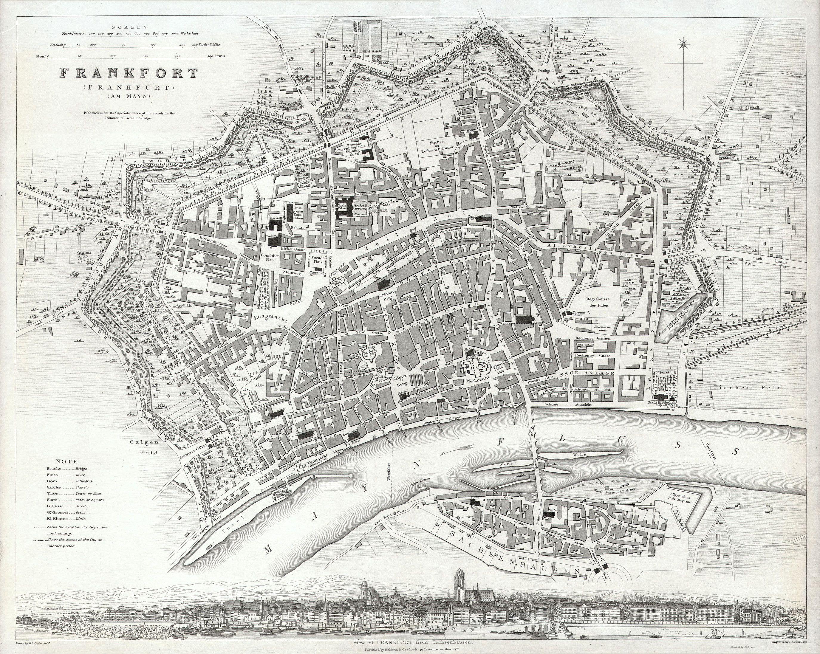
English: This map is a steel plate engraving, dating to 1837 and published by the S.D.U.K. or “The Society for the Diffusion of Useful Knowledge”. It represents the world famous German city of Frankfort or Frankfurt. All important buildings, bridges, and parks are shown. Across the bottom of the map there is a stunning panoramic of Frankfort from Sachsenhausen. |
|||||||||||||||||||
| Date | 1837 | |||||||||||||||||||
| Dimensions | height: 13 in (33 cm); width: 15 in (38.1 cm) | |||||||||||||||||||
| Accession number |
Geographicus link: Frankfurt-SDUK-1837 |
|||||||||||||||||||
| Source/Photographer |
Maps of the Society for the Diffusion of Useful Knowledge. Vol1. 1844.
|
|||||||||||||||||||
| Permission (Reusing this file) |
|
|||||||||||||||||||
File history
Click on a date/time to view the file as it appeared at that time.
| Date/Time | Thumbnail | Dimensions | User | Comment | |
|---|---|---|---|---|---|
| current | 21:12, 15 March 2011 | | 2,750 × 2,194 (1.75 MB) | BotMultichill (talk | contribs) | {{subst:User:Multichill/Geographicus |link=http://www.geographicus.com/P/AntiqueMap/Frankfurt-SDUK-1837 |product_name=1837 S.D.U.K. City Map or Plan of Frankfort, Germany |map_title=Frankfort, Germany. |description=This map is a steel plate engraving, dat |
You cannot overwrite this file.
File usage on Commons
The following page uses this file: