File:1832 Hohenhaslach UFK NW XLVII 2 Landesarchiv BW.jpg
Jump to navigation
Jump to search

Size of this preview: 578 × 600 pixels. Other resolutions: 231 × 240 pixels | 463 × 480 pixels | 740 × 768 pixels | 987 × 1,024 pixels | 1,794 × 1,861 pixels.
Original file (1,794 × 1,861 pixels, file size: 2.1 MB, MIME type: image/jpeg)
Captions
Captions
Add a one-line explanation of what this file represents
| Description |
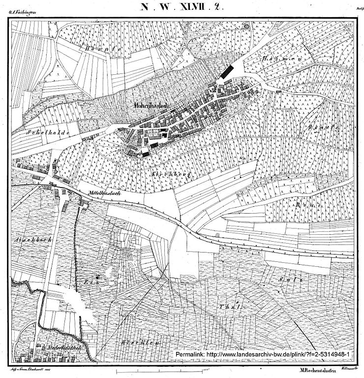
Deutsch: Hohenhaslach mit Mittel- und Niederhaslach auf der Urflurkarte NW XLVII, Blatt 2, von 1832 |
| Date | |
| Source | Staatsarchiv Ludwigsburg (Landesarchiv BW) |
| Author | Statistisch-topographisches Bureau des Köngreichs Württemberg, Geometer Eberhardt |
| Object location | | View this and other nearby images on: OpenStreetMap |
|---|
(ca. Kartenmitte)
|
This work is in the public domain in its country of origin and other countries and areas where the copyright term is the author's life plus 100 years or fewer. | |
| This file has been identified as being free of known restrictions under copyright law, including all related and neighboring rights. | |
File history
Click on a date/time to view the file as it appeared at that time.
| Date/Time | Thumbnail | Dimensions | User | Comment | |
|---|---|---|---|---|---|
| current | 02:09, 1 April 2015 | | 1,794 × 1,861 (2.1 MB) | Grüninger (talk | contribs) | {{Information |Description={{de|1=Hohenhaslach mit Mittel- und Niederhaslach auf der Urflurkarte NW XLVII, Blatt 2, von 1832}} |Source= Staatsarchiv Ludwigsburg ([http://www2.landesarchiv-bw.de Landesarchiv BW]) |Date= 1832 |Author=Statistisch-topograp... |
You cannot overwrite this file.
File usage on Commons
There are no pages that use this file.
File usage on other wikis
The following other wikis use this file:
- Usage on de.wikipedia.org