File:180525 Higashiyama Water Tower frm NE.jpg
Jump to navigation
Jump to search
Size of this preview: 522 × 599 pixels. Other resolutions: 209 × 240 pixels | 418 × 480 pixels | 669 × 768 pixels | 892 × 1,024 pixels | 1,784 × 2,048 pixels | 4,912 × 5,640 pixels.
Original file (4,912 × 5,640 pixels, file size: 14.54 MB, MIME type: image/jpeg)
Captions
Captions
Add a one-line explanation of what this file represents
Summary[edit]
| Description |
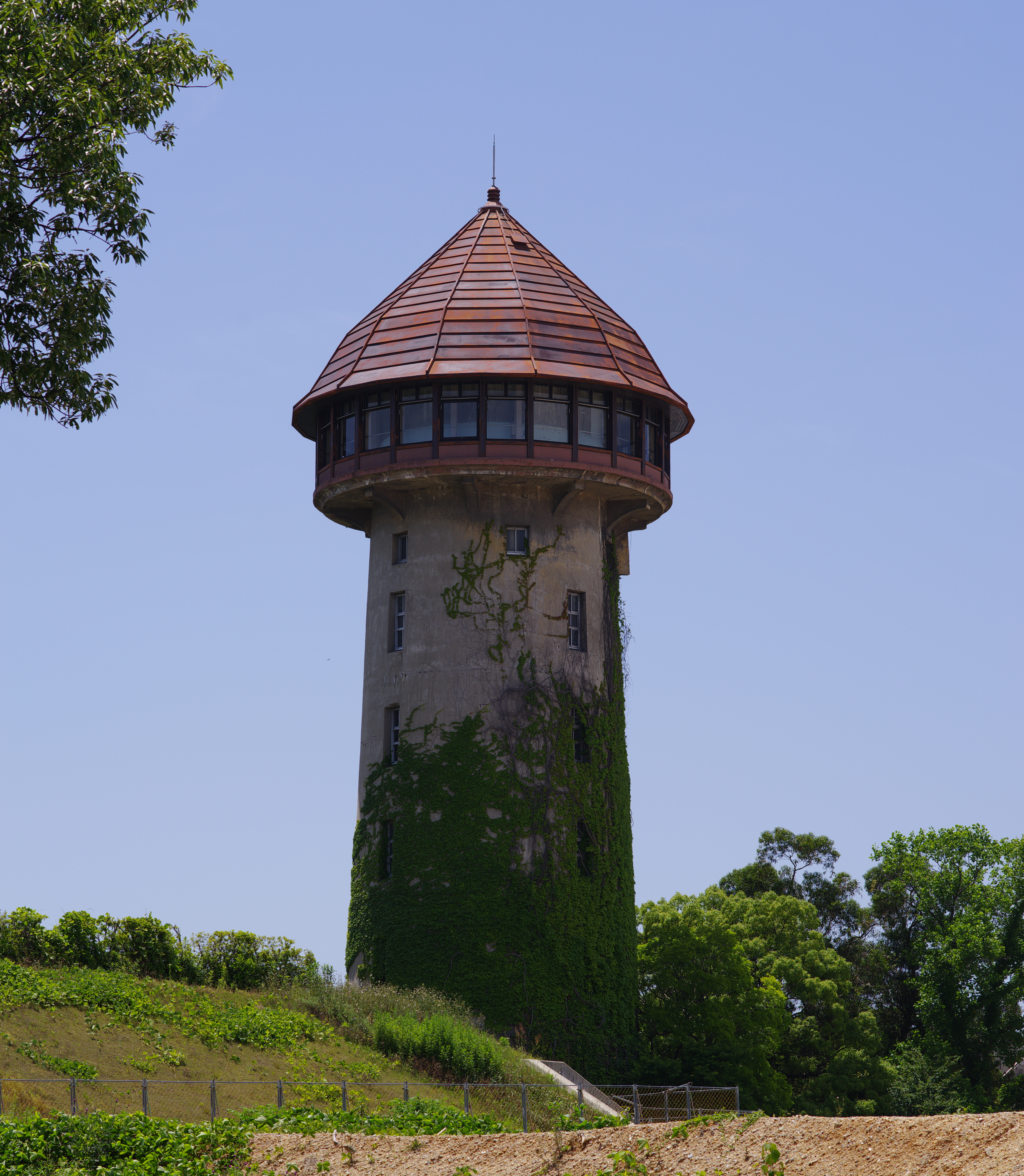
日本語: 名古屋市千種区東山給水塔。北東よりみる。 |
| Date | Taken on 25 May 2018 |
| Source | Own work PENTAX K-1 + smc PENTAX-A MACRO 1:2.8 100mm |
| Author | 名古屋太郎 |
| Camera location | | View this and other nearby images on: OpenStreetMap |
|---|
Licensing[edit]
I, the copyright holder of this work, hereby publish it under the following licenses:
This file is licensed under the Creative Commons Attribution-Share Alike 4.0 International license.
- You are free:
- to share – to copy, distribute and transmit the work
- to remix – to adapt the work
- Under the following conditions:
- attribution – You must give appropriate credit, provide a link to the license, and indicate if changes were made. You may do so in any reasonable manner, but not in any way that suggests the licensor endorses you or your use.
- share alike – If you remix, transform, or build upon the material, you must distribute your contributions under the same or compatible license as the original.

|
Permission is granted to copy, distribute and/or modify this document under the terms of the GNU Free Documentation License, Version 1.2 or any later version published by the Free Software Foundation; with no Invariant Sections, no Front-Cover Texts, and no Back-Cover Texts. A copy of the license is included in the section entitled GNU Free Documentation License. |
You may select the license of your choice.
File history
Click on a date/time to view the file as it appeared at that time.
| Date/Time | Thumbnail | Dimensions | User | Comment | |
|---|---|---|---|---|---|
| current | 12:40, 25 May 2018 | | 4,912 × 5,640 (14.54 MB) | 名古屋太郎 (talk | contribs) | {{Information |description ={{ja|1=名古屋市千種区東山給水塔。北東よりみる。}} |source ={{own}} PENTAX K-1 + smc PENTAX-A MACRO 1:2.8 100mm |author =User:名古屋太郎 |date =2018-05-25 }} Category:Nagoya City Waterworks & Sewerage Bureau Category:Architecture of the Showa era Category:Towers in Nagoya Category:Buildings in Chikusa-ku, Nagoya Category:Water towers in Japan Category:Tashiro-chō, Nagoya Category:Taken with Pentax K-1 |
You cannot overwrite this file.
File usage on Commons
The following page uses this file:
- File:180525 Hgashiyama Water Tower frm NE.jpg (file redirect)
File usage on other wikis
The following other wikis use this file:
- Usage on ja.wikipedia.org