File:17th Century map of Cheshire.JPG
Jump to navigation
Jump to search
Size of this preview: 800 × 600 pixels. Other resolutions: 320 × 240 pixels | 640 × 480 pixels | 1,024 × 768 pixels | 1,280 × 960 pixels | 2,560 × 1,920 pixels | 3,456 × 2,592 pixels.
Original file (3,456 × 2,592 pixels, file size: 5.39 MB, MIME type: image/jpeg)
Captions
Captions
Add a one-line explanation of what this file represents
Summary
[edit]
| Description |
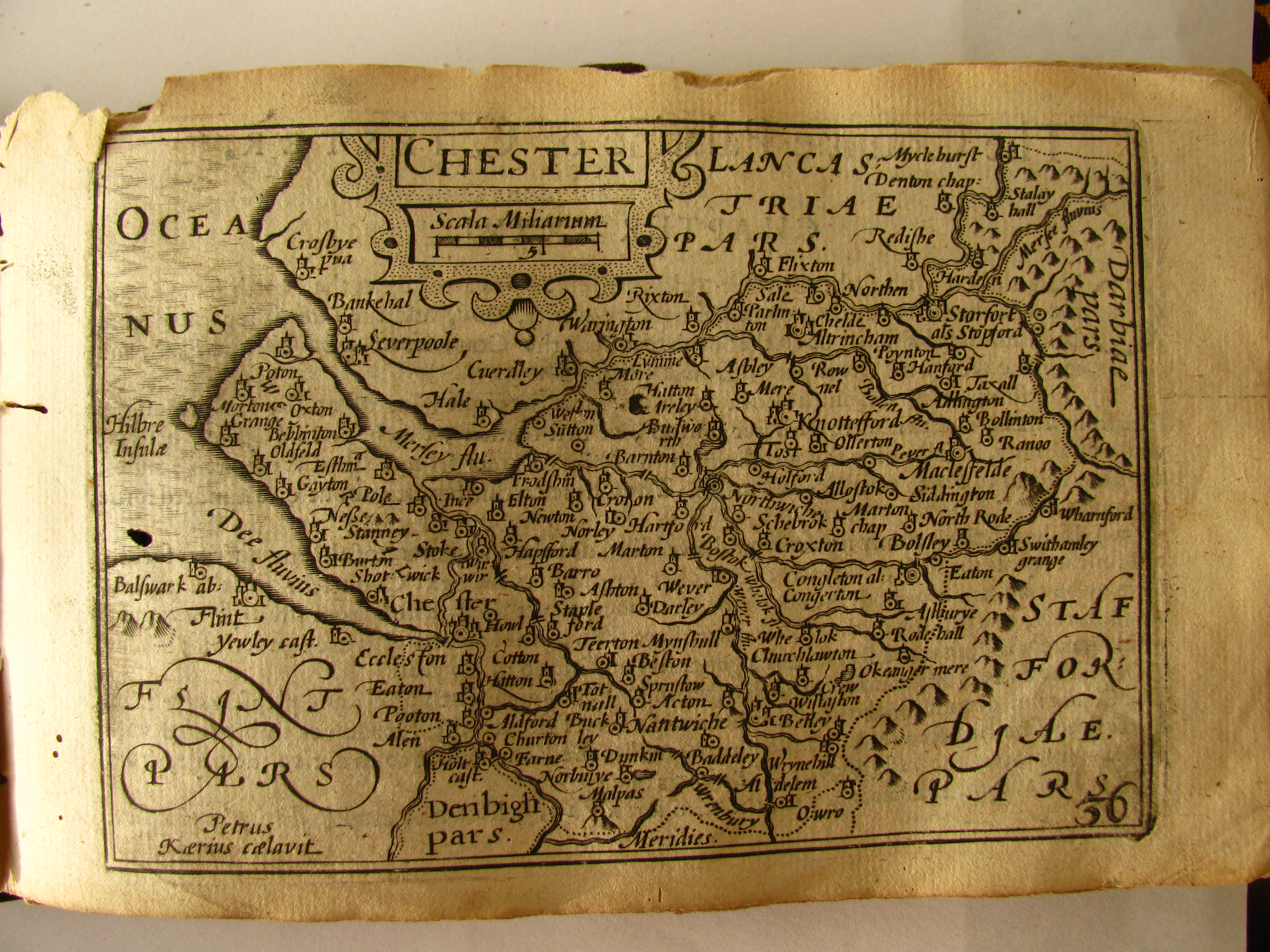
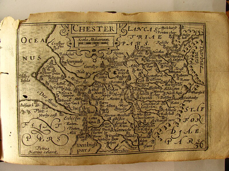
English: Map from the 1627 "Miniature Speed Atlas" of England Sotland Ireland and Wales, with maps by Pieter van den Keere Photograph taken mby me, the atlas owned by me |
| Date | |
| Source | Own work |
| Author |
John Speed Pieter van der Keere |
| Permission (Reusing this file) |
Public Domain |
Licensing
[edit]
|
This work is in the public domain in its country of origin and other countries and areas where the copyright term is the author's life plus 70 years or fewer. This work is in the public domain in the United States because it was published (or registered with the U.S. Copyright Office) before January 1, 1929. | |
| This file has been identified as being free of known restrictions under copyright law, including all related and neighboring rights. | |
File history
Click on a date/time to view the file as it appeared at that time.
| Date/Time | Thumbnail | Dimensions | User | Comment | |
|---|---|---|---|---|---|
| current | 23:49, 10 December 2011 | | 3,456 × 2,592 (5.39 MB) | Rotatebot (talk | contribs) | Bot: Image rotated by 270° (EXIF-Orientation set from 6 to 1, rotated 0°) |
| 16:01, 3 May 2010 |  | 2,592 × 3,456 (5.39 MB) | Seriykotik (talk | contribs) | {{Information |Description={{en|1=Map from the 1627 "Miniature Speed Atlas" of England Sotland Ireland and Wales, with maps by Pieter van den Keere Photograph taken mby me, the atlas owned by me}} |Source={{own}} |Author=Seriykotik |Da |
You cannot overwrite this file.
File usage on Commons
The following page uses this file:
- File:17the Century map of Chester.jpg (file redirect)
File usage on other wikis
The following other wikis use this file:
- Usage on fr.wikipedia.org