File:1794 Anville Map of the Western Roman Empire (includes Italy) - Geographicus - RomanEmpireWest-anville-1794.jpg
Jump to navigation
Jump to search

Size of this preview: 477 × 599 pixels. Other resolutions: 191 × 240 pixels | 382 × 480 pixels | 611 × 768 pixels | 815 × 1,024 pixels | 1,630 × 2,048 pixels | 3,979 × 5,000 pixels.
Original file (3,979 × 5,000 pixels, file size: 6.07 MB, MIME type: image/jpeg)
Captions
Captions
Add a one-line explanation of what this file represents
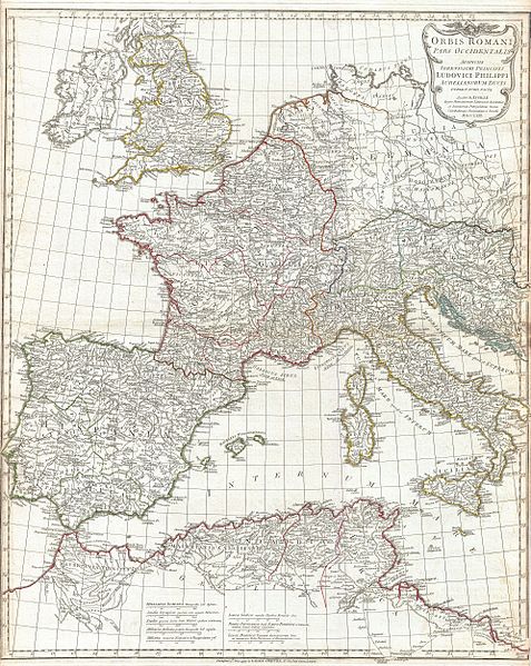
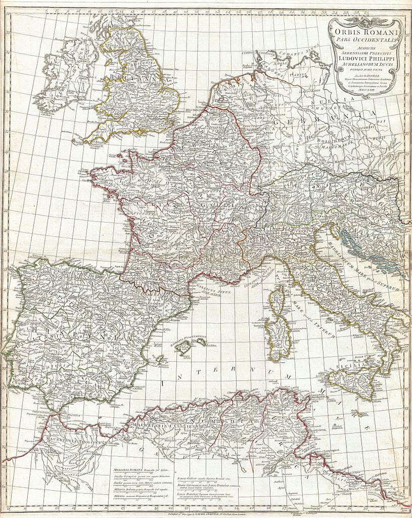
| Jean Baptiste Bourguignon d'Anville: Orbis Romani Pars Occidentalis Auspiciis Serenissimi Principis Ludovici Philippi Aurelianorum Ducis Publici juris Facta…
( |
|||||||||||||||||||||
|---|---|---|---|---|---|---|---|---|---|---|---|---|---|---|---|---|---|---|---|---|---|
| Artist |
|
||||||||||||||||||||
| Title |
Orbis Romani Pars Occidentalis Auspiciis Serenissimi Principis Ludovici Philippi Aurelianorum Ducis Publici juris Facta… |
||||||||||||||||||||
| Description |
English: A large and dramatic J. B. B. D'Anville map of the western part of the Roman Empire. Covers from England (Brittania) and Ireland (Hibernia), south to Spain (Hispania) and Morocco (Mauretania), and east as far as Italy (Italia) and Dalmatia. Includes the western part of the Mediterranean Sea and the Adriatic. Details mountains rivers, cities, roadways, and lakes with political divisions highlighted in outline color. Decorative title cartouche bearing the Roman Eagle appears in the upper right. Includes eight distance scales, bottom center, referencing various measurement systems common in antiquity. Text in Latin and English. Drawn by J. B. B. D'Anville in 1764 and published in 1794 by Laurie and Whittle, London. |
||||||||||||||||||||
| Date | dated 1763, published 1794 | ||||||||||||||||||||
| Dimensions | height: 26.5 in (67.3 cm); width: 21.5 in (54.6 cm) | ||||||||||||||||||||
| Accession number |
Geographicus link: RomanEmpireWest-anville-1794 |
||||||||||||||||||||
| Source/Photographer |
D'Anville, J. B. B., Complete Body of Ancient Geography, Laurie and Whittle, London, 1795.
|
||||||||||||||||||||
| Permission (Reusing this file) |
|
||||||||||||||||||||

File history
Click on a date/time to view the file as it appeared at that time.
| Date/Time | Thumbnail | Dimensions | User | Comment | |
|---|---|---|---|---|---|
| current | 14:05, 23 March 2011 | | 3,979 × 5,000 (6.07 MB) | BotMultichillT (talk | contribs) | {{subst:User:Multichill/Geographicus |link=http://www.geographicus.com/P/AntiqueMap/RomanEmpireWest-anville-1794 |product_name=1794 Anville Map of the Western Roman Empire (includes Italy) |map_title=Orbis Romani Pars Occidentalis Auspiciis Serenissimi Pr |
You cannot overwrite this file.
File usage on Commons
The following 2 pages use this file:
_-_Geographicus_-_RomanEmpireWest-anville-1794.jpg)
_-_Geographicus_-_RomanEmpireWest-anville-1794.jpg&oldid=744743628)