File:1785 Map of the Castillo (1263da9e-931a-4c8e-a40f-cb9b0ef6c1b3).jpg
Jump to navigation
Jump to search

Size of this preview: 800 × 512 pixels. Other resolutions: 320 × 205 pixels | 640 × 409 pixels | 1,024 × 655 pixels | 1,280 × 819 pixels | 2,154 × 1,378 pixels.
Original file (2,154 × 1,378 pixels, file size: 2.27 MB, MIME type: image/jpeg)
Captions
Captions
Add a one-line explanation of what this file represents

|
The categories of this image need checking. You can do so here.
|
.jpg&action=edit&withJS=MediaWiki:Catcheck.js)
Summary[edit]
.jpg&action=edit§ion=1)
| English: 1785 Map of the Castillo | ||||
|---|---|---|---|---|
| Photographer |
English: NPS |
|||
| Title |
English: 1785 Map of the Castillo |
|||
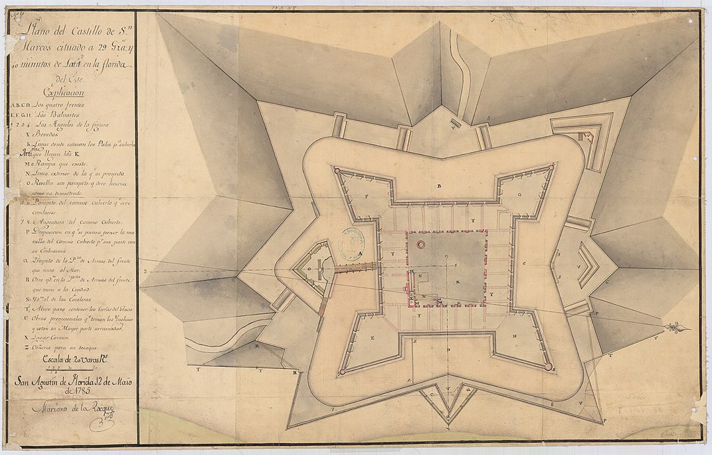
| Description |
English: Black and White drawing of fort and surrounding area Map shows interior room layout and surrounding outer defenses. |
|||
| Depicted place |
English: Castillo de San Marcos National Monument, St. Johns County, Florida |
|||
| Date | Taken on 2 March 2010 | |||
| Accession number | ||||
| Source |
English: NPGallery |
|||
| Permission (Reusing this file) |
|
|||
| NPS Unit Code | CASA | |||
File history
Click on a date/time to view the file as it appeared at that time.
| Date/Time | Thumbnail | Dimensions | User | Comment | |
|---|---|---|---|---|---|
| current | 11:35, 13 January 2022 | | 2,154 × 1,378 (2.27 MB) | BMacZeroBot (talk | contribs) | Batch upload (Commons:Batch uploading/NPGallery) |
You cannot overwrite this file.
File usage on Commons
The following page uses this file:
.jpg)
.jpg&oldid=744732728)