File:1784 Bocage Map of Athens, Greece - Geographicus - Athens-bocage-1784.jpg
Jump to navigation
Jump to search

Size of this preview: 800 × 520 pixels. Other resolutions: 320 × 208 pixels | 640 × 416 pixels | 1,024 × 666 pixels | 1,280 × 832 pixels | 3,000 × 1,951 pixels.
Original file (3,000 × 1,951 pixels, file size: 1.45 MB, MIME type: image/jpeg)
Captions
Captions
Add a one-line explanation of what this file represents
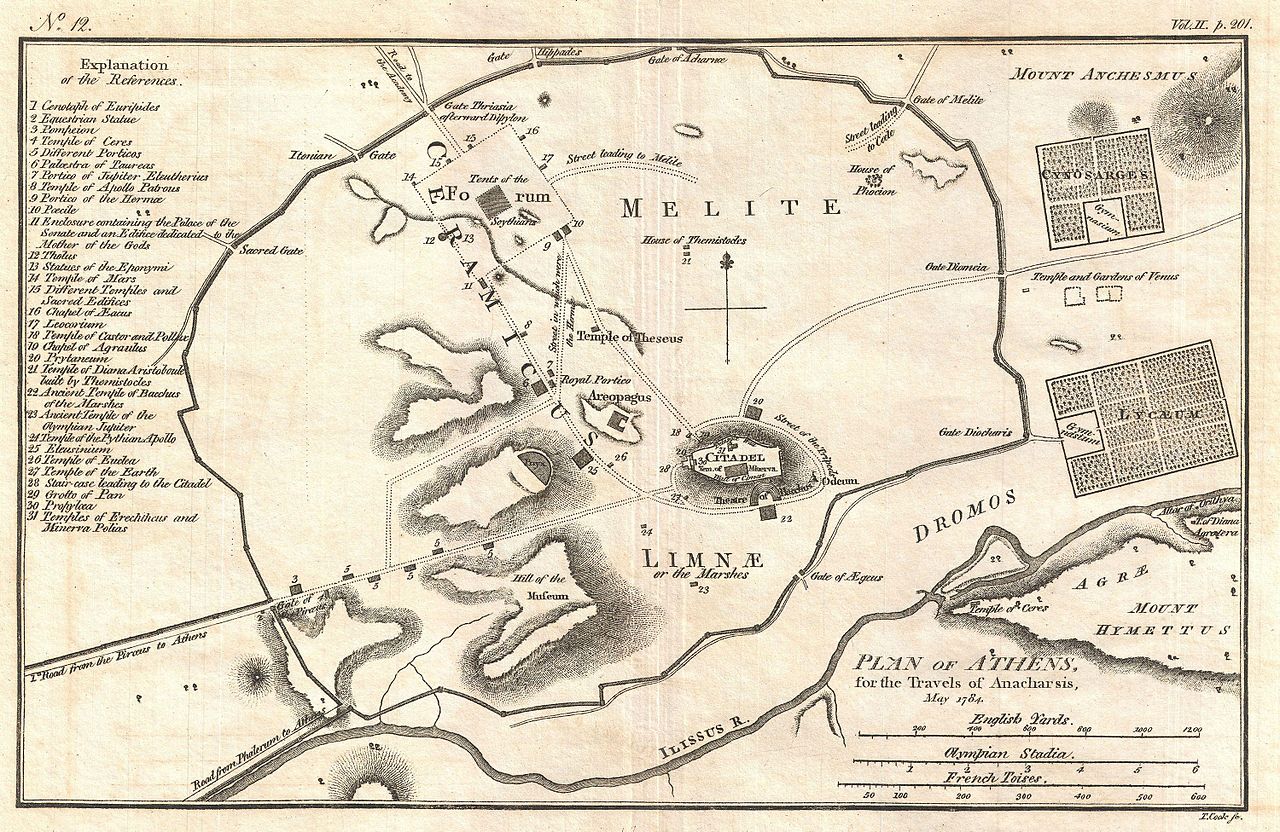
| Jean-Denis Barbié du Bocage: Plan of Athens, for the Travels of Anacharsis, May 1784.
( |
||||||||||||||||||||||||
|---|---|---|---|---|---|---|---|---|---|---|---|---|---|---|---|---|---|---|---|---|---|---|---|---|
| Artist |
|
|||||||||||||||||||||||
| Title |
Plan of Athens, for the Travels of Anacharsis, May 1784. |
|||||||||||||||||||||||
| Description |
English: This is an attractive 1784 map of ancient Athens, Greece. Covering the walled center of ancient Athens, this map details the ancient city’s most important buildings and monuments. Names the Lyceum (Aristotle’s famous school of philosophy) and the Cynosarges (Public gymnasium) as well as the Forum, the Citadel, the Temple of Theseus, and the Areopagus. Prepared by Barbie de Bocage for publication in the atlas volume attached to Jean Jacques Barthelemy’s 1788 Travels of Anacharsis the Younger in Greece . |
|||||||||||||||||||||||
| Date | 1784 (dated) | |||||||||||||||||||||||
| Dimensions | height: 8.5 in (21.5 cm); width: 12.5 in (31.7 cm) | |||||||||||||||||||||||
| Accession number |
Geographicus link: Athens-bocage-1784 |
|||||||||||||||||||||||
| Source/Photographer |
Barthelemy, J. J., Atlas to Accompany The Travels of Anacharsis the Younger in Greece, 1788.
|
|||||||||||||||||||||||
| Permission (Reusing this file) |
|
|||||||||||||||||||||||

File history
Click on a date/time to view the file as it appeared at that time.
| Date/Time | Thumbnail | Dimensions | User | Comment | |
|---|---|---|---|---|---|
| current | 02:35, 25 March 2011 | | 3,000 × 1,951 (1.45 MB) | BotMultichillT (talk | contribs) | {{subst:User:Multichill/Geographicus |link=http://www.geographicus.com/P/AntiqueMap/Athens-bocage-1784 |product_name=1784 Bocage Map of Athens, Greece |map_title=Plan of Athens, for the Travels of Anacharsis, May 1784. |description=This is an attractive 1 |
You cannot overwrite this file.
File usage on Commons
The following page uses this file:
File usage on other wikis
The following other wikis use this file:
- Usage on da.wikipedia.org
- Usage on el.wikipedia.org
- Usage on eu.wikipedia.org
- Usage on hu.wikipedia.org