File:1780 Raynal and Bonne Map of Great Lakes and Upper Mississippi - Geographicus - OccidentileCanada-bonne-1780.jpg
Jump to navigation
Jump to search
Size of this preview: 800 × 551 pixels. Other resolutions: 320 × 220 pixels | 640 × 441 pixels | 1,024 × 705 pixels | 1,280 × 881 pixels | 2,500 × 1,721 pixels.
Original file (2,500 × 1,721 pixels, file size: 1.27 MB, MIME type: image/jpeg)
Captions
Captions
Add a one-line explanation of what this file represents
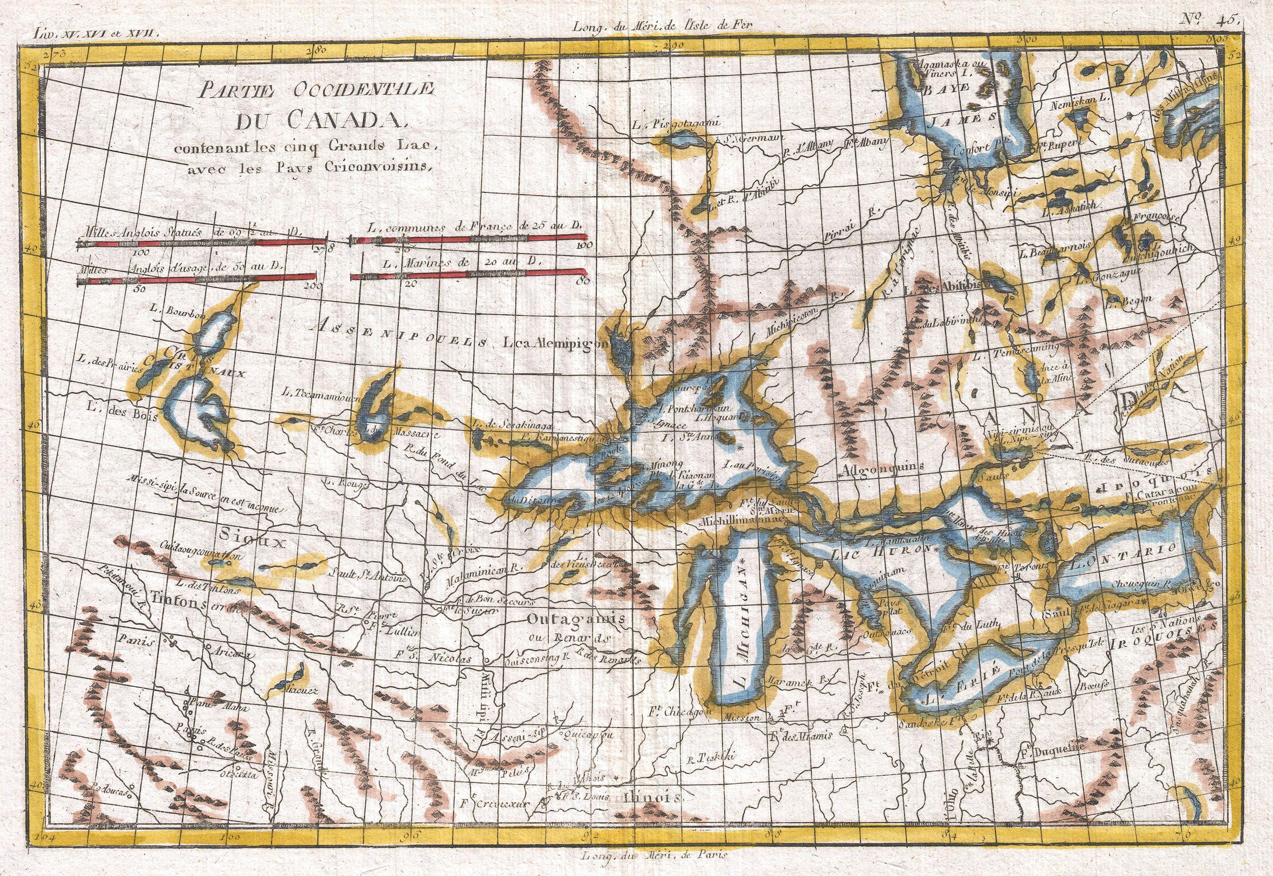
| Rigobert Bonne: Partie Occidentale Du Canada, Contenant Les Cinq Grands Lac, Avec Les Pays Criconvoisins
( |
|||||||||||||||||||||||
|---|---|---|---|---|---|---|---|---|---|---|---|---|---|---|---|---|---|---|---|---|---|---|---|
| Artist |
|
||||||||||||||||||||||
| Title |
Partie Occidentale Du Canada, Contenant Les Cinq Grands Lac, Avec Les Pays Criconvoisins |
||||||||||||||||||||||
| Description |
English: A fine example of Rigobert Bonne and Guilleme Raynal’s 1780 map of the Great Lakes and upper Mississippi Valley. *A map of considerable importance, this chart was constructed during a period of aggressive exploration into this region.
|
||||||||||||||||||||||
| Date | 1780 (undated) | ||||||||||||||||||||||
| Dimensions | height: 9 in (22.8 cm); width: 13 in (33 cm) | ||||||||||||||||||||||
| Accession number |
Geographicus link: OccidentileCanada-bonne-1780 |
||||||||||||||||||||||
| Source/Photographer |
Raynal, G., Atlas de Toutes les Parties Connues du Globe Terrestre, Dressé pour l'Histoire Philosophique et Politique des Établissemens et du Commerce des Européens dans les Deux Indes, 1780.
|
||||||||||||||||||||||
| Permission (Reusing this file) |
|
||||||||||||||||||||||
File history
Click on a date/time to view the file as it appeared at that time.
| Date/Time | Thumbnail | Dimensions | User | Comment | |
|---|---|---|---|---|---|
| current | 11:06, 24 March 2011 | | 2,500 × 1,721 (1.27 MB) | BotMultichillT (talk | contribs) | {{subst:User:Multichill/Geographicus |link=http://www.geographicus.com/P/AntiqueMap/OccidentileCanada-bonne-1780 |product_name=1780 Raynal and Bonne Map of Great Lakes and Upper Mississippi |map_title=Partie Occidentale Du Canada, Contenant Les Cinq Grand |
You cannot overwrite this file.
File usage on Commons
The following 2 pages use this file:
File usage on other wikis
The following other wikis use this file:
- Usage on fr.wikipedia.org