File:12communesWilayaConstantine.svg
Jump to navigation
Jump to search

Size of this PNG preview of this SVG file: 744 × 535 pixels. Other resolutions: 320 × 230 pixels | 640 × 460 pixels | 1,024 × 736 pixels | 1,280 × 920 pixels | 2,560 × 1,841 pixels.
Original file (SVG file, nominally 744 × 535 pixels, file size: 104 KB)
Captions
Captions
Add a one-line explanation of what this file represents
Summary[edit]
| Description |
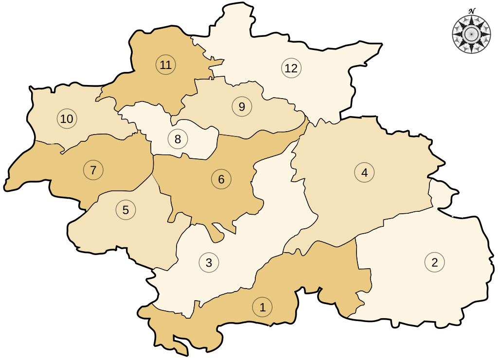
English: Map of the 12 communes of the Constantine's Wilaya. Each commune can be colored separately.
Français : Carte des 12 communes de la Wilaya de Constantine. Chaque commune peut être colorée séparément.
|
| Date | |
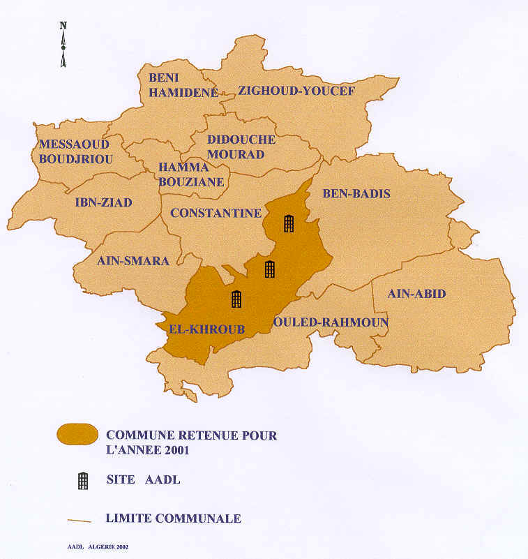
| Source | Own work, from this map of Agence nationale de l'Amélioration et du Développement du Logement (AADL) |
| Author | Balougador, modified by Sémhur |
| SVG development |
| Camera location | | View this and other nearby images on: OpenStreetMap |
|---|
Licensing[edit]
I, the copyright holder of this work, hereby publish it under the following licenses:

|
Permission is granted to copy, distribute and/or modify this document under the terms of the GNU Free Documentation License, Version 1.2 or any later version published by the Free Software Foundation; with no Invariant Sections, no Front-Cover Texts, and no Back-Cover Texts. A copy of the license is included in the section entitled GNU Free Documentation License. |
This file is licensed under the Creative Commons Attribution-Share Alike 3.0 Unported, 2.5 Generic, 2.0 Generic and 1.0 Generic license.
- You are free:
- to share – to copy, distribute and transmit the work
- to remix – to adapt the work
- Under the following conditions:
- attribution – You must give appropriate credit, provide a link to the license, and indicate if changes were made. You may do so in any reasonable manner, but not in any way that suggests the licensor endorses you or your use.
- share alike – If you remix, transform, or build upon the material, you must distribute your contributions under the same or compatible license as the original.
You may select the license of your choice.
File history
Click on a date/time to view the file as it appeared at that time.
| Date/Time | Thumbnail | Dimensions | User | Comment | |
|---|---|---|---|---|---|
| current | 03:29, 31 May 2021 | | 744 × 535 (104 KB) | কুউ পুলক (talk | contribs) | File uploaded using svgtranslate tool (https://svgtranslate.toolforge.org/). Added translation for bn. |
| 15:50, 21 May 2013 |  | 744 × 535 (100 KB) | Sémhur (talk | contribs) | correcting svg bugs | |
| 18:42, 17 November 2007 |  | 744 × 535 (100 KB) | Sémhur (talk | contribs) | Now all the communes can be colored separately. | |
| 14:06, 7 November 2007 |  | 744 × 535 (53 KB) | Balougador~commonswiki (talk | contribs) | {{Information |Description=Carte des 12 communes de la Wilaya de Constantine suivant [http://www.aadl.com.dz/images/WCons2.jpg] |Source=travail personnel |Date=7/11/2007 |Author= Balougador |Permission= |other_versions= }} |
You cannot overwrite this file.
File usage on Commons
The following page uses this file:
File usage on other wikis
The following other wikis use this file:
- Usage on en.wikipedia.org
- Usage on fr.wikipedia.org