File:07-la-serena.jpg
Jump to navigation
Jump to search

Size of this preview: 800 × 483 pixels. Other resolutions: 320 × 193 pixels | 640 × 387 pixels | 1,024 × 618 pixels | 1,280 × 773 pixels | 2,560 × 1,546 pixels | 5,462 × 3,299 pixels.
Original file (5,462 × 3,299 pixels, file size: 3.2 MB, MIME type: image/jpeg)
Captions
Captions
Add a one-line explanation of what this file represents
Summary[edit]
| Description |
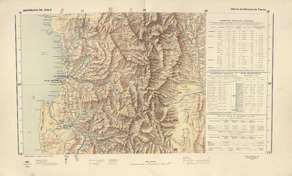
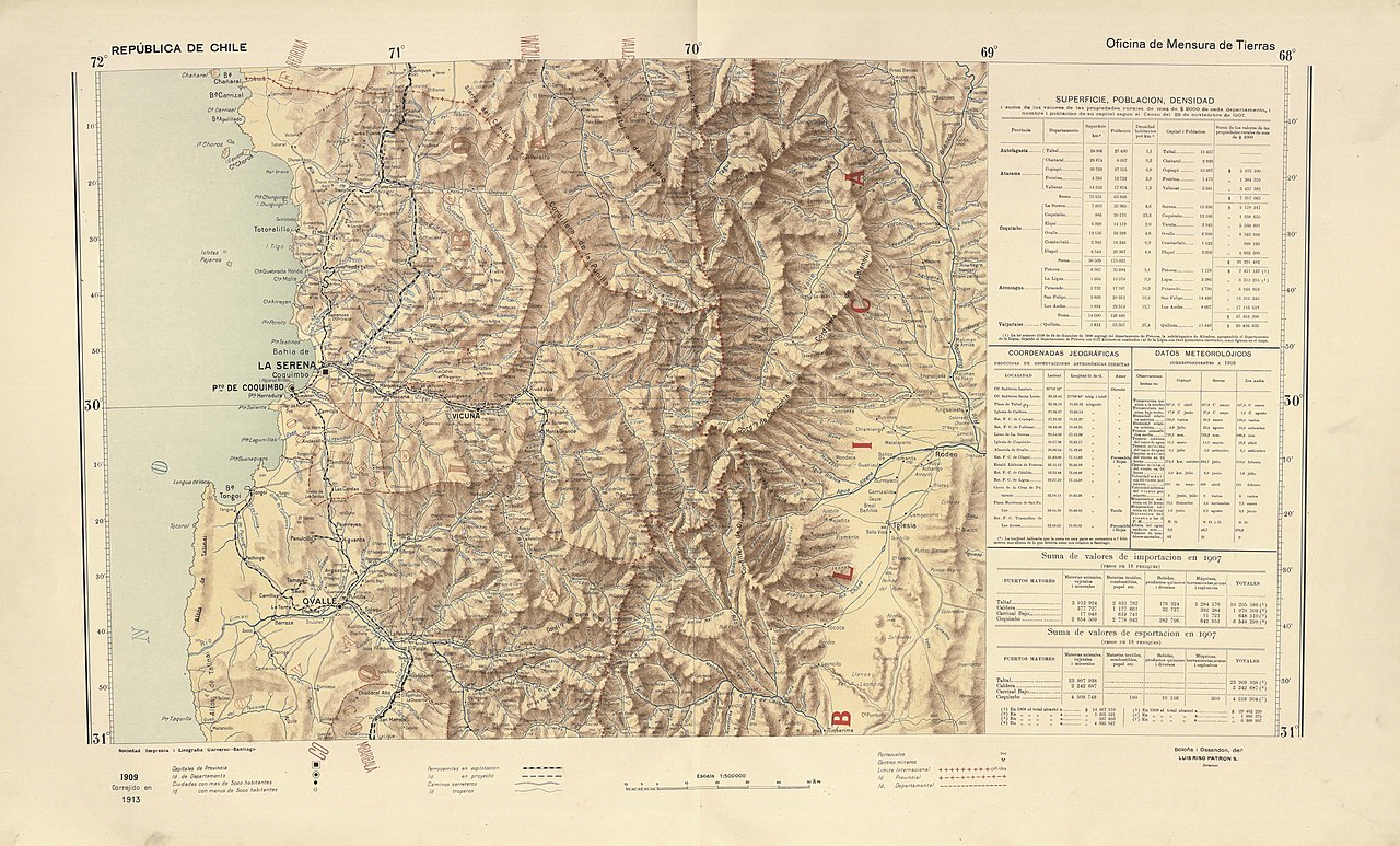
Español: Los mapas provinciales del “Atlas Centenario”, surgen de la preocupación del Presidente Pedro Montt por contar con un buen mapa de Chile. Los mapas fueron encargados a don Luis Risopatrón, director de la Oficina de Mensura de Tierras. Para la realización de este importante encargo presidencial, Risopatrón contó con la colaboración de los cartógrafos don Nicanor Boloña y Dañino y don Luis Ossandón y Cressy, quienes compilaron todos aquellos trabajos cartográficos disponibles a la fecha. El total de hojas que componen el mapa alcanza a 22 y se fueron editando entre 1908 y 1911, abarcando desde los 17° a los 57° grados de latitud sur. Su título oficial es: “Mapa de Chile. Ejecutado por orden de S.E. el Presidente de la República Excmo. Señor don Pedro Montt. Oficina de Mensura de Tierras. Edición Centenaria 1910.” |
| Date | |
| Source |
file:Risopatron-mapas-MC0073683-arica-temuco 01.pdf file:Risopatron-mapas-MC0073683-valdivia-cabo-de-hornos.pdf |
| Author | Nicanor Boloña y Dañino, Luis Ossandón y Cressy, Luis Risopatrón |
Licensing[edit]
|
This work is in the public domain in its country of origin and other countries and areas where the copyright term is the author's life plus 70 years or fewer. This work is in the public domain in the United States because it was published (or registered with the U.S. Copyright Office) before January 1, 1929. | |
| This file has been identified as being free of known restrictions under copyright law, including all related and neighboring rights. | |
File history
Click on a date/time to view the file as it appeared at that time.
| Date/Time | Thumbnail | Dimensions | User | Comment | |
|---|---|---|---|---|---|
| current | 16:20, 6 April 2020 | | 5,462 × 3,299 (3.2 MB) | Juan Villalobos (talk | contribs) | Uploaded a work by Nicanor Boloña y Dañino, Luis Ossandón y Cressy, Luis Risopatrón from file:Risopatron-mapas-MC0073683-arica-temuco 01.pdf file:Risopatron-mapas-MC0073683-valdivia-cabo-de-hornos.pdf with UploadWizard |
You cannot overwrite this file.
File usage on Commons
There are no pages that use this file.
File usage on other wikis
The following other wikis use this file:
- Usage on es.wikipedia.org
- Río Hurtado
- Río Elqui
- Central hidroeléctrica Los Molles
- Caleta Hornos (Chile)
- Quebrada Los Choros
- Quebrada Honda (Coquimbo)
- Río Turbio (Elqui)
- Río Claro (Elqui)
- Río Cochiguaz
- Río Mostazal
- Río Los Molles
- Río Incaguaz
- Río La Laguna
- Río Toro (Turbio)
- Río Malo (Toro)
- Estero Punitaqui
- Río Vacas Heladas
- Río Potrerillo
- Río Chacay
- Estero Ingenio (Limarí)
- Río Rapel (Grande)
- Laguna El Cepo
- Río Sasso
- Río Seco (La Laguna)
- Río Tulahuencito
- Río Ponio
- Río San Miguel (El Mostazal)
- Río del Medio (El Carmen)
- Río Primero (El Carmen)
- Río Sancarrón
- Río Palomo
- Río Tomés
- Río Ternero
- Río San Andrés
- Estero Guanta
- Río Carachas
- Río Patillos