File:02 Schaalsee-S-Hoffmeister.jpg
Jump to navigation
Jump to search

Size of this preview: 800 × 532 pixels. Other resolutions: 320 × 213 pixels | 640 × 426 pixels | 1,024 × 681 pixels | 1,280 × 851 pixels | 2,560 × 1,702 pixels | 3,500 × 2,327 pixels.
Original file (3,500 × 2,327 pixels, file size: 2.16 MB, MIME type: image/jpeg)
Captions
Captions
Add a one-line explanation of what this file represents
Summary[edit]
| Description |
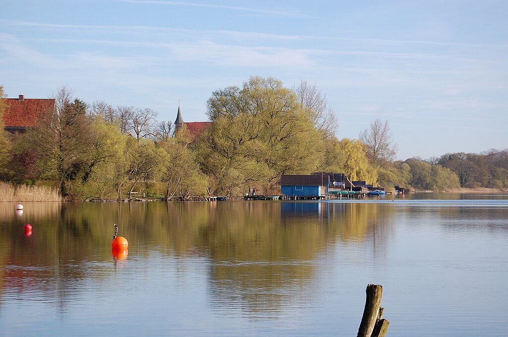
Deutsch: Der Schaalsee ist 24km² groß und mit 71m der tiefste See Norddeutschlands. Seine vielen Buchten, Inseln und Halbinseln kann man von keinem Standort aus überblicken. Nur wenige Boote sind auf dem See zugelassen und Motorboote sind verboten. Das macht den See so ruhig und geheimnisvoll. |
| Date | |
| Source | Own work |
| Author | Biosphärenreservatsamt Schaalsee-Elbe, S. Hoffmeister |
| Camera location | | View this and other nearby images on: OpenStreetMap |
|---|
Licensing[edit]
I, the copyright holder of this work, hereby publish it under the following license:
This file is licensed under the Creative Commons Attribution-Share Alike 4.0 International license.
- You are free:
- to share – to copy, distribute and transmit the work
- to remix – to adapt the work
- Under the following conditions:
- attribution – You must give appropriate credit, provide a link to the license, and indicate if changes were made. You may do so in any reasonable manner, but not in any way that suggests the licensor endorses you or your use.
- share alike – If you remix, transform, or build upon the material, you must distribute your contributions under the same or compatible license as the original.
This image was uploaded as part of Wiki Loves Earth 2019.
|
 |
File history
Click on a date/time to view the file as it appeared at that time.
| Date/Time | Thumbnail | Dimensions | User | Comment | |
|---|---|---|---|---|---|
| current | 11:38, 29 May 2019 | | 3,500 × 2,327 (2.16 MB) | Biosphärenband Schaalsee-Elbe (talk | contribs) | User created page with UploadWizard |
You cannot overwrite this file.
File usage on Commons
The following page uses this file: