File:00 8863 Markermeer (NL) - Houtribdijk (Straße N302).jpg
Jump to navigation
Jump to search
Size of this preview: 800 × 533 pixels. Other resolutions: 320 × 213 pixels | 640 × 427 pixels | 1,024 × 683 pixels | 1,280 × 853 pixels | 3,000 × 2,000 pixels.
Original file (3,000 × 2,000 pixels, file size: 3.95 MB, MIME type: image/jpeg)
Captions
Captions
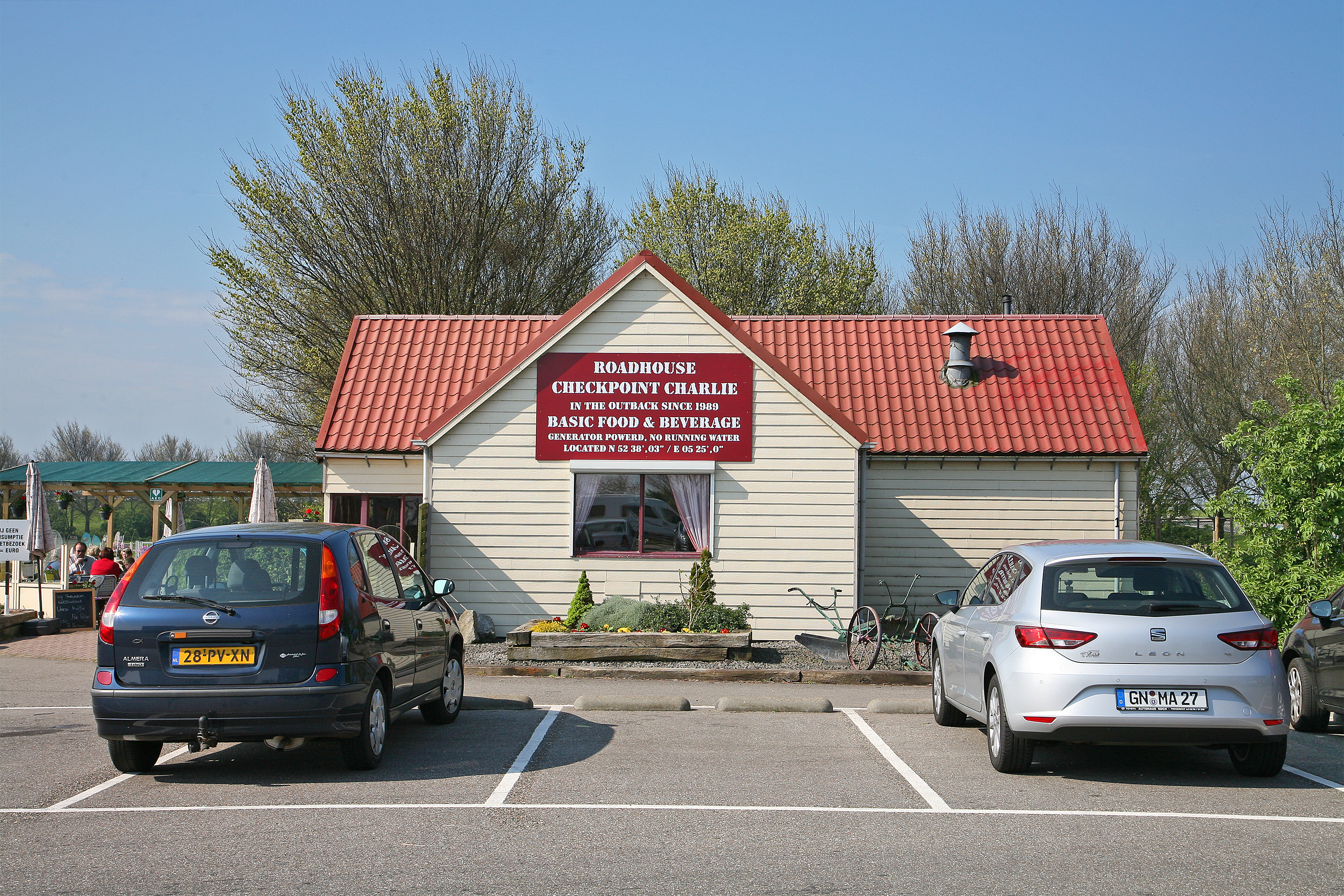
Netherlands: Service station on the road N302 (Lelystad - Enkhuizen).
Summary
[edit]_-_Houtribdijk_(Stra%C3%9Fe_N302).jpg&action=edit§ion=1)
| Description |
Deutsch: Raststätte an der Straße N302, die über den Damm Houtribdijk (Lelystad - Enkhuizen) führt. Der Damm trennt das Markermeer vom Ijsselmeer
(Länge etwa 32 Kilometer).
English: Service station on the road N302, which leads over the dam Houtribdijk (Lelystad - Enkhuizen). The dam separates the Markermeer from the Ijsselmeer (Length about 32 kilometers). |
| Date | |
| Source | Own work |
| Author | W. Bulach |
| Camera location | | View this and other nearby images on: OpenStreetMap |
|---|
_-_Houtribdijk_(Stra%C3%9Fe_N302).jpg¶ms=052.636511_N_0005.415644_E_globe:Earth_type:camera__&language=en)
Licensing
[edit]_-_Houtribdijk_(Stra%C3%9Fe_N302).jpg&action=edit§ion=2)
I, the copyright holder of this work, hereby publish it under the following license:
This file is licensed under the Creative Commons Attribution-Share Alike 4.0 International license.
- You are free:
- to share – to copy, distribute and transmit the work
- to remix – to adapt the work
- Under the following conditions:
- attribution – You must give appropriate credit, provide a link to the license, and indicate if changes were made. You may do so in any reasonable manner, but not in any way that suggests the licensor endorses you or your use.
- share alike – If you remix, transform, or build upon the material, you must distribute your contributions under the same or compatible license as the original.
File history
Click on a date/time to view the file as it appeared at that time.
| Date/Time | Thumbnail | Dimensions | User | Comment | |
|---|---|---|---|---|---|
| current | 14:51, 10 April 2017 | | 3,000 × 2,000 (3.95 MB) | W. Bulach (talk | contribs) | User created page with UploadWizard |
You cannot overwrite this file.
File usage on Commons
There are no pages that use this file.
_-_Houtribdijk_(Straße_N302).jpg&oldid=767581885)