File:005252023 Ratan Deo group of temples, Dwarahat Uttarakhand 224.jpg

Original file (4,624 × 3,468 pixels, file size: 9.29 MB, MIME type: image/jpeg)
Captions
Captions
Summary
[edit]
| Description |
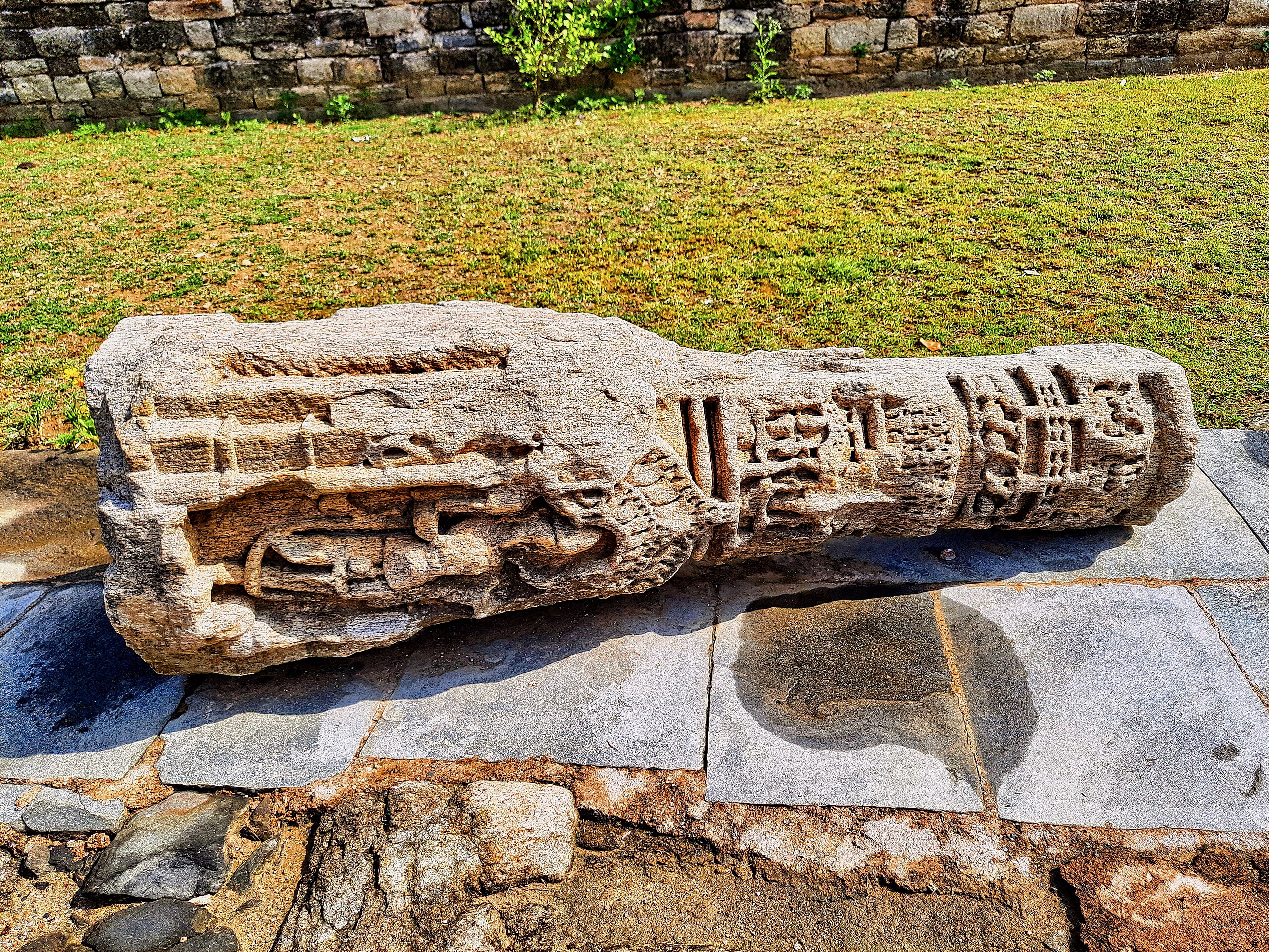
English: The Ratan Deo group of temples, also known as Ratan Deval shrines, are 11th to 13th-century Hindu temples in Dwarahat. This complex consists of a row of shrines in Himalayan version of Nagara architecture. The shikharas are economically fashioned, and "bear karṇāmalakas (ribbed stones set at corners) to suggest storeys and notched pieces of stone on the corners of veṇukośas (segmented outer nodal sheaths) and madhyalatās (central bands) to suggest a projecting cornice or a receding necking", writes Chanchani (Nachiket Chanchani (2014), From Asoda to Almora, The Roads Less Taken: Māru-Gurjara Architecture in the Central Himalayas, Arts Asiatiques, Tome 69, pp. 3-16).
Dwarahat is a historic site in Uttarakhand with many groups of Hindu temples built and restored between the 8th and the 16th century. These temples are attributed to various Hindu kings and queens from different dynasties, particularly those from the Katyuri dynasty. Totaling about 55 Hindu temples, they are notable as central Himalayan temples built with design and architecture typically found in distant, different parts of India (west, south, east). The Dwarahat temples were reduced to ruins by Delhi Sultanate and later the Mughals. Some were restored after the 15th century, and more recently in the 21st century by regional Hindu community and the ASI. For scholarly sources on Gujardeo temple group, see: Nachiket Chanchani (2019), Mountain Temples and Temple Mountains: Architecture, Religion, and Nature in the Central Himalayas, University of Washington Press. |
| Date | |
| Source | Own work |
| Author | Ms Sarah Welch |
| Camera location | | View this and other nearby images on: OpenStreetMap |
|---|
Licensing
[edit]
| This file is made available under the Creative Commons CC0 1.0 Universal Public Domain Dedication. | |
| The person who associated a work with this deed has dedicated the work to the public domain by waiving all of their rights to the work worldwide under copyright law, including all related and neighboring rights, to the extent allowed by law. You can copy, modify, distribute and perform the work, even for commercial purposes, all without asking permission.
|
File history
Click on a date/time to view the file as it appeared at that time.
| Date/Time | Thumbnail | Dimensions | User | Comment | |
|---|---|---|---|---|---|
| current | 19:35, 24 December 2023 | | 4,624 × 3,468 (9.29 MB) | Ms Sarah Welch (talk | contribs) | Uploaded own work with UploadWizard |
You cannot overwrite this file.
File usage on Commons
There are no pages that use this file.