File:001 No Fault, No Trail — Hermit Road Shuttle Bus Transfer Station (ecb9259a-1261-4d65-9ac3-6b533bc383d6).jpg
Jump to navigation
Jump to search
Size of this preview: 800 × 400 pixels. Other resolutions: 320 × 160 pixels | 640 × 320 pixels | 1,024 × 512 pixels | 1,280 × 640 pixels | 2,560 × 1,280 pixels | 5,376 × 2,688 pixels.
Original file (5,376 × 2,688 pixels, file size: 2.17 MB, MIME type: image/jpeg)
Captions
Captions
Add a one-line explanation of what this file represents

|
The categories of this image need checking. You can do so here.
|
.jpg&action=edit&withJS=MediaWiki:Catcheck.js)
Summary[edit]
.jpg&action=edit§ion=1)
| English: 001 No Fault, No Trail — Hermit Road Shuttle Bus Transfer Station | ||||
|---|---|---|---|---|
| Photographer |
English: NPS |
|||
| Title |
English: 001 No Fault, No Trail — Hermit Road Shuttle Bus Transfer Station |
|||
| Description |
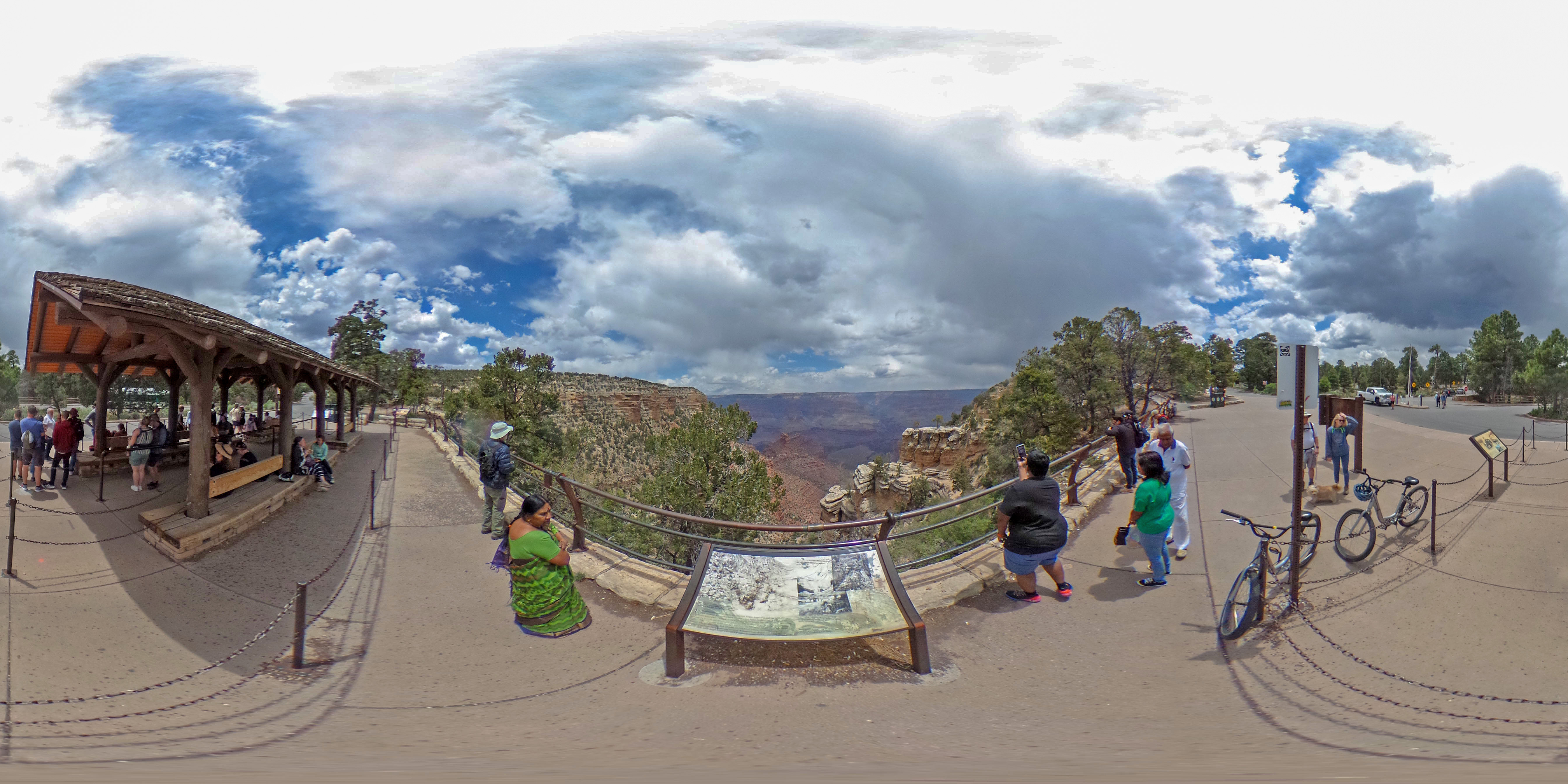
English: A 360 spherical panorama showing a faded wayside panel in the center with several people on either side looking into a canyon landscape. On the left is a bus stop shelter. Click on photo and tilt down to view panel just below the railing. Pan around to view the panel location in relation to the shuttle bus stop. This panel has faded and is delaminating.
|
|||
| Depicted place |
English: Latitude: 36.0572277777778, Longitude: -112.144605555556, Elevation: 2083.18; Grand Canyon National Park, Arizona; Latitude: 36.3291397094727, Longitude: -112.790603637695 |
|||
| Date | Taken on 14 May 2023 | |||
| Accession number | ||||
| Source |
English: NPGallery |
|||
| Permission (Reusing this file) |
|
|||
| NPS Unit Code | GRCA | |||
| Album(s) | English: 360 Spherical Panoramas from Grand Canyon National Park. |
|||
File history
Click on a date/time to view the file as it appeared at that time.
| Date/Time | Thumbnail | Dimensions | User | Comment | |
|---|---|---|---|---|---|
| current | 18:01, 24 June 2023 | | 5,376 × 2,688 (2.17 MB) | BMacZeroBot (talk | contribs) | Batch upload (Commons:Batch uploading/NPGallery) |
You cannot overwrite this file.
File usage on Commons
The following page uses this file:
.jpg)
.jpg&oldid=877034542)