File:(La) Calera - material cartográfico (1890) (cropped).png
Jump to navigation
Jump to search
No higher resolution available.
(La)_Calera_-_material_cartográfico_(1890)_(cropped).png (508 × 392 pixels, file size: 401 KB, MIME type: image/png)
Captions
Captions
Add a one-line explanation of what this file represents
Summary
[edit]| Description |
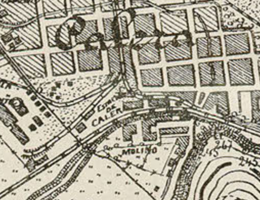
Español: Mapa de la localidad de Calera, 1890. |
| Date | |
| Source | http://www.bibliotecanacionaldigital.gob.cl/bnd/631/w3-article-154846.html |
| Author | Ejercito de Chile |
| Other versions |
_Calera_-_material_cartogr%C3%A1fico_(1890).png)
_Calera_-_material_cartogr%C3%A1fico_(1890)_(cropped).png&action=edit§ion=1)
Licensing
[edit]_Calera_-_material_cartogr%C3%A1fico_(1890)_(cropped).png&action=edit§ion=2)
This file has fallen into the public domain according to Chilean copyright law (No. 17336 and its amendments). Nevertheless, its author and source must be acknowledged.
See here for the type of material that is in the public domain (patrimonio cultural común / common cultural heritage).
|

|
File history
Click on a date/time to view the file as it appeared at that time.
| Date/Time | Thumbnail | Dimensions | User | Comment | |
|---|---|---|---|---|---|
| current | 03:46, 10 October 2021 | | 508 × 392 (401 KB) | LuisCG11 (talk | contribs) | File:(La) Calera - material cartográfico (1890).png cropped 91 % horizontally, 94 % vertically using CropTool with precise mode. |
You cannot overwrite this file.
File usage on Commons
The following page uses this file:
File usage on other wikis
The following other wikis use this file:
- Usage on es.wikipedia.org
_Calera_-_material_cartográfico_(1890)_(cropped).png&oldid=734015027)