File:臺北市東側南北向捷運系統(東環段)規劃路線示意圖.jpg
Jump to navigation
Jump to search

Size of this preview: 424 × 600 pixels. Other resolutions: 170 × 240 pixels | 339 × 480 pixels | 543 × 768 pixels | 724 × 1,024 pixels | 1,470 × 2,079 pixels.
Original file (1,470 × 2,079 pixels, file size: 427 KB, MIME type: image/jpeg)
Captions
Captions
Add a one-line explanation of what this file represents
Summary
[edit]%E8%A6%8F%E5%8A%83%E8%B7%AF%E7%B7%9A%E7%A4%BA%E6%84%8F%E5%9C%96.jpg&action=edit§ion=1)
| Description |
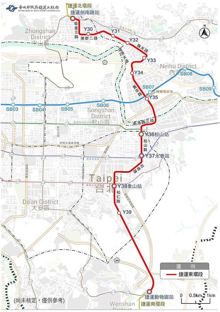
中文:臺北市東側南北向捷運系統(東環段)規劃路線示意圖 |
| Date | |
| Source | 中華民國臺北市政府捷運工程局, Department of Rapid Transit Systems, Taipei City Government, ROC[1][2] |
| Author | 中華民國臺北市政府捷運工程局, Department of Rapid Transit Systems, Taipei City Government, ROC |
![[2]](https://www-ws.gov.taipei/001/Upload/388/relpic/17619/95955/e21f2d16-df02-49a5-a503-b2eeac4ee13d.png)
Licensing
[edit]%E8%A6%8F%E5%8A%83%E8%B7%AF%E7%B7%9A%E7%A4%BA%E6%84%8F%E5%9C%96.jpg&action=edit§ion=2)

|
The copyright holder of this file, Department of Rapid Transit Systems, Taipei, allows anyone to use it for any purpose, provided that the copyright holder is properly attributed. Redistribution, derivative work, commercial use, and all other use is permitted. |
Attribution:
|
|
|
This file is licensed under the Government Website Open Information Announcement.
Information on Related Items:
|
 |
|
|
File history
Click on a date/time to view the file as it appeared at that time.
| Date/Time | Thumbnail | Dimensions | User | Comment | |
|---|---|---|---|---|---|
| current | 02:47, 10 March 2020 | | 1,470 × 2,079 (427 KB) | Jrthsr700tmax (talk | contribs) | 更新國發會通過後之版本 |
| 08:31, 20 March 2018 |  | 2,072 × 2,908 (919 KB) | Happy60907 (talk | contribs) | {{Information |description ={{zh|1=臺北市東側南北向捷運系統(東環段)規劃路線示意圖}} |source =中華民國臺北市政府捷運工程局, Department of Rapid Transit Systems, Taipei City Government, ROC[https://www-ws.gov.taipei/Download.ashx?u=LzAwMS9VcGxvYWQvMzg4L3JlbGZpbGUvMTk1MDIvNzYzNjczMS85MjUxYTUxZi0yNjJhLTQ2MDQtOTYxYS03OTNmZmU4MGQ1NzAucGRm&n=5rCR55y%2b5pu46Z2i6Kqq5piO6LOH5paZLnBkZg%3d%3d] |author =中華民國臺北市政府捷運工程局, Department of Rapid Transit Systems, Taipei City Government, ROC |date =2018-03-16 |permission ={{PD-ROC-exempt}} }} Category:Taipei MRT Maps |
You cannot overwrite this file.
File usage on Commons
The following 6 pages use this file:
- User:Chumwa/OgreBot/Potential transport maps/2018 March 11-20
- User:Chumwa/OgreBot/Public transport information/2018 March 11-20
- User:Chumwa/OgreBot/Public transport information/2020 March 1-10
- User:Chumwa/OgreBot/Transport Maps/2018 March 11-20
- User:Chumwa/OgreBot/Transport Maps/2020 March 1-10
- User:Chumwa/OgreBot/Travel and communication maps/2018 March 11-20
File usage on other wikis
The following other wikis use this file:
- Usage on www.wikidata.org
- Usage on zh.wikipedia.org
規劃路線示意圖.jpg&oldid=756176439)