File:模写 府屋地形分類図.png
Jump to navigation
Jump to search
Size of this preview: 800 × 461 pixels. Other resolutions: 320 × 184 pixels | 640 × 369 pixels | 1,024 × 590 pixels | 1,336 × 770 pixels.
Original file (1,336 × 770 pixels, file size: 194 KB, MIME type: image/png)
Captions
Captions
Add a one-line explanation of what this file represents
Summary[edit]
| Description |
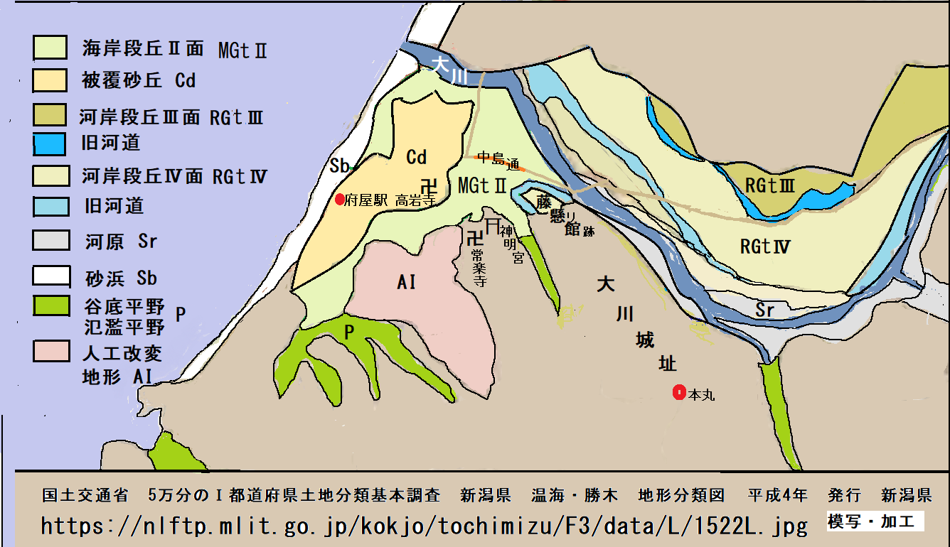
日本語: 府屋の被覆砂丘・旧河道などの画像 |
| Date | |
| Source | Own work |
| Author | 大川忠秀 |
Licensing[edit]
I, the copyright holder of this work, hereby publish it under the following license:
This file is licensed under the Creative Commons Attribution-Share Alike 4.0 International license.
- You are free:
- to share – to copy, distribute and transmit the work
- to remix – to adapt the work
- Under the following conditions:
- attribution – You must give appropriate credit, provide a link to the license, and indicate if changes were made. You may do so in any reasonable manner, but not in any way that suggests the licensor endorses you or your use.
- share alike – If you remix, transform, or build upon the material, you must distribute your contributions under the same or compatible license as the original.

|
This media file is uncategorized.
Please help improve this media file by adding it to one or more categories, so it may be associated with related media files (how?), and so that it can be more easily found.
Please notify the uploader with {{subst:Please link images|File:模写 府屋地形分類図.png}} ~~~~ |
File history
Click on a date/time to view the file as it appeared at that time.
| Date/Time | Thumbnail | Dimensions | User | Comment | |
|---|---|---|---|---|---|
| current | 10:07, 17 March 2024 | | 1,336 × 770 (194 KB) | 大川忠秀 (talk | contribs) | Uploaded while editing "府屋" on ja.wikipedia.org |
You cannot overwrite this file.
File usage on Commons
The following page uses this file: