File:خريطة لمراحل احتلال المغرب 1920.jpg
Jump to navigation
Jump to search

Size of this preview: 741 × 600 pixels. Other resolutions: 297 × 240 pixels | 593 × 480 pixels | 949 × 768 pixels | 1,266 × 1,024 pixels | 2,531 × 2,048 pixels | 8,446 × 6,834 pixels.
Original file (8,446 × 6,834 pixels, file size: 8.77 MB, MIME type: image/jpeg)
Captions
Captions
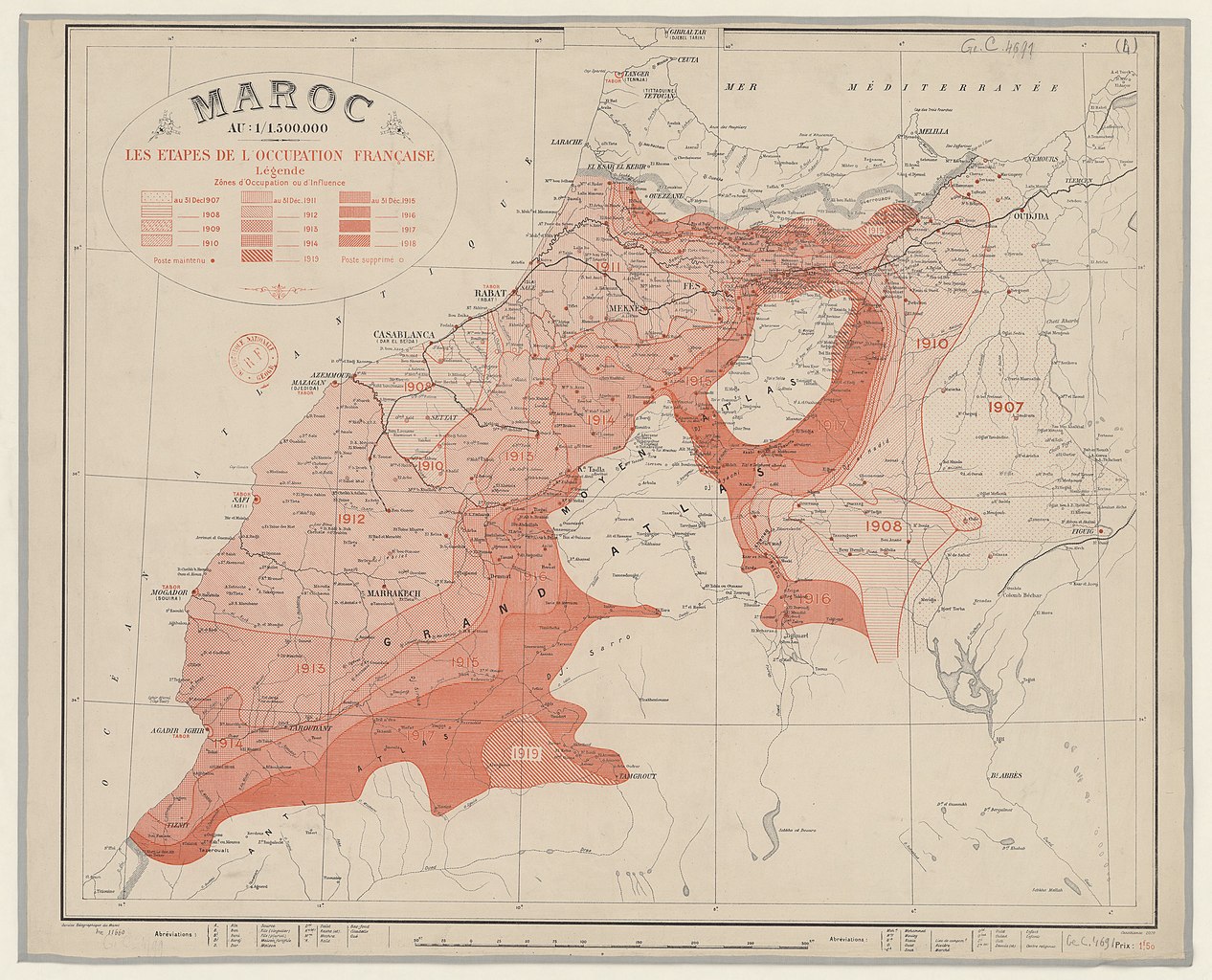
Map of stages of French occupation of Morocco 1920
Summary[edit]
| Description |
English: "Maroc au : 1/1.500.000. Les étapes de l'occupation française "
Service Géographique du Maroc (Casablanca) 1920 55 x 65 cmالعربية: "المغرب بمقياس : 1/1.500.000. مراحل الاحتلال الفرنسي "
خدمة المغرب للجغرفيا (الدار البيضاء) 1920 55 x 65 س.م |
| Date | |
| Source | https://gallica.bnf.fr/ark:/12148/btv1b530648332 |
| Author | Service Géographique du Maroc (Casablanca) |
Licensing[edit]
| Previous public domain rationale, no longer applicable | ||
|---|---|---|
|
File history
Click on a date/time to view the file as it appeared at that time.
| Date/Time | Thumbnail | Dimensions | User | Comment | |
|---|---|---|---|---|---|
| current | 04:48, 13 February 2019 | | 8,446 × 6,834 (8.77 MB) | إيان (talk | contribs) | User created page with UploadWizard |
You cannot overwrite this file.
File usage on Commons
There are no pages that use this file.
File usage on other wikis
The following other wikis use this file:
- Usage on ar.wikipedia.org
- Usage on cy.wikipedia.org
- Usage on eu.wikipedia.org
- Usage on he.wikipedia.org