File:Ísland með sveitarfélögum.svg
Jump to navigation
Jump to search

Size of this PNG preview of this SVG file: 799 × 560 pixels. Other resolutions: 320 × 224 pixels | 640 × 449 pixels | 1,024 × 718 pixels | 1,280 × 897 pixels | 2,560 × 1,794 pixels.
Original file (SVG file, nominally 799 × 560 pixels, file size: 118 KB)
Captions
Captions
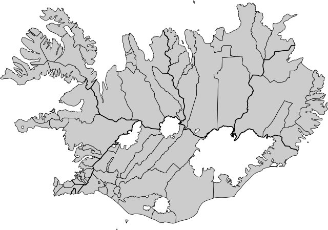
A map of Iceland, with municipal and regional boundaries.
Summary[edit]
| Description |
English: Built on data from OpenStreetMap using Overpass Turbo and Mapshaper. Municipalities are grouped by region.
Íslenska: Byggt á gögnum úr OpenStreetMap með Overpass Turbo og Mapshaper. Sveitarfélög eru flokkuð saman eftir landshlutum. |
| Date | |
| Source | Own work |
| Author | Maxí |
Licensing[edit]
I, the copyright holder of this work, hereby publish it under the following license:
This file is licensed under the Creative Commons Attribution-Share Alike 4.0 International license.
- You are free:
- to share – to copy, distribute and transmit the work
- to remix – to adapt the work
- Under the following conditions:
- attribution – You must give appropriate credit, provide a link to the license, and indicate if changes were made. You may do so in any reasonable manner, but not in any way that suggests the licensor endorses you or your use.
- share alike – If you remix, transform, or build upon the material, you must distribute your contributions under the same or compatible license as the original.
File history
Click on a date/time to view the file as it appeared at that time.
| Date/Time | Thumbnail | Dimensions | User | Comment | |
|---|---|---|---|---|---|
| current | 17:33, 20 January 2019 | | 799 × 560 (118 KB) | Maxí (talk | contribs) | User created page with UploadWizard |
You cannot overwrite this file.
File usage on Commons
There are no pages that use this file.
File usage on other wikis
The following other wikis use this file:
- Usage on fr.wikipedia.org
- Akureyri
- Stykkishólmur
- Îles Vestmann
- Bolungarvík
- Blönduós
- Mosfellsbær
- Seltjarnarnes
- Akranes
- Árneshreppur
- Árborg
- Dalvíkurbyggð
- Fjarðabyggð
- Municipalité (Islande)
- Reykjanesbær
- Skagaströnd
- Hveragerði
- Grundarfjörður
- Modèle:Palette Municipalités de l'Islande
- Bláskógabyggð
- Kjósarhreppur
- Hornafjörður
- Skaftárhreppur
- Mýrdalshreppur
- Rangárþing eystra
- Rangárþing ytra
- Ásahreppur
- Flóahreppur
- Skeiða- og Gnúpverjahreppur
- Grímsnes- og Grafningshreppur
- Ölfus
- Vogar (municipalité)
- Suðurkjördæmi
- Þingeyjarsveit
- Fjallabyggð
- Hörgársveit
- Eyjafjarðarsveit
- Svalbarðsstrandarhreppur
- Grýtubakkahreppur
- Norðurþing
- Tjörneshreppur
- Langanesbyggð
- Vopnafjarðarhreppur
- Fljótsdalshreppur
- Hvalfjarðarsveit
- Skorradalshreppur
- Borgarbyggð
- Eyja- og Miklaholtshreppur
- Snæfellsbær
- Dalabyggð
- Reykhólahreppur
View more global usage of this file.