File:Åshusby - KMB - 16000300023285.jpg
Jump to navigation
Jump to search
Size of this preview: 401 × 599 pixels. Other resolutions: 161 × 240 pixels | 491 × 733 pixels.
Original file (491 × 733 pixels, file size: 88 KB, MIME type: image/jpeg)
Captions
Captions
Add a one-line explanation of what this file represents
| Åshusby
( |
|||||||||||||||||||||||||||
|---|---|---|---|---|---|---|---|---|---|---|---|---|---|---|---|---|---|---|---|---|---|---|---|---|---|---|---|
| Photographer |
|
||||||||||||||||||||||||||
| Title |
Åshusby |
||||||||||||||||||||||||||
| Original caption |
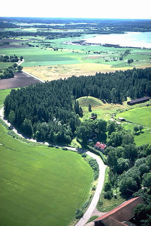
Notera Av dokumentationsskäl har originalbeskrivningen från Riksantikvarieämbetet behållits. Tillrättalägganden och alternativa beskrivningar bör införas separat från nedanstående information. Nordians hög (fornlämningsnummer, RAÄnr 0057:31), i bildens mitt, och sjön Fysingen.Felaktigheter kan även anmälas till denna sida. Motiv: Åshusby |
||||||||||||||||||||||||||
| Description |
Nordians hög (fornlämningsnummer, RAÄnr 0057:31), i bildens mitt, och sjön Fysingen. |
||||||||||||||||||||||||||
| Depicted place | Sweden, Sigtuna Municipality, Norrsunda socken | ||||||||||||||||||||||||||
| Date | 23 July 1991 | ||||||||||||||||||||||||||
| Collection |
|
||||||||||||||||||||||||||
| Accession number | |||||||||||||||||||||||||||
| Source |
Jan Norrman / Kulturmiljöbild, Riksantikvarieämbetet
|
||||||||||||||||||||||||||
| Permission (Reusing this file) |
This file is licensed under the Creative Commons Attribution 2.5 Generic license. Attribution: Jan Norrman / Riksantikvarieämbetet
|
||||||||||||||||||||||||||


| Object location | | View this and other nearby images on: OpenStreetMap |
|---|
File history
Click on a date/time to view the file as it appeared at that time.
| Date/Time | Thumbnail | Dimensions | User | Comment | |
|---|---|---|---|---|---|
| current | 18:46, 25 November 2020 | | 491 × 733 (88 KB) | Nasko (talk | contribs) | Cropped 4 % horizontally, 5 % vertically using CropTool with lossless mode. |
| 22:19, 28 September 2017 |  | 512 × 768 (86 KB) | AliciaFagervingWMSE-bot (talk | contribs) | {{Kulturmiljöbild-image | short title = Åshusby | original description = Nordians hög (fornlämningsnummer, RAÄnr 0057:31), i bildens mitt, och sjön Fysingen.<br> Motiv: Åshusby<br> Nyckelord: Flygbilder, Raä-Fastigheter, Riksintressen<br> Kateg... |
You cannot overwrite this file.
File usage on Commons
The following 3 pages use this file:
File usage on other wikis
The following other wikis use this file:
- Usage on de.wikipedia.org