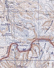
File:"NANGPA LA" "CHO OYU" "GYACHUNG KANG"- "KYETRAK" "KYETRAK GLACIER" "PALUNG" "PALUNG GLACIER" "GYACHUNG GLACIER" "JAPAWA"- "LAJE" "LUNAK" "KYAJUMBA" "NGOJUMBA GLACIER")- Map China 1-250,000 Tile NH 45-14 Tingri Dzong (cropped).jpg
Jump to navigation
Jump to search

Size of this preview: 476 × 600 pixels. Other resolutions: 190 × 240 pixels | 604 × 761 pixels.
Original file (604 × 761 pixels, file size: 202 KB, MIME type: image/jpeg)
Captions
Captions
Add a one-line explanation of what this file represents
| Description |
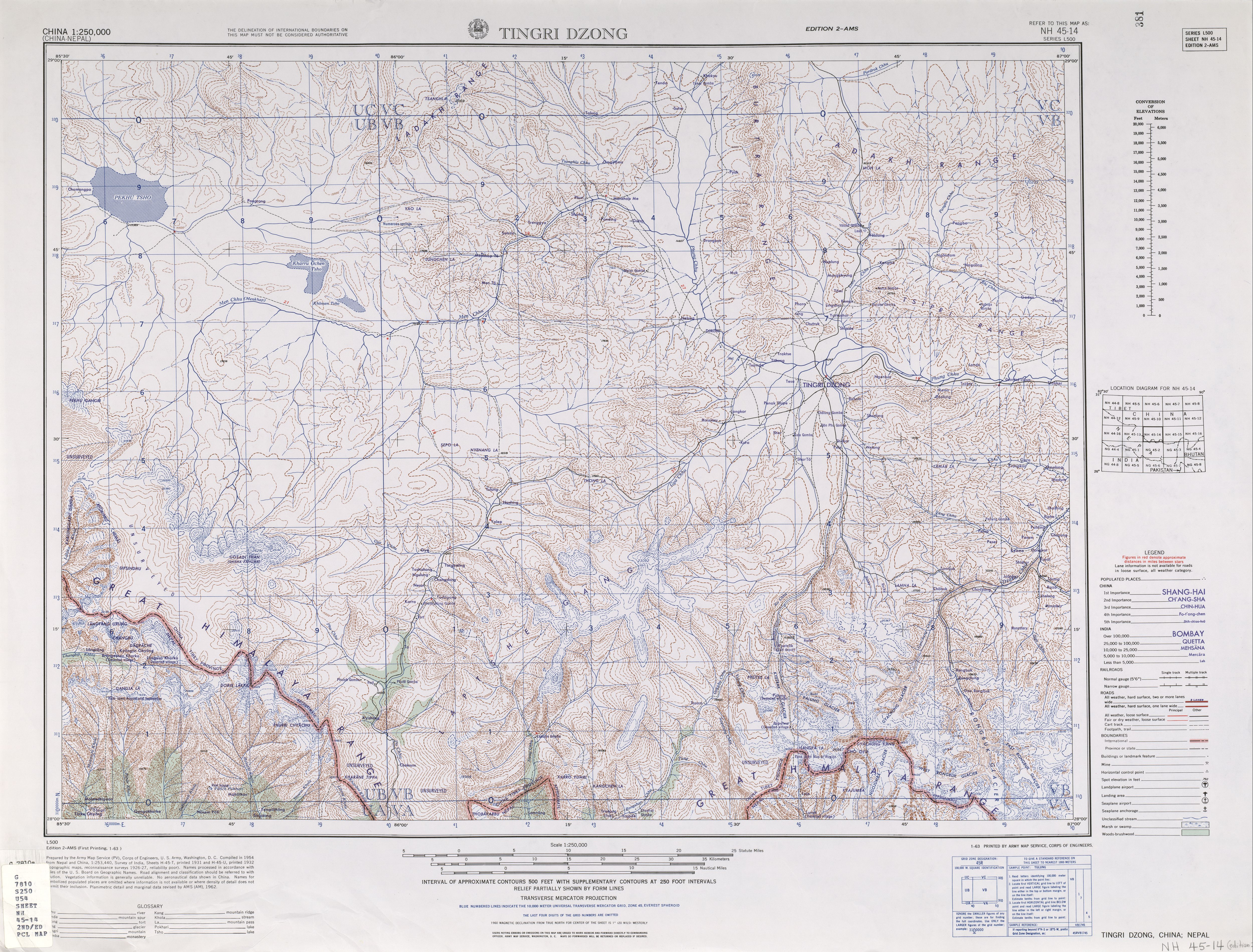
English: NH 45-14 Tingri Dzong. Tile of the Map India and Pakistan 1:250,000. Series L500, U.S. Army Map Service, 1955 |
||||||
| Date | |||||||
| Source | http://www.lib.utexas.edu/maps/ams/china/txu-oclc-10552568-nh45-14.jpg | ||||||
| Author | U.S. Army Maps Service | ||||||
| Permission (Reusing this file) |
|
||||||
| Other versions |
|
||||||


File history
Click on a date/time to view the file as it appeared at that time.
| Date/Time | Thumbnail | Dimensions | User | Comment | |
|---|---|---|---|---|---|
| current | 20:12, 2 October 2019 | | 604 × 761 (202 KB) | Tibet Nation (talk | contribs) | File:Map China 1-250,000 Tile NH 45-14 Tingri Dzong.jpg cropped 88 % horizontally, 80 % vertically using CropTool with lossless mode. |
You cannot overwrite this file.
File usage on Commons
The following page uses this file:
-_Map_China_1-250,000_Tile_NH_45-14_Tingri_Dzong_(cropped).jpg&oldid=731844485)