Pomerania
(Redirected from Pommern)
historical region of present-day Poland and Germany | |||||
| Upload media | |||||
| Instance of | |||||
|---|---|---|---|---|---|
| Location |
| ||||
| Located in or next to body of water | |||||
| Has part(s) | |||||
| Area |
| ||||
| Different from | |||||
 | |||||
- Pomerania (latina, english, italiano, español)
- Pommern (deutsch, dansk, svenska, norsk)
- Pomorze (polski)
- Pòmòrskô (kaszëbsczi)
- Pommeren (nederlands)
- Poméranie (français)
- Pommeri (suomi)
- ポメラニア、ポモージェ、ポンメルン (日本語) ...
Find out more here:
- Mecklenburg-Vorpommern, Vorpommern (Western Pomerania) being the remaining German part of Pomerania.
- West Pomeranian Voivodeship (Województwo zachodniopomorskie), today a province in north-central Poland.
- Pomeranian Voivodeship (Województwo pomorskie), today a province in northwestern Poland.
Places:
- Cities: Gdańsk (Danzig) - Szczecin (Stettin) - Stralsund - Greifswald - Koszalin - Słupsk
- Islands: Rügen - Hiddensee - Usedom - Wolin
Insignia
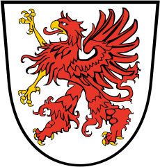
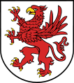
[edit]The griffin is the charge of Pomerania's coat of arms. This rare animal combines genetic material of both an eagle and a lion, and is very important for this country. The Pomeranian ducal dynasty was named after it (de:Greifen/pl:Gryfici), and some Pomeranian towns, too (Greifswald/Gryfia, Greifenhagen/Gryfino, Greifenberg/Gryfice).
-
Traditional coat of arms, big version
-
Traditional coat of arms, small version
-
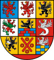
Mecklenburg and Western Pomerania...
-
...the griffin representing the latter
-
Coat of arms of West Pomeranian Voivodeship, northern central Poland
-
Coat of arms of Pomeranian Voivodeship in northern west Poland
Maps
[edit]General maps, location maps
[edit]-
Pomeraniae Ducatus Tabula, 1635 (Lubinus)
-
Pomerania Province, 1905
-
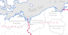
Pomerania in today's state borders (western part German, eastern part Polish)
-
Mecklenburg & Western Pomerania today (Germany)
-
MV with the border to Western Pomerania highlighted (Germany)
-
West Pomeranian Voivodeship (PL)
-
Pomeranian Voivodeship (PL)
1905 County maps
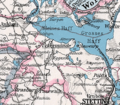
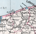
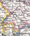
[edit]English: Detail maps of the 1905 province map linked above were made to illustrate articles on counties (Landkreise) of the former prussian province of Pomerania. County names are given with the thumbnails, the administration seat is added in brackets if not identical with the county name. As the majority of Pomerania became polish in 1945, names for these counties are noted bilingually for easier location on modern maps. Similar maps were made for the former provinces of Brandenburg and Silesia.
Deutsch: Von der in der obigen Galerie aufgeführten Provinzkarte von 1905 wurden Ausschnitte angefertigt, um die Artikel zu den einzelnen Landkreisen zu illustrieren. Unter den Vorschaubildern stehen die Namen der Landkreise plus der Sitz der Kreisverwaltung in Klammern, falls nicht mit dem Kreisnamen identisch. Da der größte Teil Pommerns 1945 polnisch wurde, werden die betroffenen Ortsnamen zweisprachig angegeben, um die Zuordnung auf modernen polnischen Landkarten zu erleichtern. Ähnliche Karten gibt es für Brandenburg und Schlesien.
-
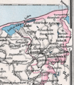
Franzburg-Barth (Barth)
-
Greifswald
-
Grimmen
-
Kammin - Kamień Pomorski
-
Naugard - Nowogard
-
Randow
-
Pyritz - Pyrzyce
-
Regenwalde (Labes - Łobez)
-
Rügen (Bergen)
-
Saatzig (Stargard)
-
Ueckermünde
-
Usedom-Wollin (Swinemünde - Świnoujście)
-
Greifenhagen - Gryfino
-
Greifenberg - Gryfice
-
Demmin
-
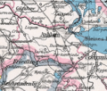
Anklam
-
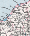
Stolp
-
Schlawe - Sławno
-
Schivelbein - Świdwin
-
Rummelsburg - Miastko
-
Neustettin - Szczecinek
-
Lauenburg - Lębork
-
Köslin - Koszalin
-
Kolberg-Körlin (Kolberg - Kołobrzeg)
-
Dramburg - Drawsko Pomorskie
-
Bütow - Bytów
-
Bublitz - Bobolice
-
Belgard - Białogard
Note: The larger towns and cities which did not belong to any county were Greifswald, Stargard in Pommern (Stargard Szczeciński), Stettin (Szczecin) (provincial capital), Stralsund, Kolberg (Kołobrzeg), Köslin (Koszalin) and Stolp (Słupsk).
