File talk:Tanzania Urambo location map.svg
Jump to navigation
Jump to search
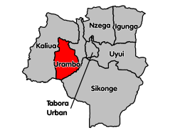
Hi! it seems that this is an old map of Urambo District, since if you compare it with this photo

, you we realize that the shape on your map also includes Kaliua District. With kindest regards --Aristo Class (talk) 15:13, 16 June 2016 (UTC)