File:Zwanemeer op de geologische kaart van 1837.png

Original file (2,114 × 1,173 pixels, file size: 4.29 MB, MIME type: image/png)
Captions
Captions
Summary
[edit]
| Description |
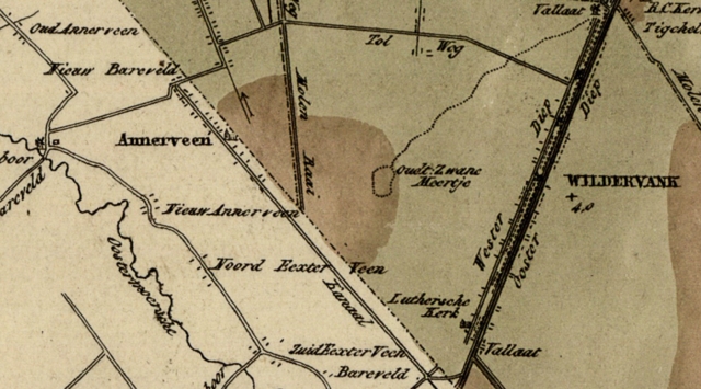
Nederlands: Deze kaart is een fragment van File:Groningen - geologische kaart 1837.jpg. Het toont het Zwanemeer dat dan inmiddels in 1837 niet meer bestaat. |
| Date | |
| Source | Fragment van File:Groningen - geologische kaart 1837.jpg |
| Author |
Samengesteld door door landmeter I.A. Smit van der Vegt uit tekeningen van de burgemeesters uit de provincie onder toezicht van Gozewinus Acker Stratingh. Gravure van Dr. Veelwaard en Zoon Licentie |
Licensing
[edit]
|
This work is in the public domain in its country of origin and other countries and areas where the copyright term is the author's life plus 70 years or fewer. This work is in the public domain in the United States because it was published (or registered with the U.S. Copyright Office) before January 1, 1929. | |
| This file has been identified as being free of known restrictions under copyright law, including all related and neighboring rights. | |
File history
Click on a date/time to view the file as it appeared at that time.
| Date/Time | Thumbnail | Dimensions | User | Comment | |
|---|---|---|---|---|---|
| current | 18:39, 27 April 2023 | | 2,114 × 1,173 (4.29 MB) | Roepers (talk | contribs) | Uploaded a work by Samengesteld door door landmeter I.A. Smit van der Vegt uit tekeningen van de burgemeesters uit de provincie onder toezicht van Gozewinus Acker Stratingh. Gravure van Dr. Veelwaard en Zoon Licentie from Fragment van File:Groningen - geologische kaart 1837.jpg with UploadWizard |
You cannot overwrite this file.
File usage on Commons
There are no pages that use this file.
File usage on other wikis
The following other wikis use this file:
- Usage on nl.wikipedia.org