File:ZuberoaUdalerriak.png
Jump to navigation
Jump to search
Size of this preview: 432 × 599 pixels. Other resolutions: 173 × 240 pixels | 553 × 767 pixels.
Original file (553 × 767 pixels, file size: 109 KB, MIME type: image/png)
Captions
Captions
Add a one-line explanation of what this file represents
Summary
[edit]
| Description |
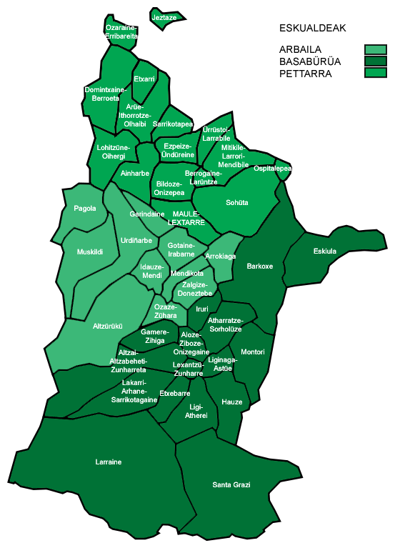
Español: Mapa de la provincia histórica de Sola (Soule en francés, Zuberoa en euskera) con sus municipios (nombres en euskera según Euskaltzaindia). Hrvatski: Karta Zuberoe s podjelom po općinama i županijama (euskaldeak) |
| Date | |
| Source | self-made (basado en la imagen de Commons Communes_de_Soule.svg, de dominio público. |
| Author | CaNyAMeL |
Licensing
[edit]
| I, the copyright holder of this work, release this work into the public domain. This applies worldwide. In some countries this may not be legally possible; if so: I grant anyone the right to use this work for any purpose, without any conditions, unless such conditions are required by law. |
File history
Click on a date/time to view the file as it appeared at that time.
| Date/Time | Thumbnail | Dimensions | User | Comment | |
|---|---|---|---|---|---|
| current | 13:08, 24 August 2007 | | 553 × 767 (109 KB) | CaNyAMeL (talk | contribs) | {{Information |Description=Mapa de la provincia histórica de Sola (Soule en francés, Zuberoa en euskera) con sus municipios (nombres en euskera según Euskaltzaindia). |Source=self-made (basado en la imagen de Commons Communes_de_Soule.svg, de dominio p |
You cannot overwrite this file.
File usage on Commons
There are no pages that use this file.
File usage on other wikis
The following other wikis use this file:
- Usage on an.wikipedia.org
- Usage on br.wikipedia.org
- Usage on ca.wikipedia.org
- Usage on el.wikipedia.org
- Usage on en.wikipedia.org
- Usage on eu.wikipedia.org
- Usage on fr.wikipedia.org
- Usage on hr.wikipedia.org
- Usage on ja.wikipedia.org
- Usage on sh.wikipedia.org
- Usage on vi.wikipedia.org