File:Zlatá stoka České Budějovice map.png
Jump to navigation
Jump to search

Size of this preview: 375 × 600 pixels. Other resolutions: 150 × 240 pixels | 300 × 480 pixels.
Original file (800 × 1,280 pixels, file size: 171 KB, MIME type: image/png)
Captions
Captions
Add a one-line explanation of what this file represents
Summary
[edit]
| Description |
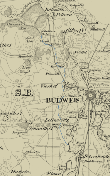
Čeština: Výřez z historické mapy (1829) se zvýrazněním původního toku Zlaté stoky. Podkladová mapa: „Topographische Karte der in Böhmen budweiser Kreises liegenden Sr. Durchlaucht dem Fürsten zu Schwarzenberg Herzog zu Krummau gehörigen Herrschaft Krummau mit Bestimmung des äussern Gränzen und Ausscheidung des im Umfange der Herrschaft befindlichen obrigkeitlichen Grundeigentums. Nro. II., Joseph Falta, 1829“ |
| Date | |
| Source | http://archiv.cbvk.cz/historicke_mapy/data/MA_367_3_001.php |
| Author | Joseph Falta, 1829 |
Licensing
[edit]
|
This work is in the public domain in its country of origin and other countries and areas where the copyright term is the author's life plus 70 years or fewer. | |
| This file has been identified as being free of known restrictions under copyright law, including all related and neighboring rights. | |
File history
Click on a date/time to view the file as it appeared at that time.
| Date/Time | Thumbnail | Dimensions | User | Comment | |
|---|---|---|---|---|---|
| current | 09:42, 23 September 2012 | | 800 × 1,280 (171 KB) | Xth-Floor (talk | contribs) | User created page with UploadWizard |
You cannot overwrite this file.
File usage on Commons
The following page uses this file:
File usage on other wikis
The following other wikis use this file:
- Usage on cs.wikipedia.org