File:Zickmantelscher Mühlgraben 1855.jpg
Original file (1,046 × 1,136 pixels, file size: 942 KB, MIME type: image/jpeg)
Captions
Captions
Summary
[edit]
| Description |
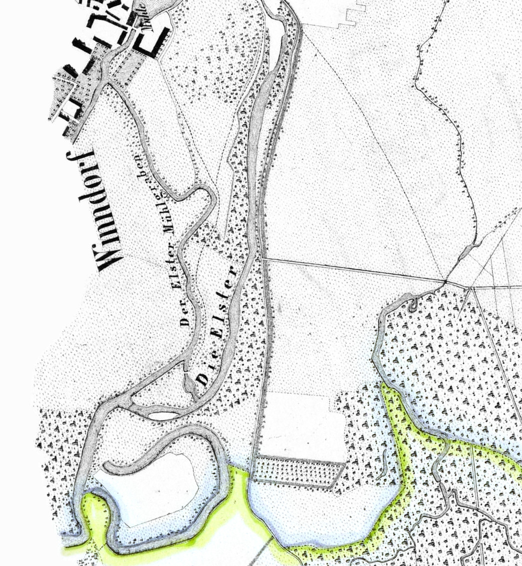
Deutsch: Ausschnitt aus: Uebersichtsplan vom Inundationsgebiete der Gewässer bei und in der Umgegend von Leipzig, ca. 1:12 000, Kupferstich, 1855 zusammengestellt nach der von ... Kohl und Georgi ... 1852-1854 aufgenommenen Flussregulierungskarte, Leipzig, Kunsch, Auf: deutschefotothek.de |
| Date | (original), 2020-04-18 (derivative work) |
| Source | |
| Author |
Original uploader was User:Cmuelle8
|
| This is a retouched picture, which means that it has been digitally altered from its original version. Modifications: I used GIMP to cut the part of the original file, where the Zickmantelscher Mühlgraben is seen.. The original can be viewed here: TK12 Sachsen Inundationsgebiet Leipziger Gewässerknoten 1855.jpg:
|
Licensing
[edit]
|
This work is in the public domain in its country of origin and other countries and areas where the copyright term is the author's life plus 70 years or fewer.
| |
| This file has been identified as being free of known restrictions under copyright law, including all related and neighboring rights. | |
File history
Click on a date/time to view the file as it appeared at that time.
| Date/Time | Thumbnail | Dimensions | User | Comment | |
|---|---|---|---|---|---|
| current | 09:21, 18 April 2020 | | 1,046 × 1,136 (942 KB) | Wolf170278 (talk | contribs) | {{Information |description ={{de|1=Ausschnitt aus: ''Uebersichtsplan vom Inundationsgebiete der Gewässer bei und in der Umgegend von Leipzig, ca. 1:12 000, Kupferstich, 1855'' zusammengestellt nach der von ... Kohl und Georgi ... 1852-1854 aufgenommenen Flussregulierungskarte, Leipzig, Kunsch, Auf: [http://www.deutschefotothek.de/documents/obj/70301661/df_dk_0000506 deutschefotothek.de]}} |date =1855 (original), 2014-11-24 (derivative work) |source =*[[:File:TK12 Sachsen Inu... |
You cannot overwrite this file.
File usage on Commons
The following page uses this file:
File usage on other wikis
The following other wikis use this file:
- Usage on de.wikipedia.org